Thursday, April 10
Hope Creek Ten Taypo Loop AKA Tremendous Trunks Trail
Prairie Creek Redwoods State Park
Redwood National and State Parks
Unceded land of the Yurok Tribe
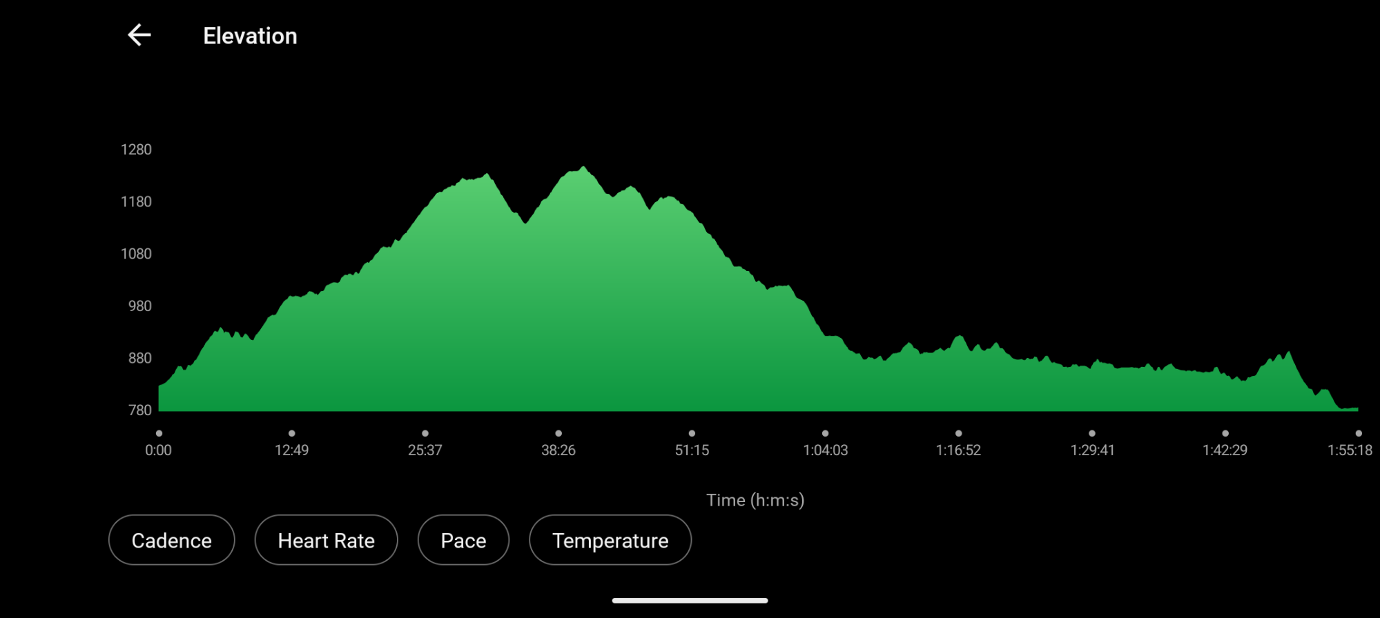
3.8 miles
856′ ascent
894′ descent
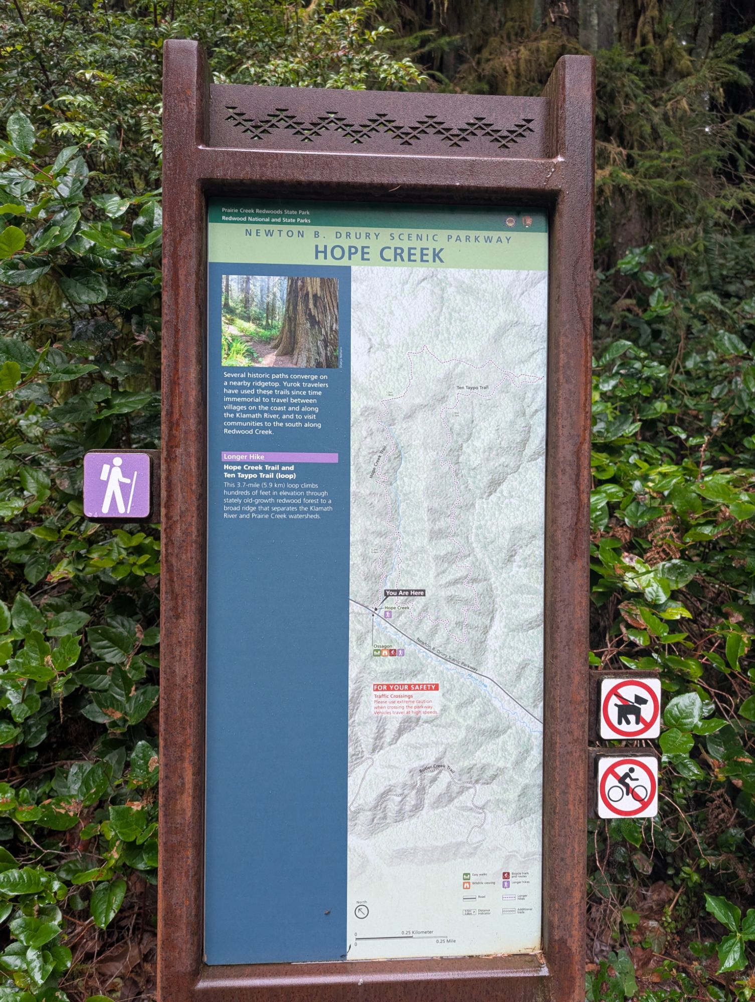
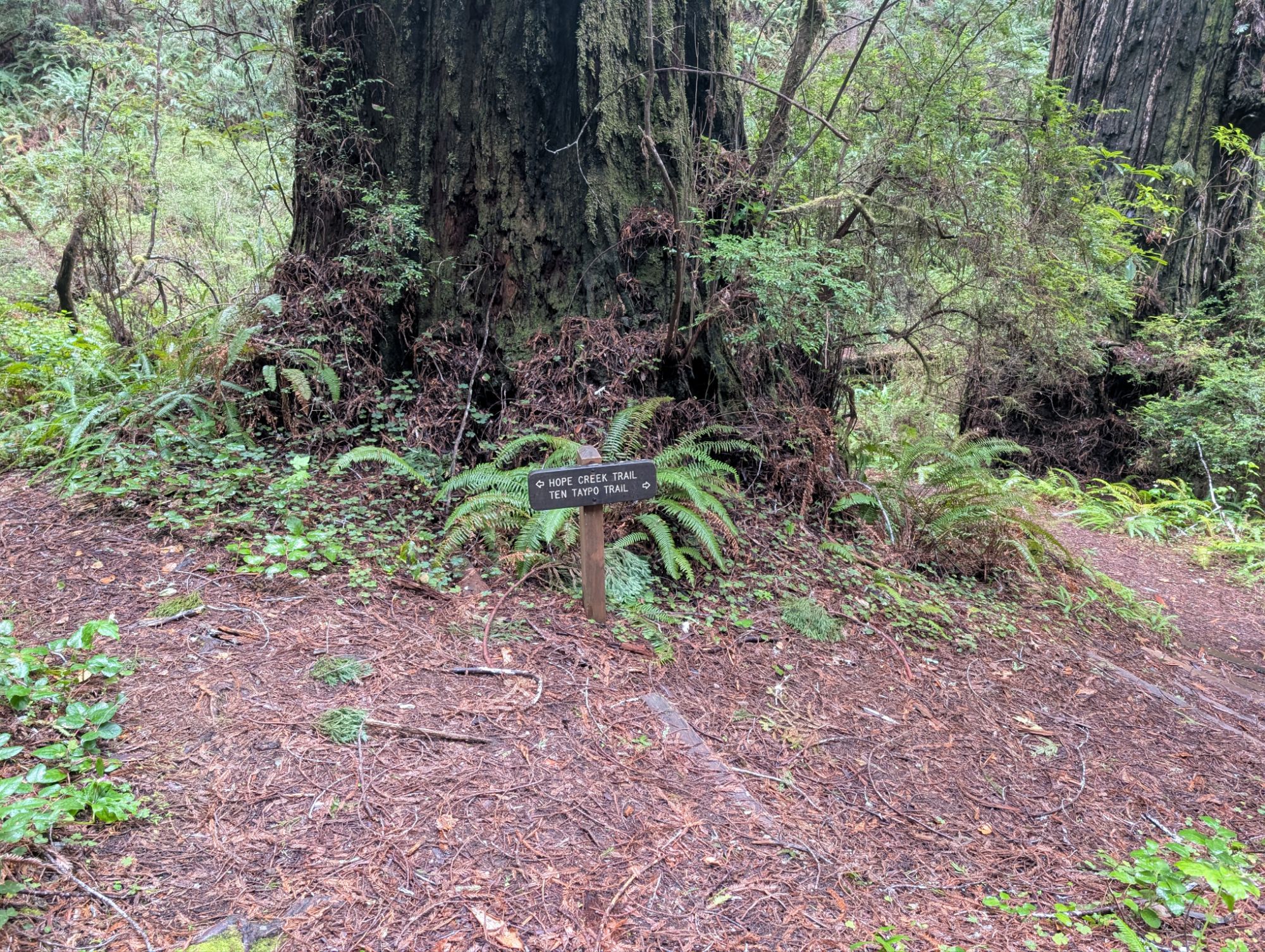
I leave Moorman-pond Trail and drive a short distance up Drury Parkway. This is a major trailhead with the Hope Creek Ten Taypo Loop and the Ossagon Trail starting across the road from each other. There’s not a lot of parking right at the trailheads but plenty of room along the creek side (west side) of Drury Parkway.
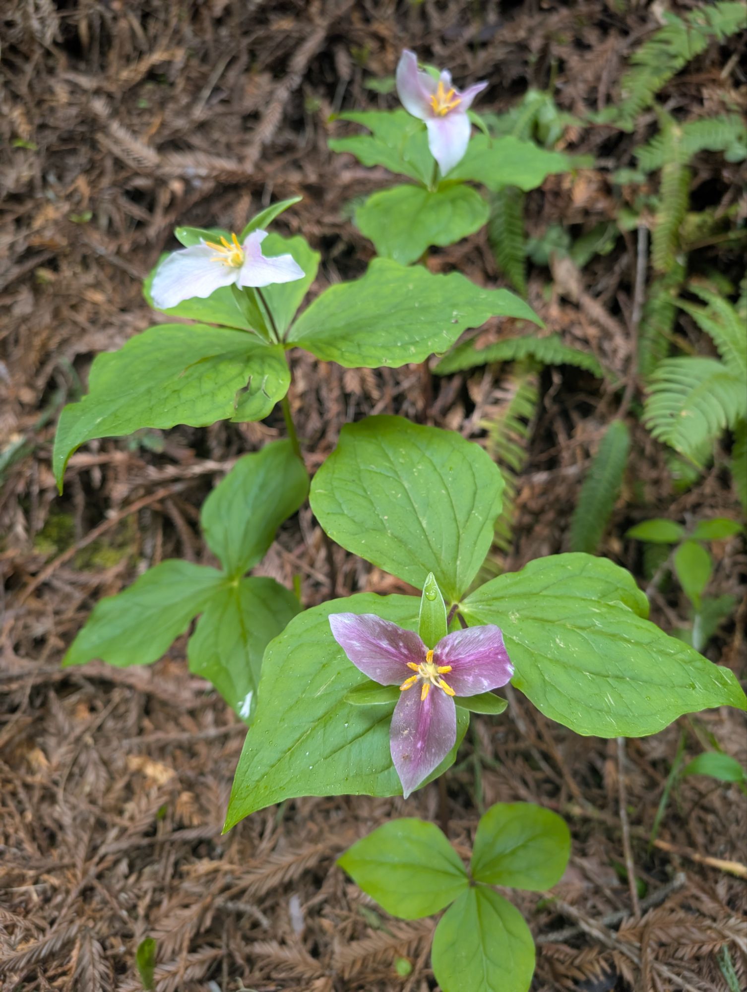
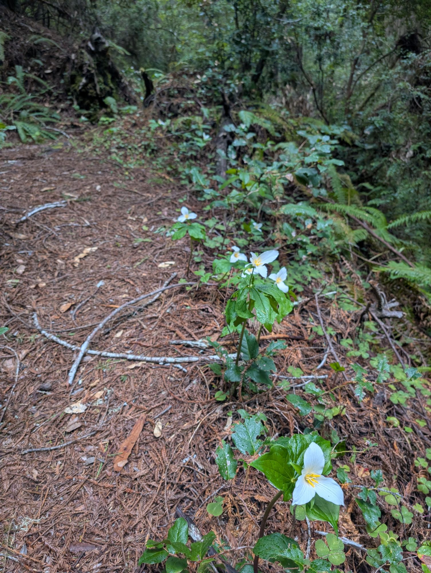
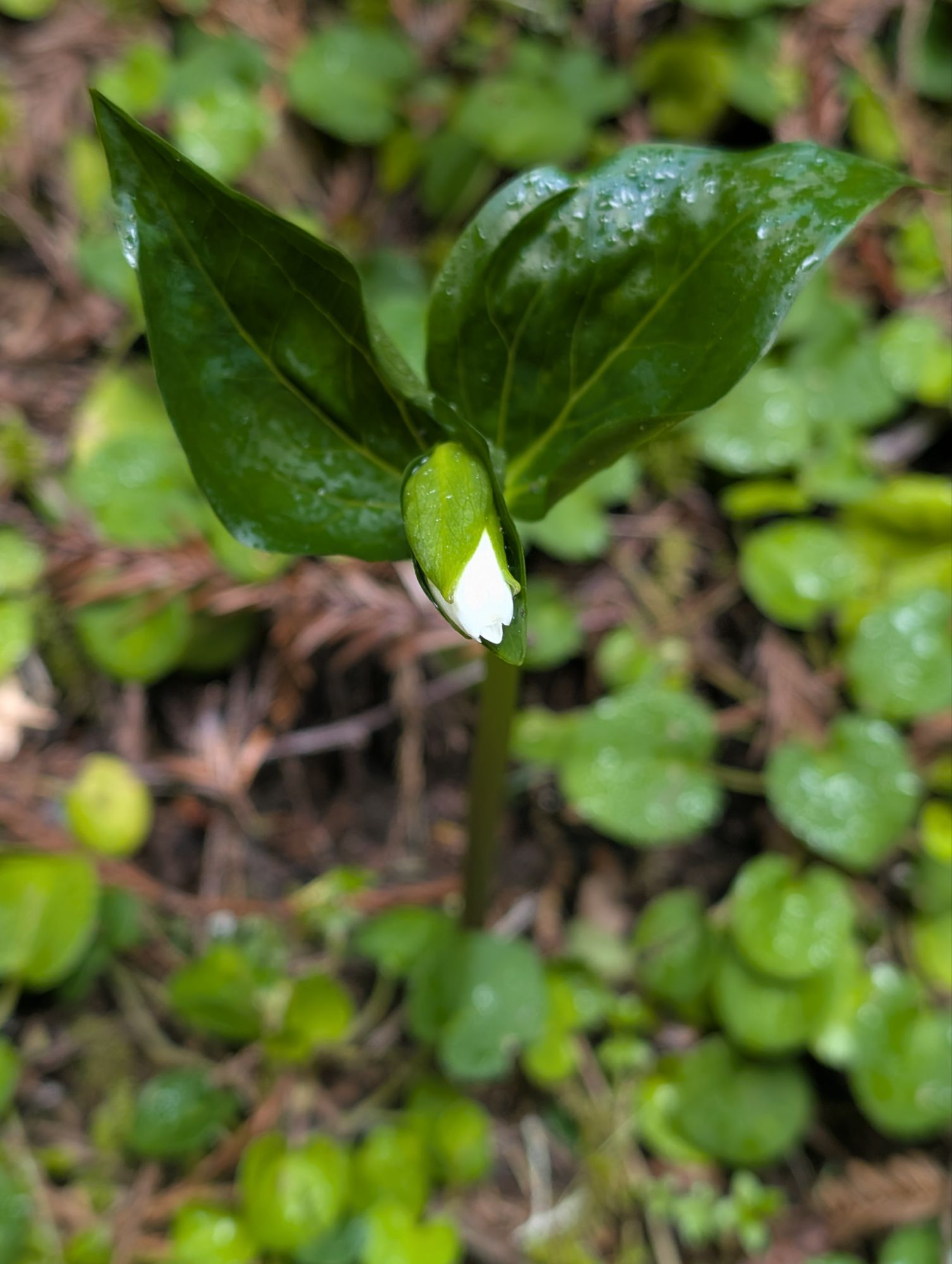
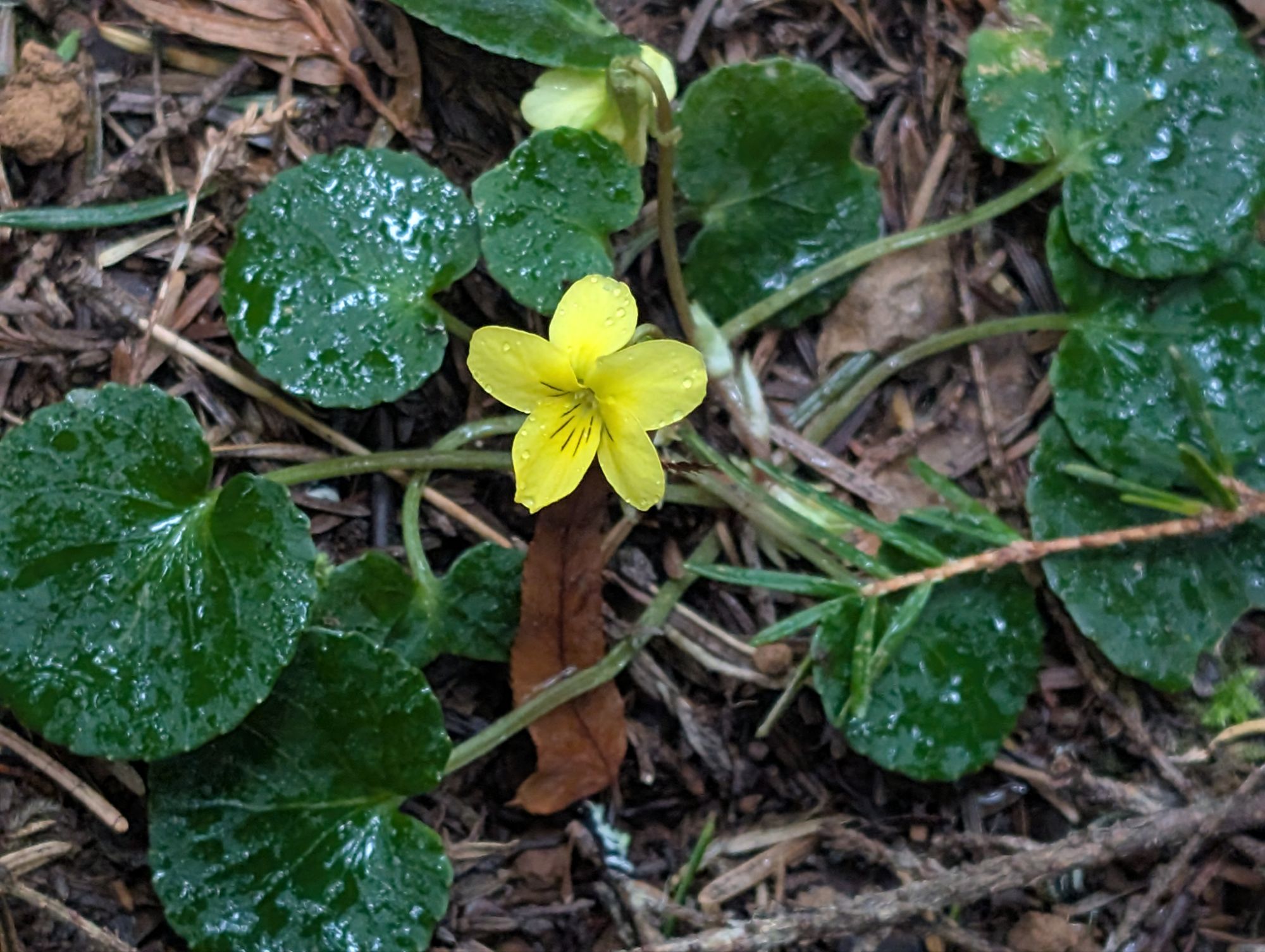
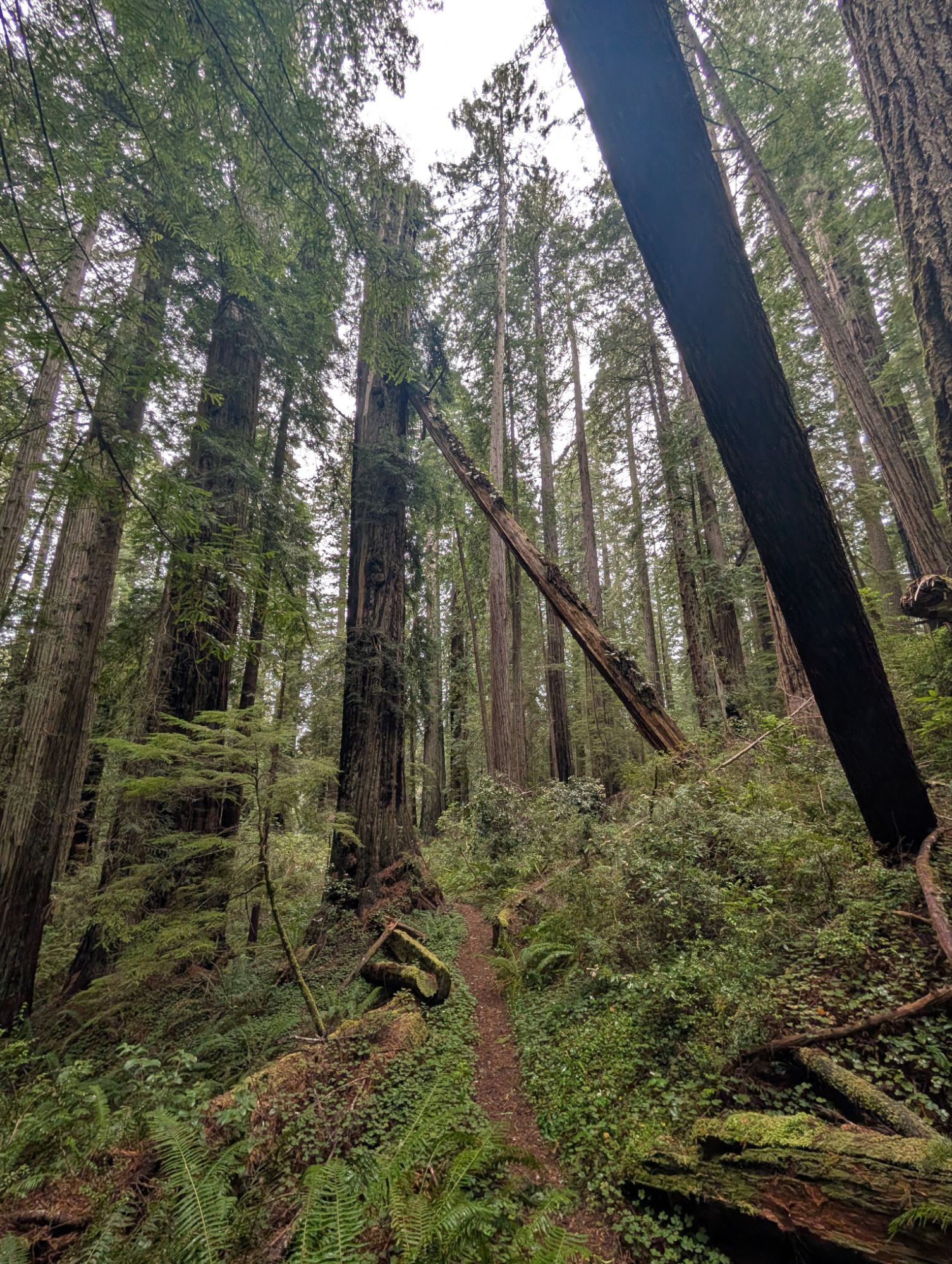
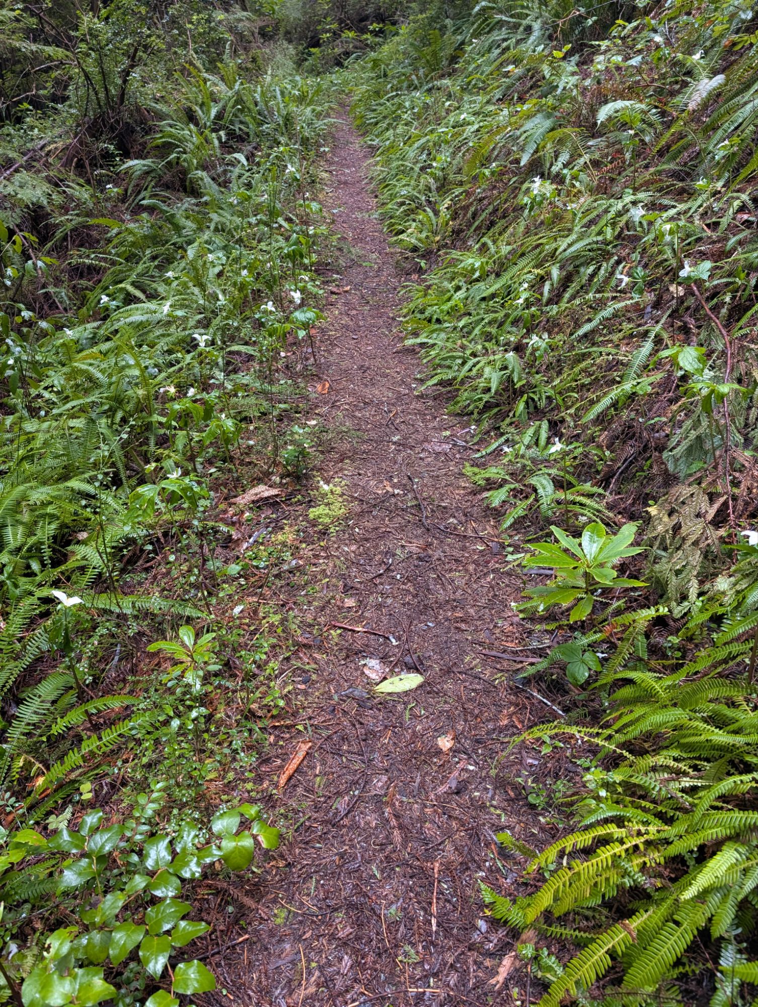
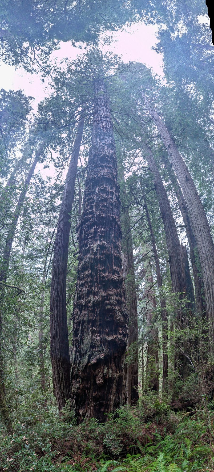
I grab my Inreach and phone but decide to leave behind my poles and umbrella. It’s 3 pm and I’m met by trillium as the trail starts climbing. The rain is still coming down gently as I pass old growth redwoods. The loop access trail climbs almost 100 feet over .7 miles and then I have to decide which direction to go.
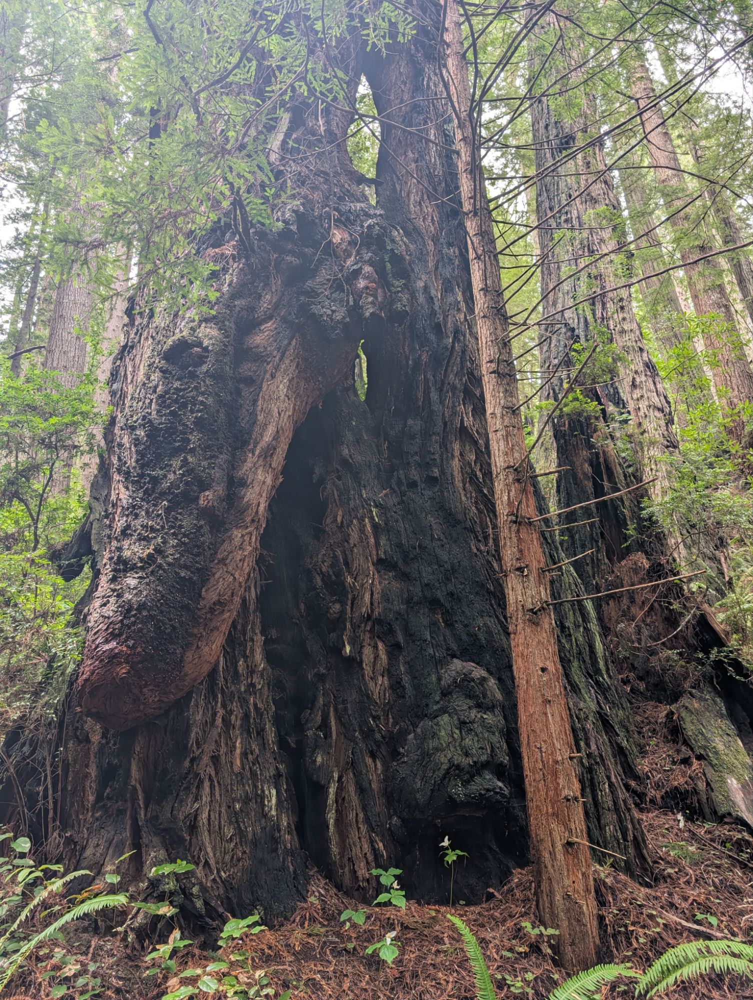
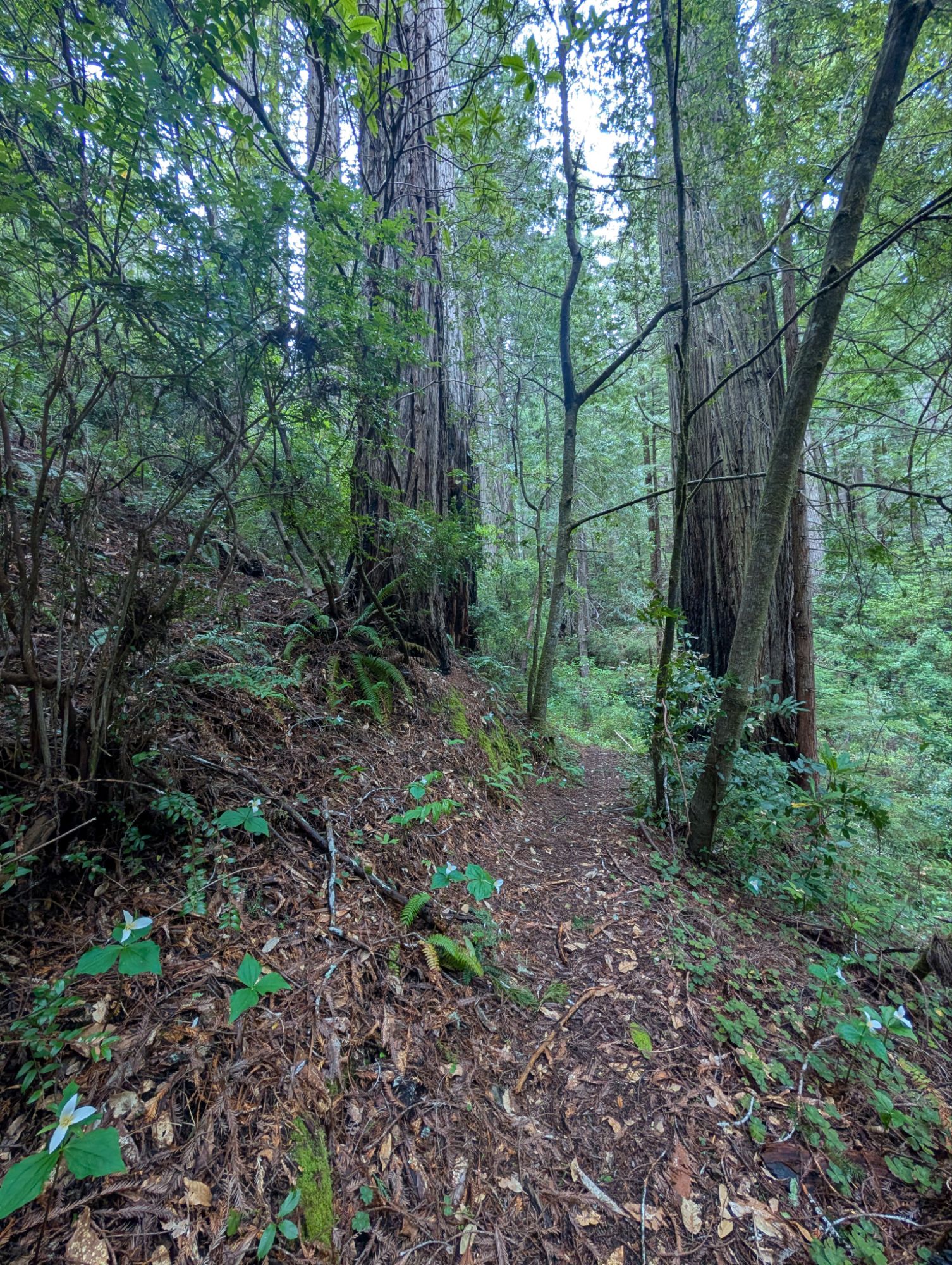
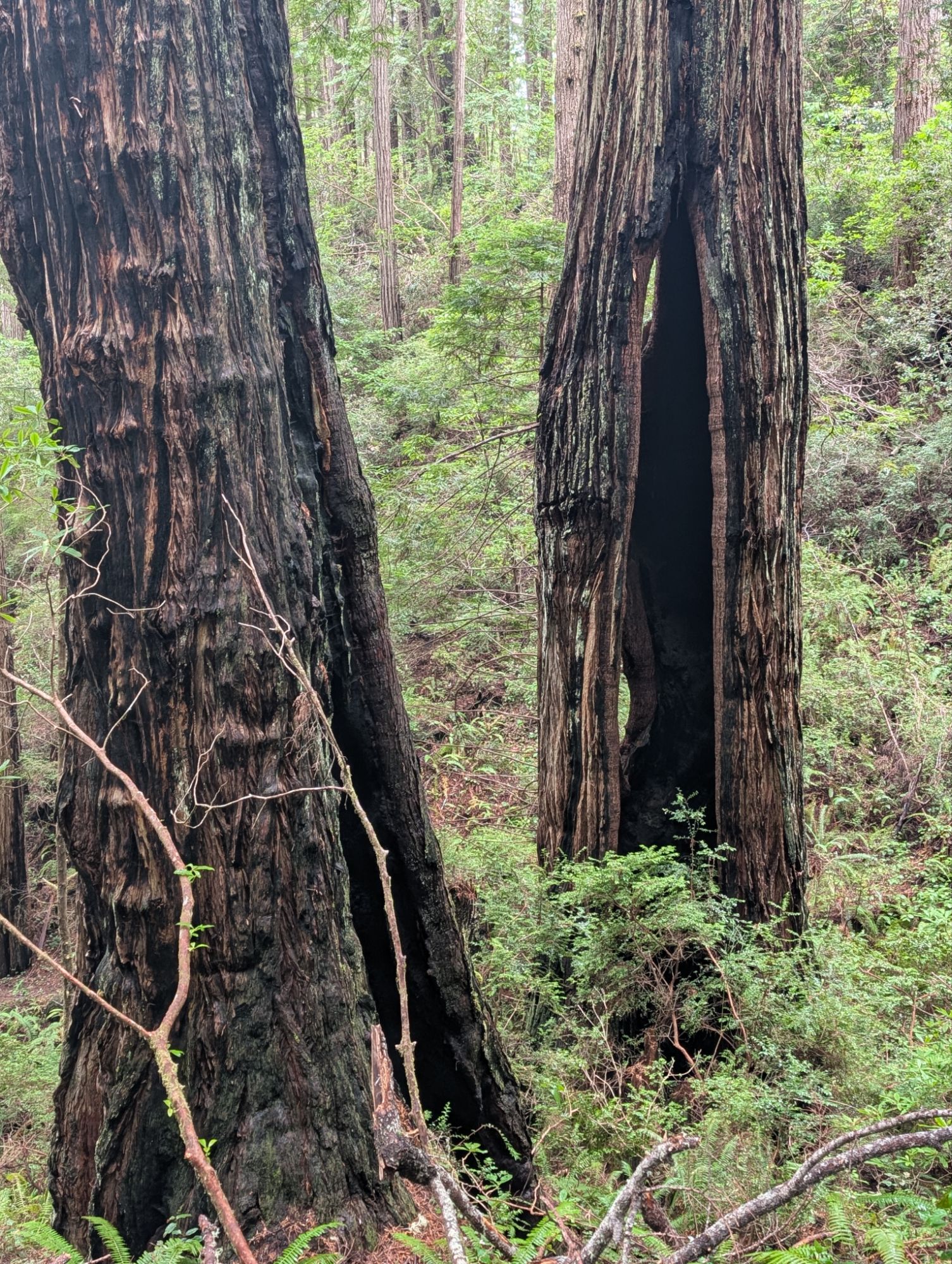
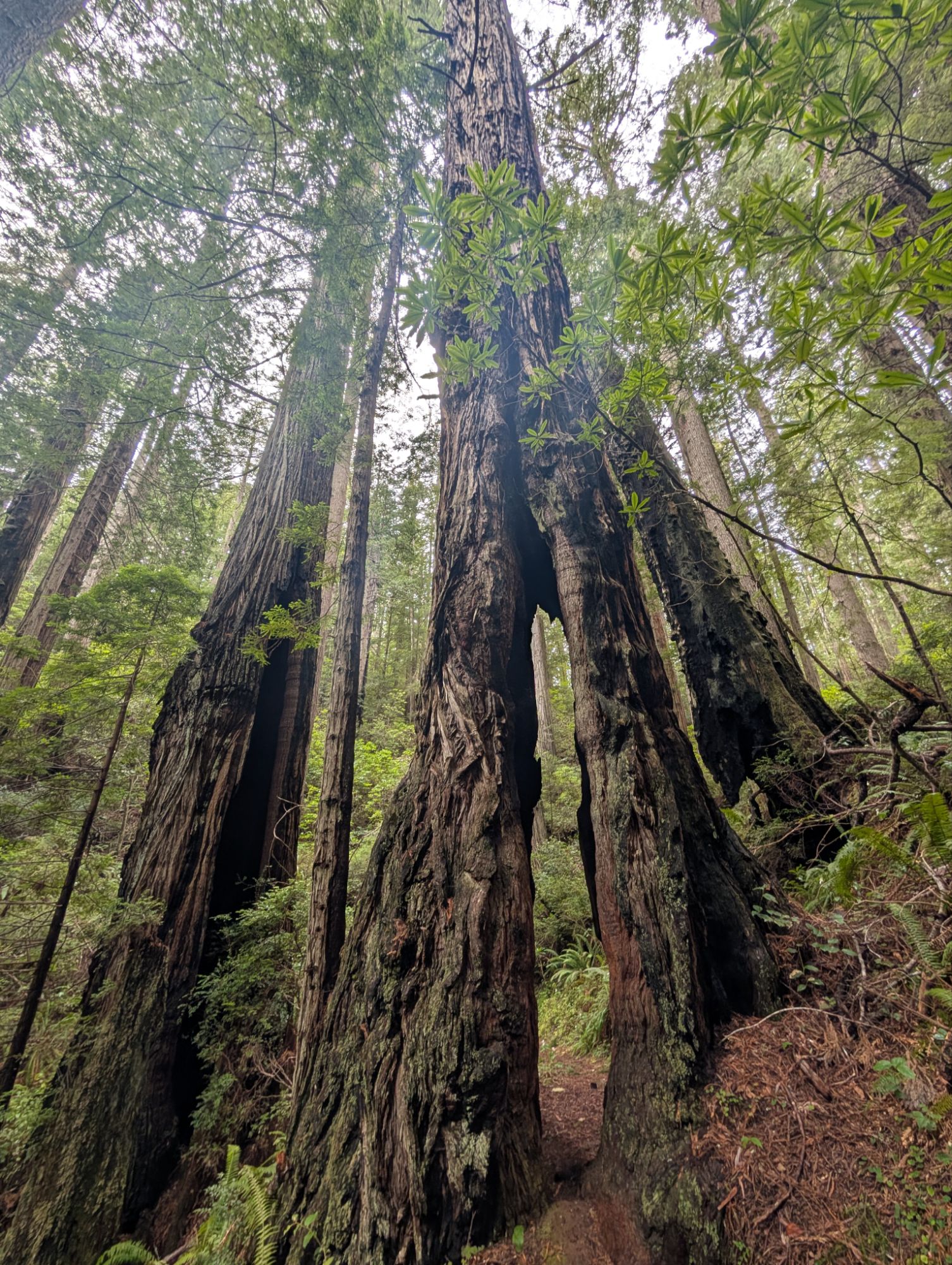
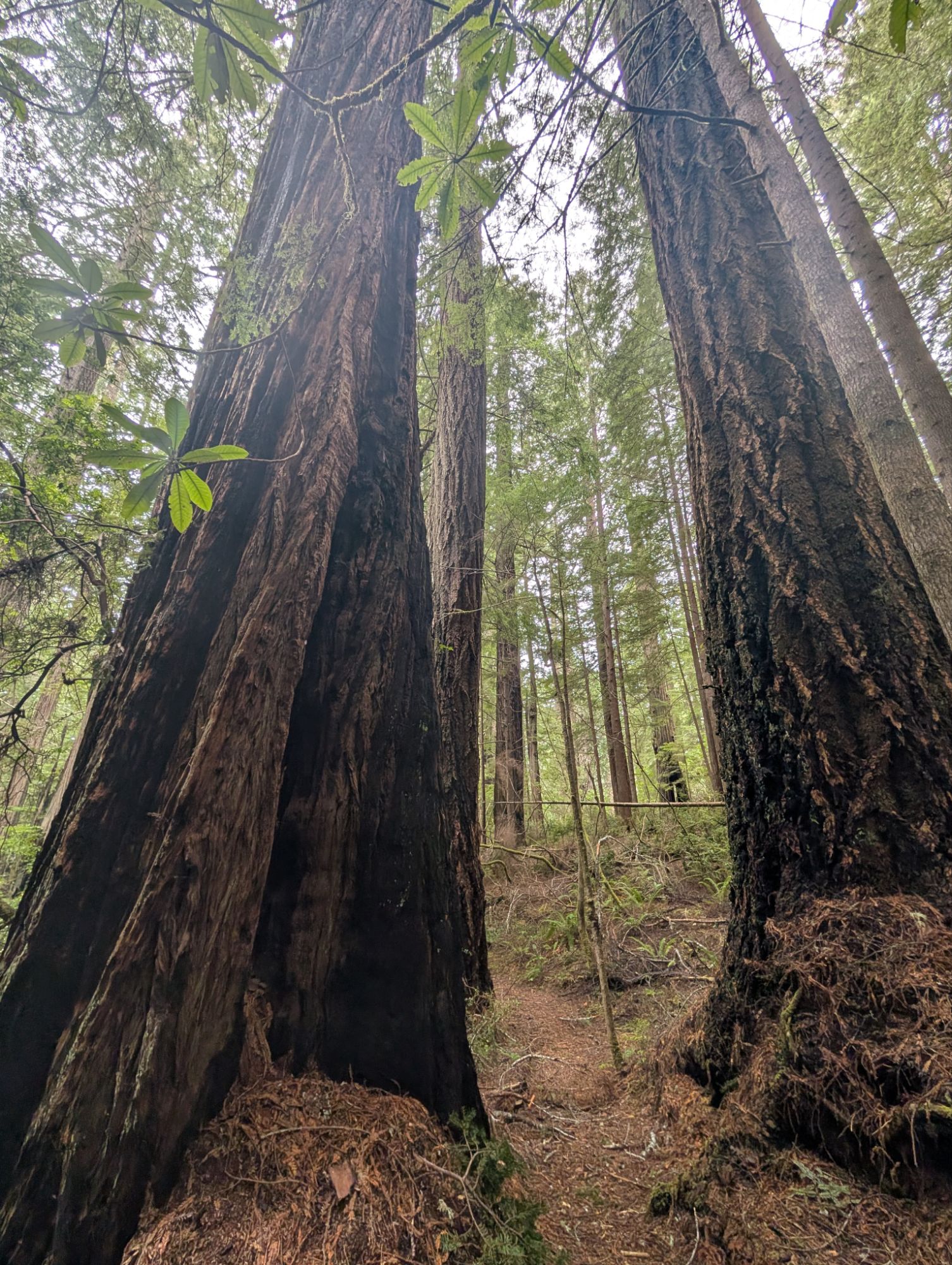
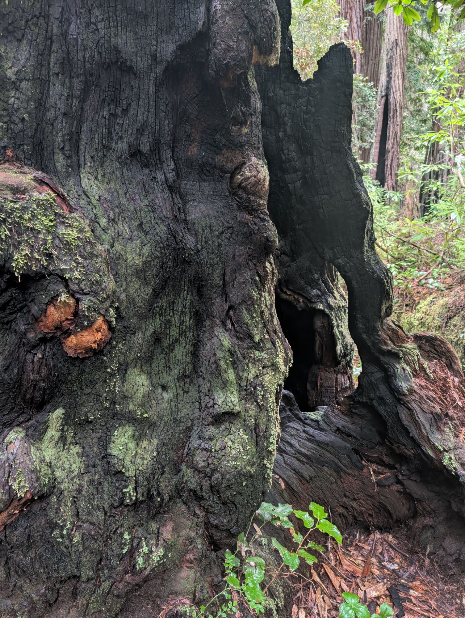
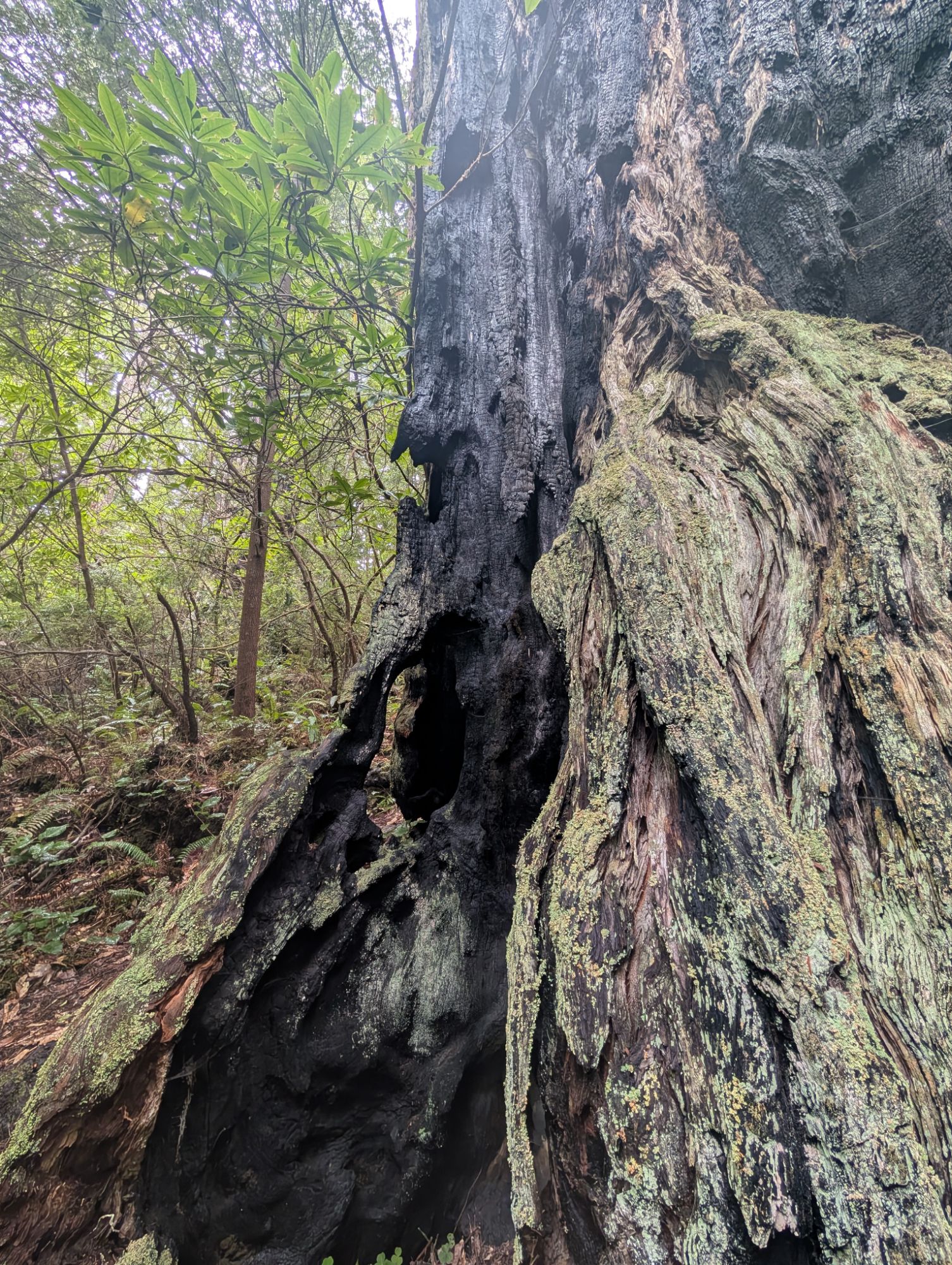
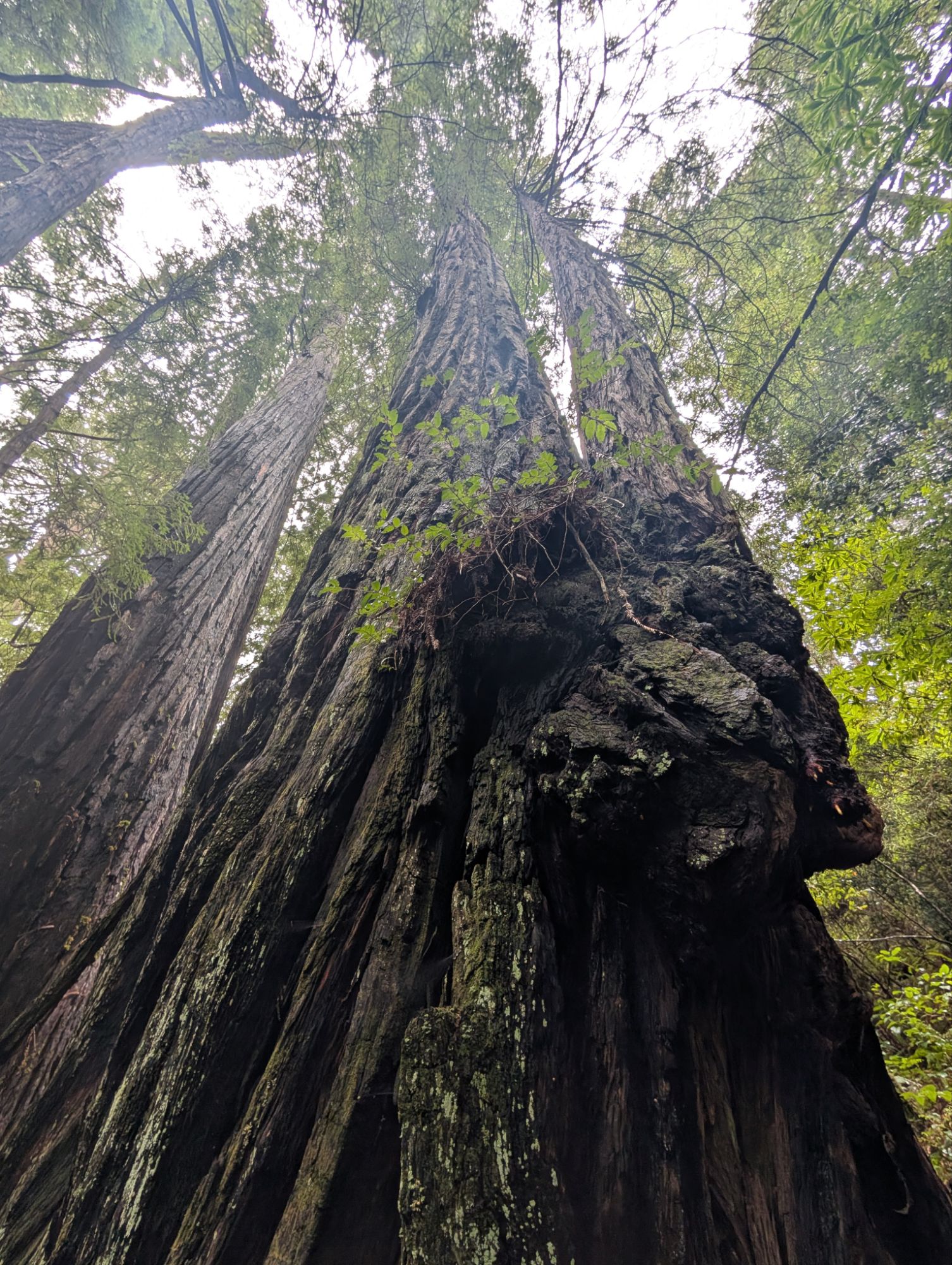
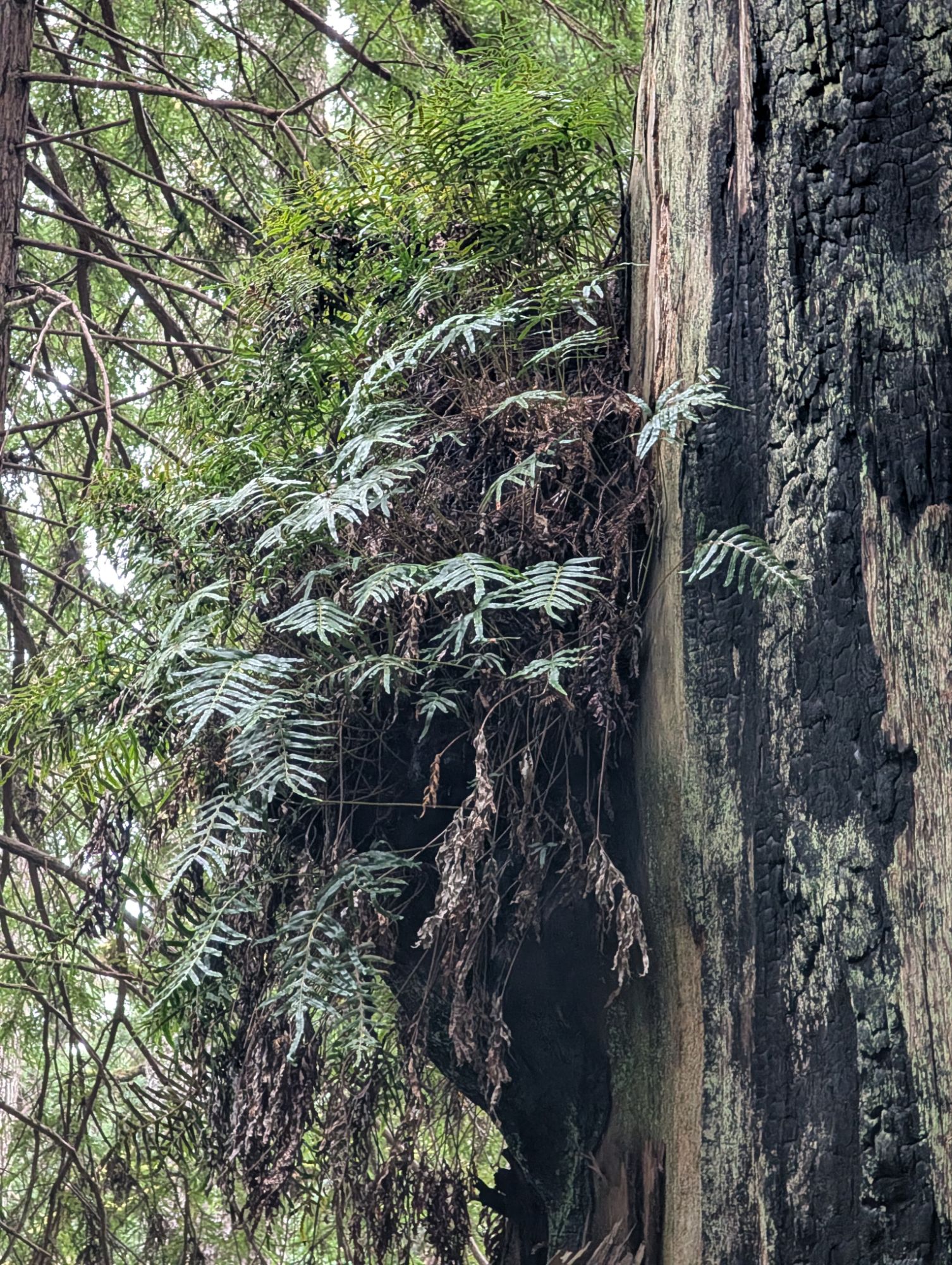
I fork left, heading clockwise through the loop. The trail continues to climb and I pass incredible old growth redwoods with massive trunks. Trunks with fire scars and twisted, gnarled bark that tell the tales of time.

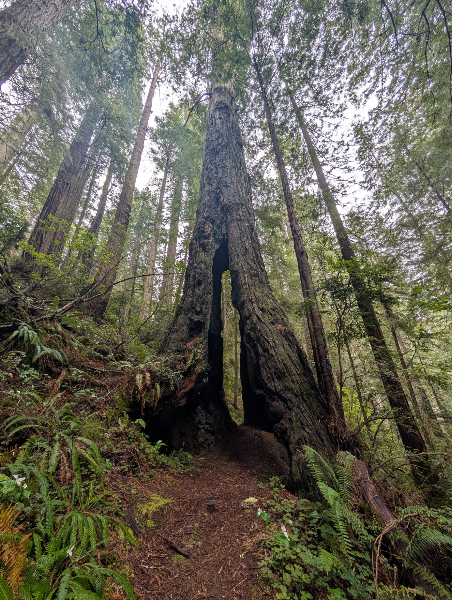

Super cool walk-through trunk with skylights!


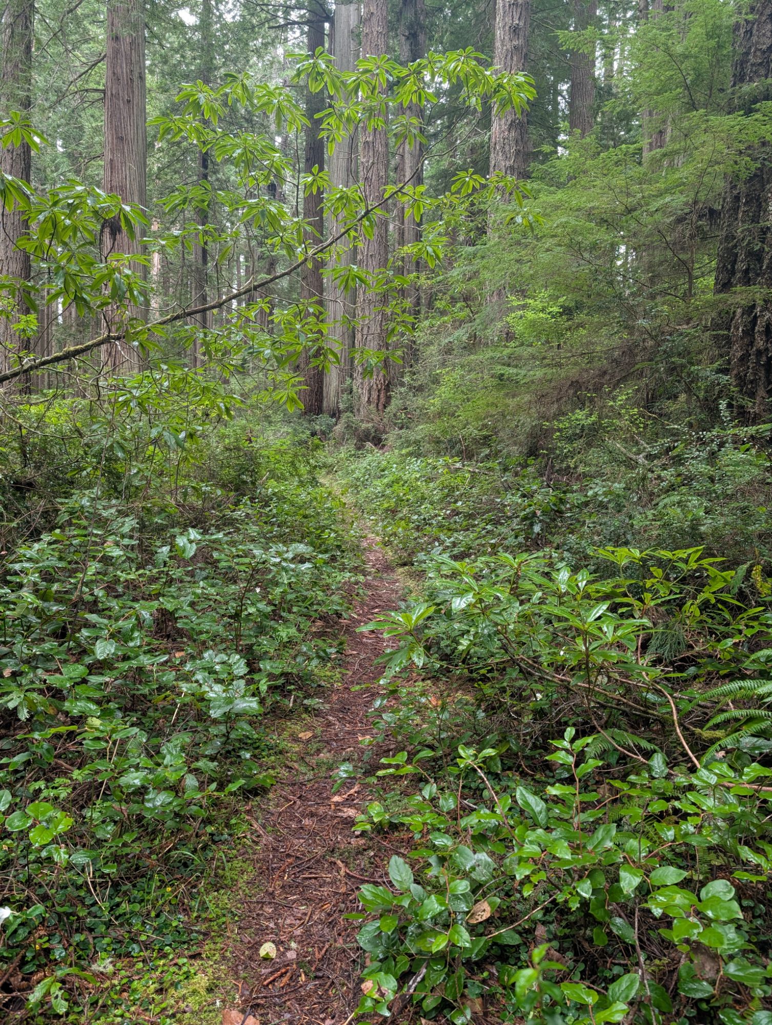
The trail meanders through the forest while it climbs another 300 feet to a ridge. I can suddenly hear the occasional hum of traffic from highway 101. This ridge line is unique for many reasons. It is the dividing line between the Klamath River and Prairie Creek watersheds. It is also the convergence of several historic paths. From the interpretive sign at the trailhead: ” Yurok travelers have used these trails since time immemorial to travel between villages on the coast and along the Klamath River, and to visit communities to the south along Redwood Creek.”
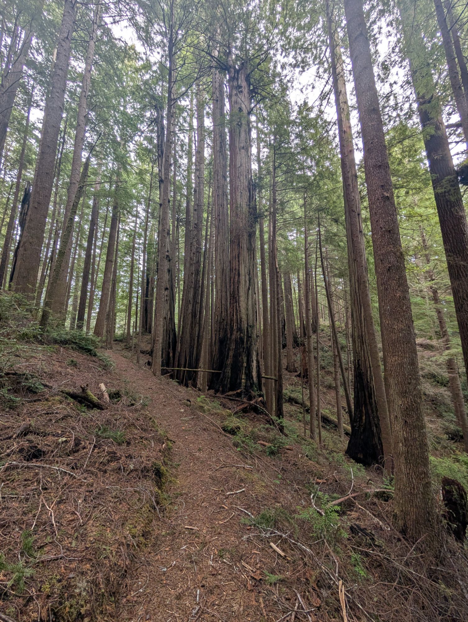
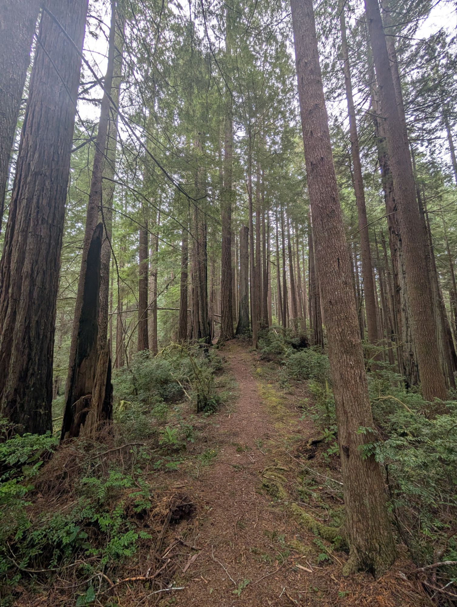
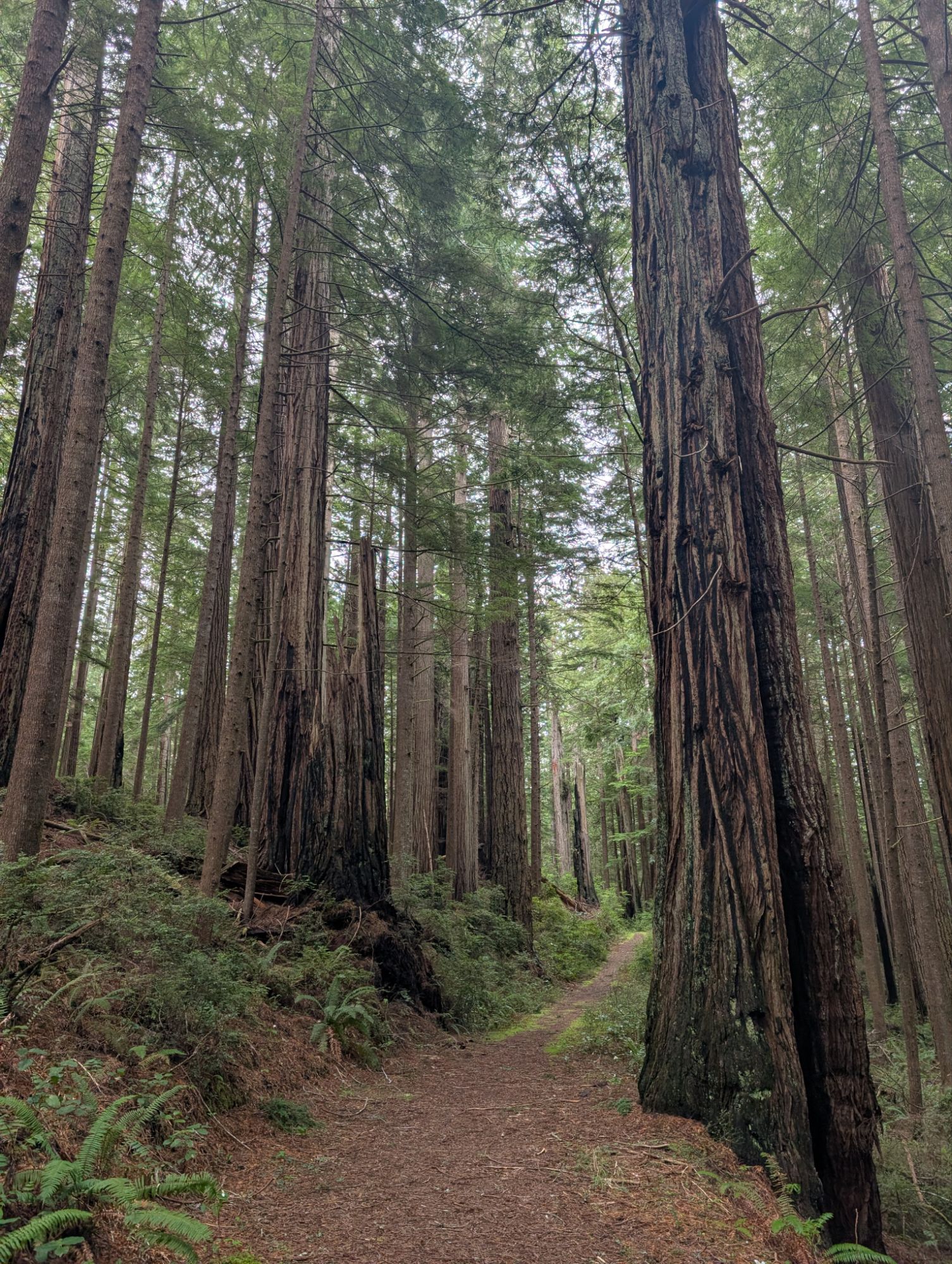

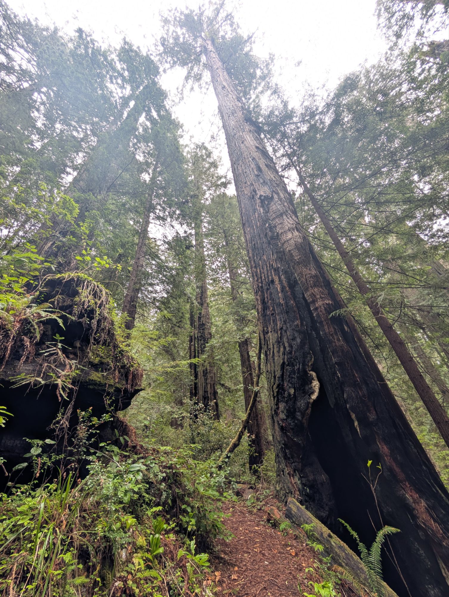
The ridge trail connects to what was obviously once a road. As vegetation now covers the road’s edge, it is slowly being consumed by the forest. My pictures truly don’t do these magnificent trees justice and yet, I just can’t stop taking pictures.
A historical note from the Redwood Hikes website: “The ridgetop road is all that remains of East Ridge Road, a former logging route that until about 1990 connected Ah Pah Road to Cal Barrel Road. It was mostly second growth, but it connected to three short spur trails that descended into old-growth memorial groves (Howard Grove, James W. Buel Grove, and Hoo-Hoo International Grove). It was abandoned after the construction of Highway 101 and, except for the short section on the Ten Taypo Trail, has completely disappeared.”


If you need a picture of yourself atop a large redwood that hangs far above a little valley, then this trail has one for you. This giant redwood has fallen and spans the entire little draw. As long as your nerves permit you, it seems to be wide enough to safely tread out to its center. At your own risk of course!


The trail rounds a corner and the car noise from Drury Parkway sounds very close. And yet, the trail curves back into the Hope Creek drainage to reconnect with the trailhead access trail. When I forked left I had seen a very lovely bridge and I’m sure I must almost be back to it. In my notes, I had written that this trail was three miles long. But I’m already at the three mile mark and not yet back to the junction to the trailhead. The loop itself must be three miles long but you have to also add the access trail.
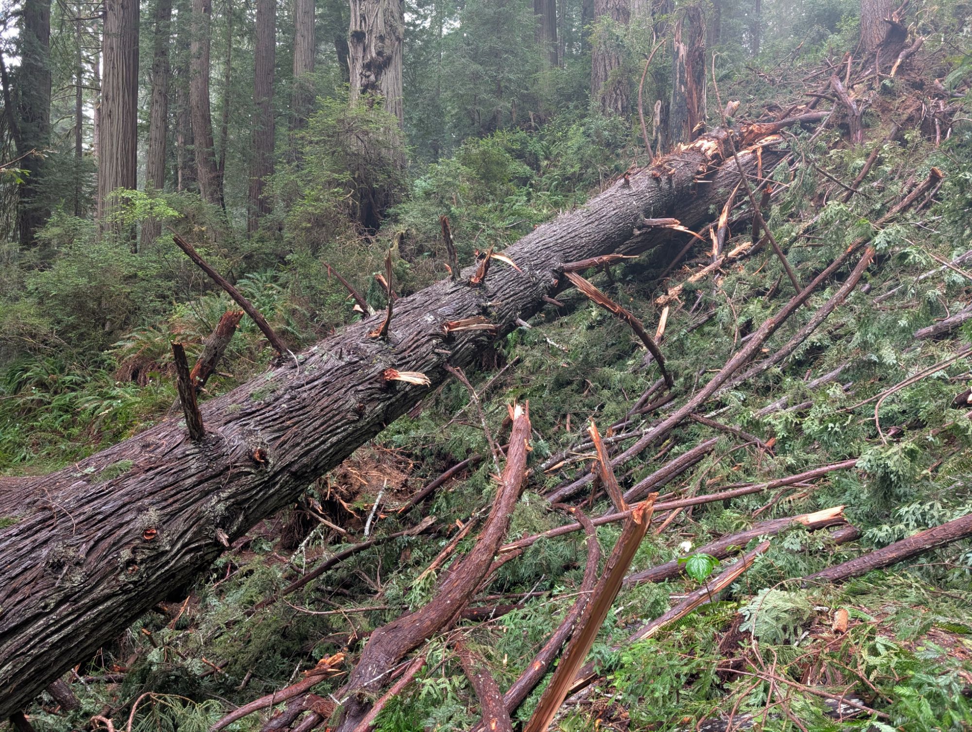
I come around a corner and find just about the biggest redwood mess I think I’ve ever seen. There are downed trees and sheared off branches everywhere and I can’t tell where the trail heads. I have this moment of worry that I might have to backtrack all the way through the loop. I look across the Hope Creek drainage and can see a switchbacking trail on the other side. Maybe I need to go down and connect to that. I start to follow what I think might be the way down but quickly pause to reassess. I look up the canyon and think I can see the cut of the trail in the hillside. So, I step back up to where I started and then move laterally through branches and then under a tree. I’m grateful to not be wearing my full backpack. Pick my way down and around a stump and then I miraculously see the trail ahead of me.


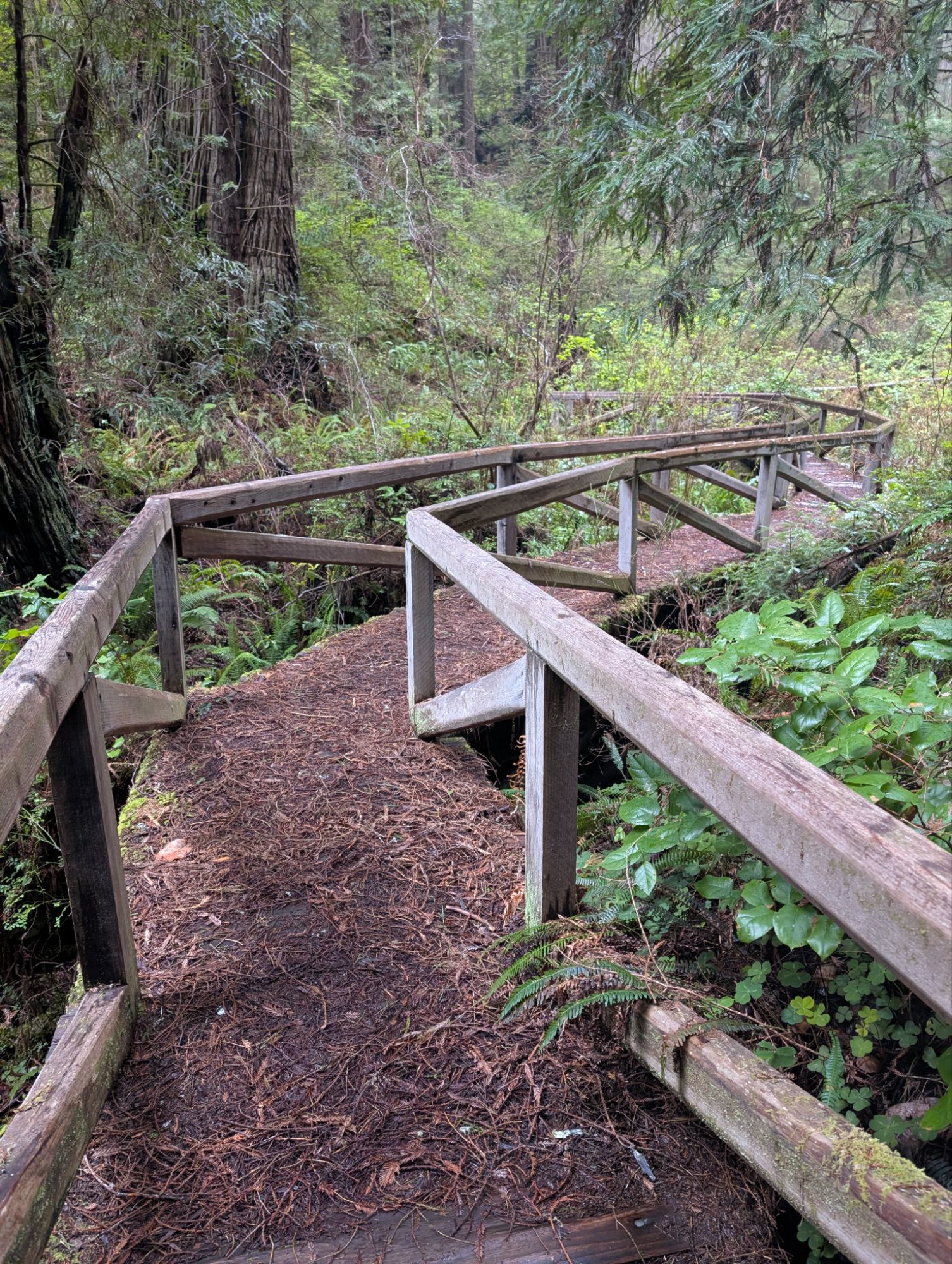
It’s about a tenth of a mile or two before I arrive at the bridge I had seen earlier. It snakes across the top of Hope Creek and the massive amounts vegetation until I arrive back at the loop and trailhead junction.
On the access trail I can see the spot across the canyon where all the downed redwoods litter the hillside. I arrive back at the trailhead at almost 5 pm, having seen no one the whole time I was out there. There’s a slight mist coming from the sky but it’s thick enough to soak you pretty fast. Given the time and weather, I decide to skip the Carruthers Cove Trail and head straight to Klamath.


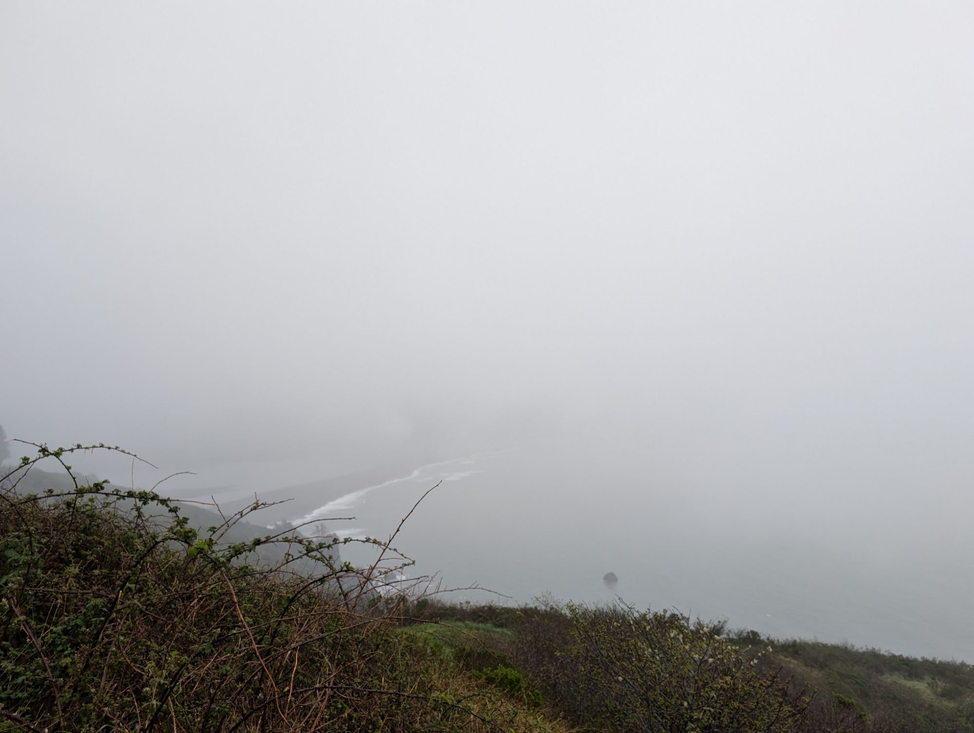
In Klamath, I get gas at the Pem-Mey Fuel Mart where $4.50/gallon seems like a real deal. I head North to check out the Klamath River Overlook. This certainly is a nice spot but it’s in the middle of a misting cloud so I can barely make out the Klamath River or the ocean. There are picnic tables, two pit toilets, interpretive signs and amazingly, cell service!
I sit in my truck and inhale the food I had prepared yesterday. Sweet potato, quinoa, shredded carrots topped with fritos and fresh strawberries and blueberries. Could I go to my reserved camp at Flint Ridge, set up camp and survive the night? Yes. Things would get a little wet but I would be ok. Despite wearing waterproof boots, both of my feet are completely soaked and that’s a bit of a bummer. They definitely won’t dry overnight but I do have a pair of dry socks. There was so much saturated brush along the Ten Taypo Loop that all the water shed straight onto my boots. All ‘waterproof’ things have their limit. I know that there will be better weather this weekend so I decide to head home for the night.
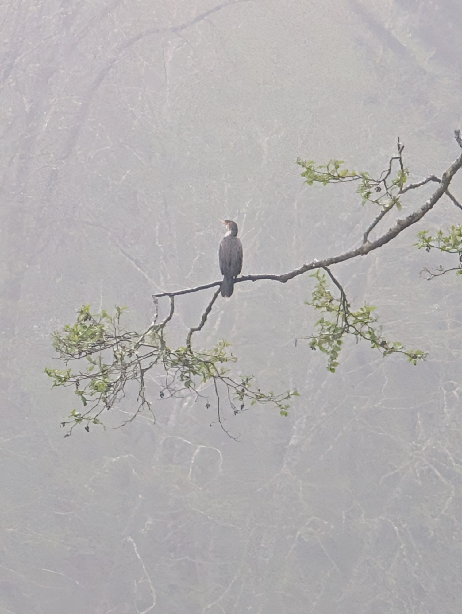
I take the first exit after crossing over the Klamath River and then turn onto Alder Camp Road. I drive into the High Bluff Overlook where there are no people and similarly, no view. I drive back out and continue on the Coastal Drive Loop. Even though I’ve decided to head home I make a deal with myself that I will stay the night if there are no cars at the Flint Ridge parking area. I go slowly on the dirt road and find that there are two parked cars. Looks like someone is trying to make camp inside their car. Even though the vistas are currently obscured, I can tell that this area is spectacular and deserves to be experienced in better weather. I’ll see if I can get back this weekend! The road loops back down to the south bank of the Klamath River. I stop at a pullout where I see a pair of giant birds high in the trees at the river’s edge. My pictures are not clear but they seem to be cormorants. Double-crested cormorant? But probably a Great cormorant!


One thought on “Hope Creek Ten Taypo Loop AKA Tremendous Trunks Trail”
Comments are closed.