Thursday, May 1
King Range Lost Coast Loop
King Range National Conservation Area
Unceded lands of the Sinkyone, Cahto and Yuki Coast people
18.71 miles
3,833′ ascent
1,080′ descent
I awake several times during the night. What is that I feel? Yep, sure enough, it’s a tick crawling on my neck. Unable to crush it to death, I put it outside my tent. Just as I’m about to drift back to sleep I feel something else on my arm. Another tick. OMG! Enough!
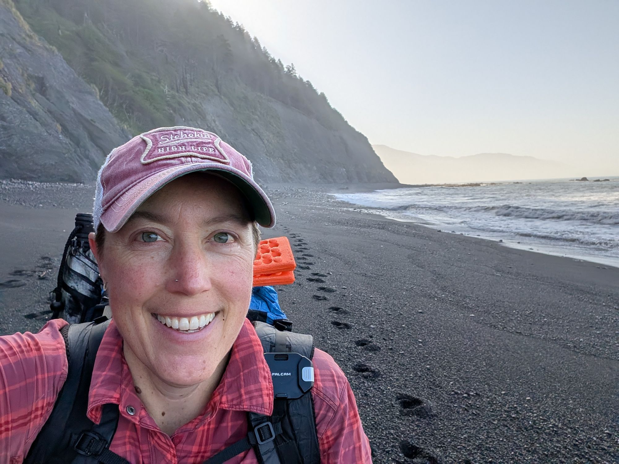
The sun is set to rise about 6:10 am but I decide to give myself a break and not start hiking until 6:30 am. I need to be able to see well in case there is poison oak to dodge. My watch alarm beeps at 5:30 am but I’m so tired that I snooze it a few times. As I expected, my tent is dry because of my perfect little forest camp. My bear canister which is out closer to the bluff and away from tree cover is soaked with moisture. California Towhee welcomes me to the morning as I stuff everything back into my pack. Since my food quantity is reduced, I decide to pack my bear canister inside my pack. I stuff my clothes around the sides of the canister to make use of the open little pockets of space.
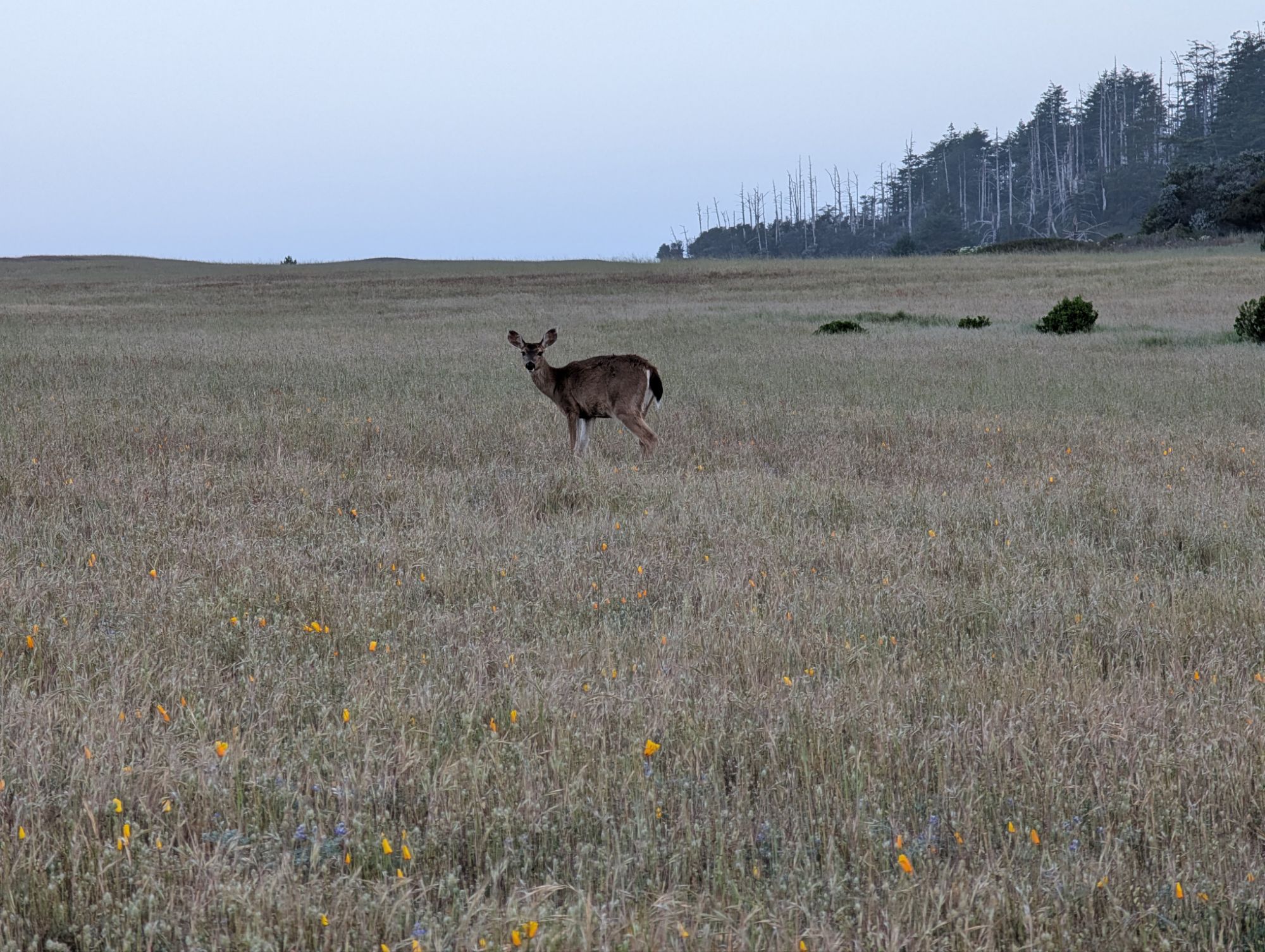
The sky brightens as I start to hike. It feels so much better to have the weight of the bear canister more centered in my pack. I have the trail all to myself except for the occasional deer, gull or turkey vulture. I pass the junction to the Rattlesnake Ridge Trail and contemplate. I wonder about the condition of that trail?! No, no, I’m here to see the Lost Coast Trail too.

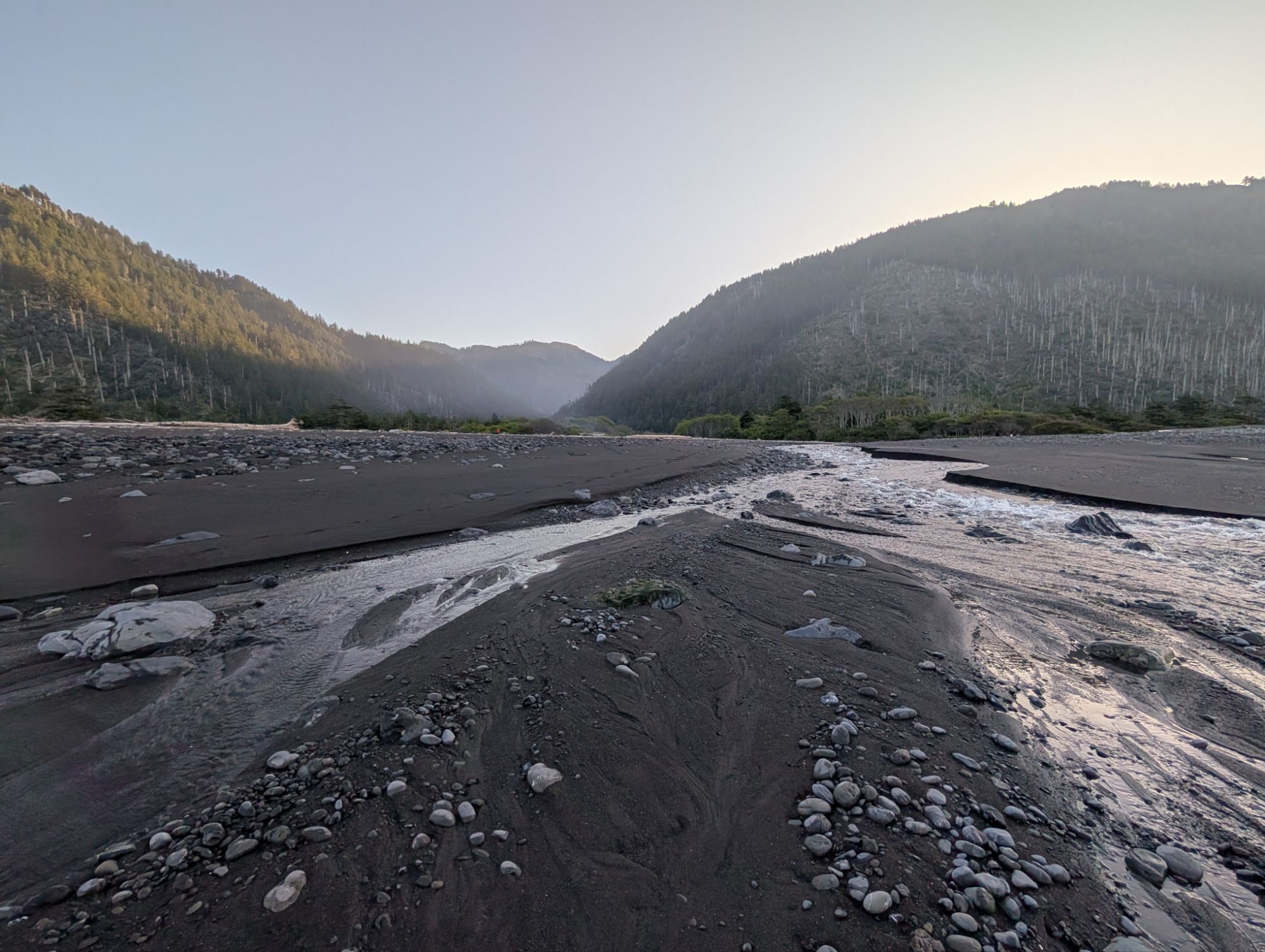
The trail turns toward the ocean and heads into Big and Miller Flats. There’s a woman sitting atop a large rock sipping coffee who comments that I have started early. I say how beautiful the morning is and then start to assess the Big Flat Creek crossing. I really don’t want to take off my boots. I watch small fish bubble at the surface for air.

I eventually tread down to the mouth of the creek where the waves are crashing in. Perhaps I can make it through the braids and the waves if I time it well. I cross the first few ribbons easily enough but then I’ve got a decent wave headed towards me. I have to speed up my crossing and go a little farther inland than I had planned. As I scurry away from the wave, I can feel a hint of wetness seep into the top of my boots. It’s not a particularly graceful crossing but it’ll do. I hike back towards the trees and connect with the trail.
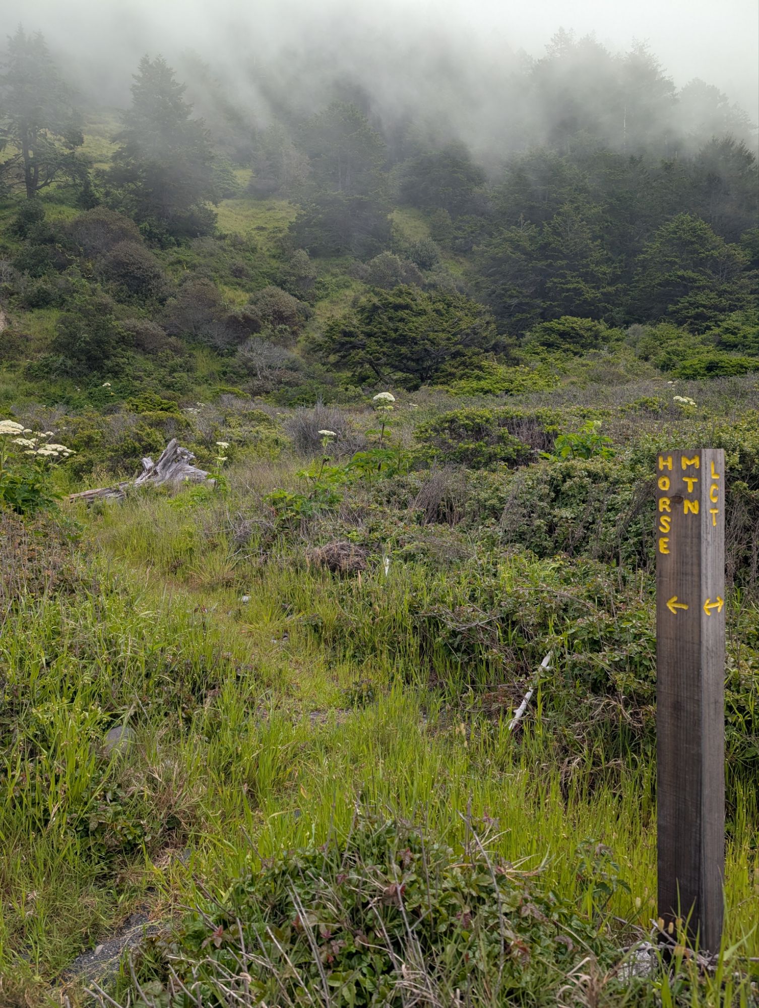
I follow the trail a short distance before I come to a new wooden post labeled LCT and pointing straight out to the ocean. Based on recent online chatter, I believe this is the point where a couple hikers went wrong and got themselves into a situation where they had to be rescued.
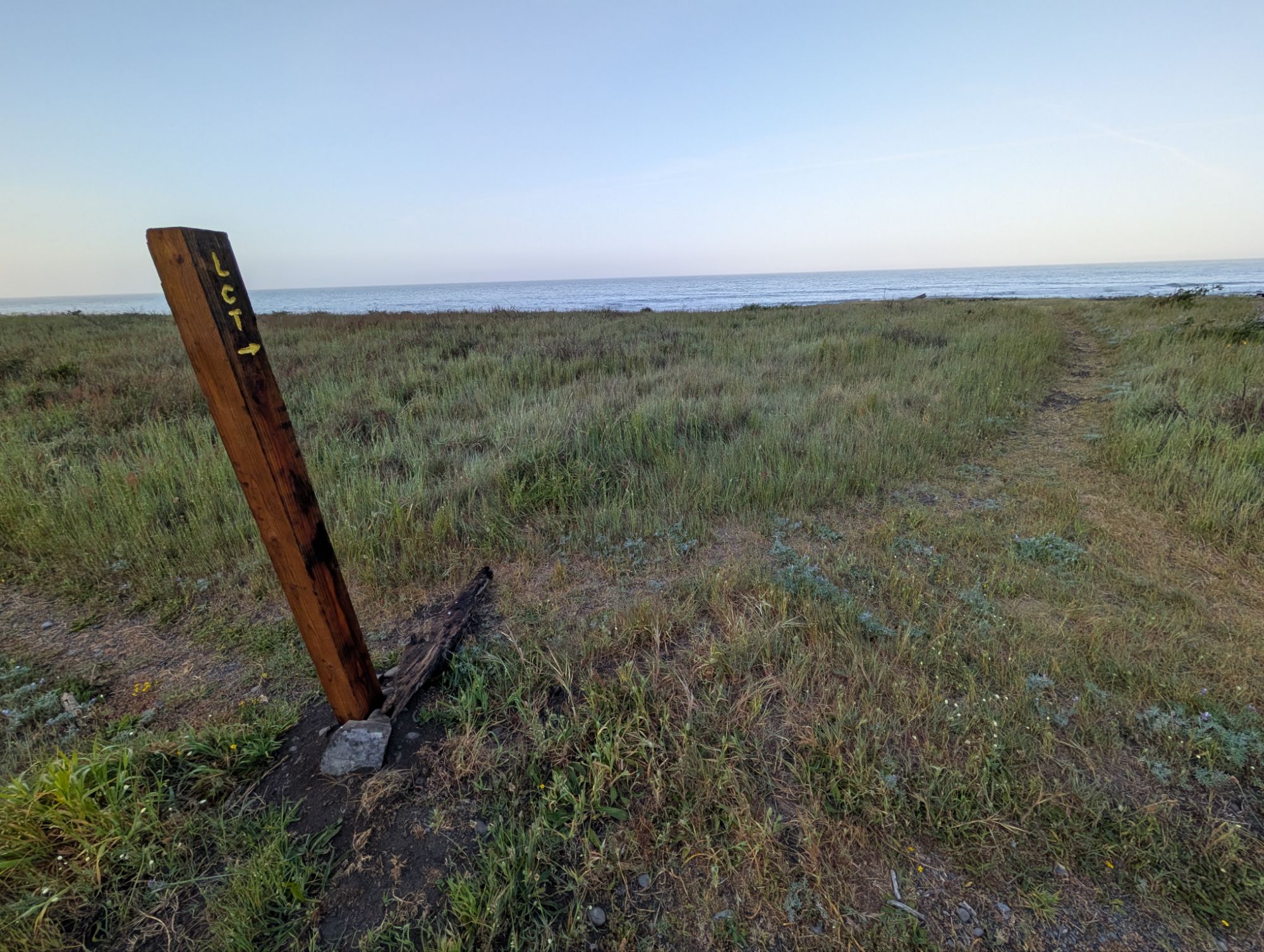
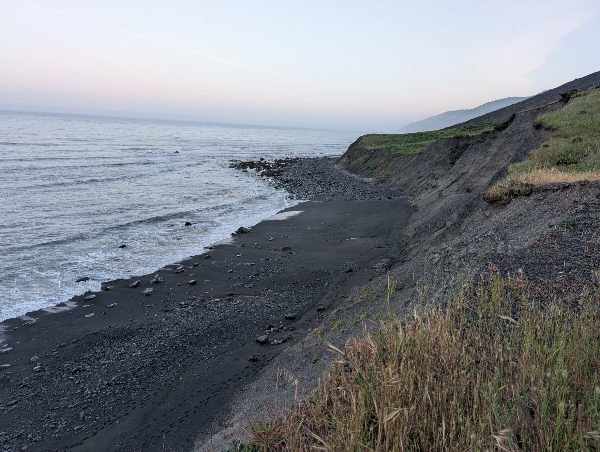
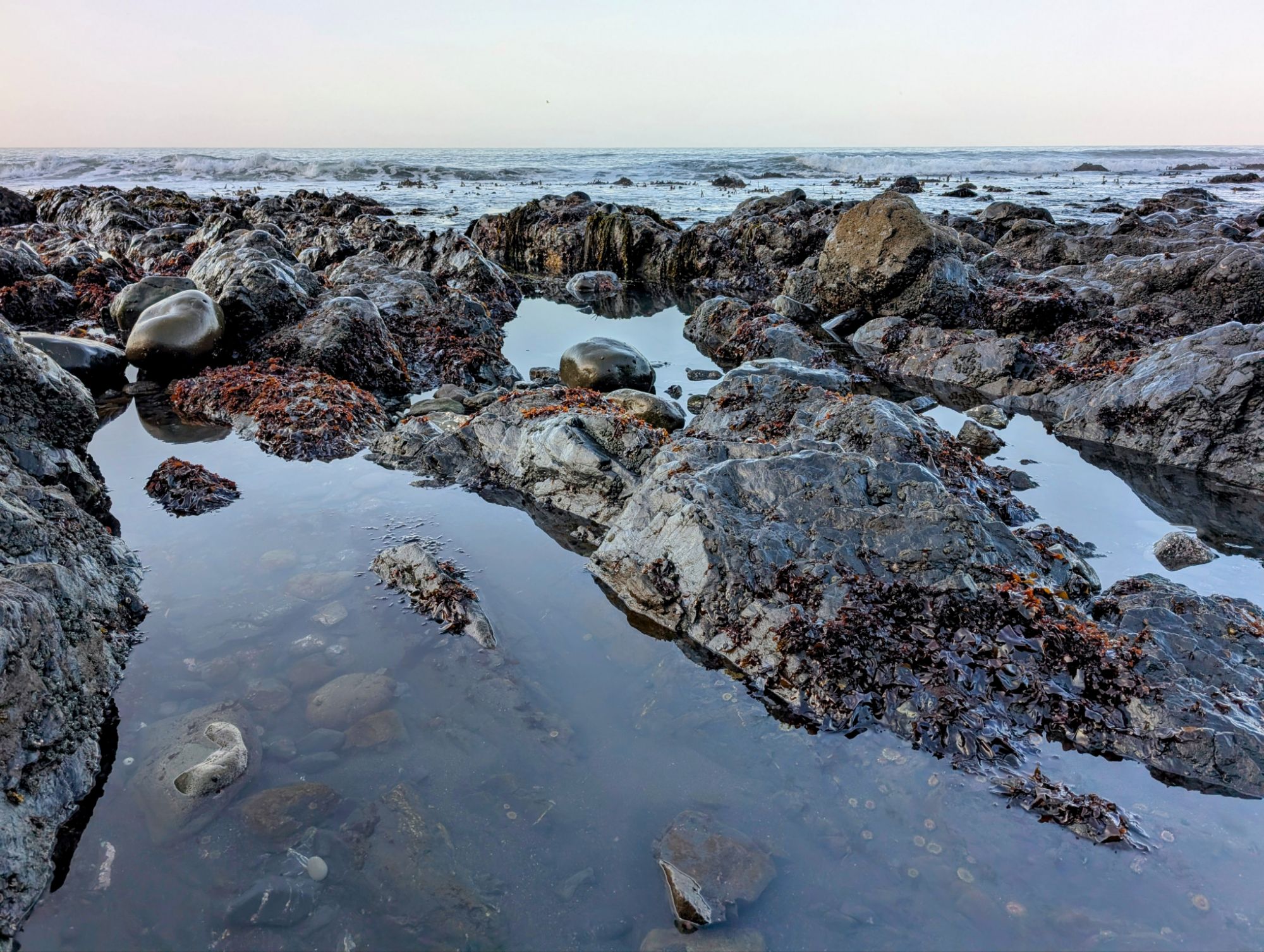
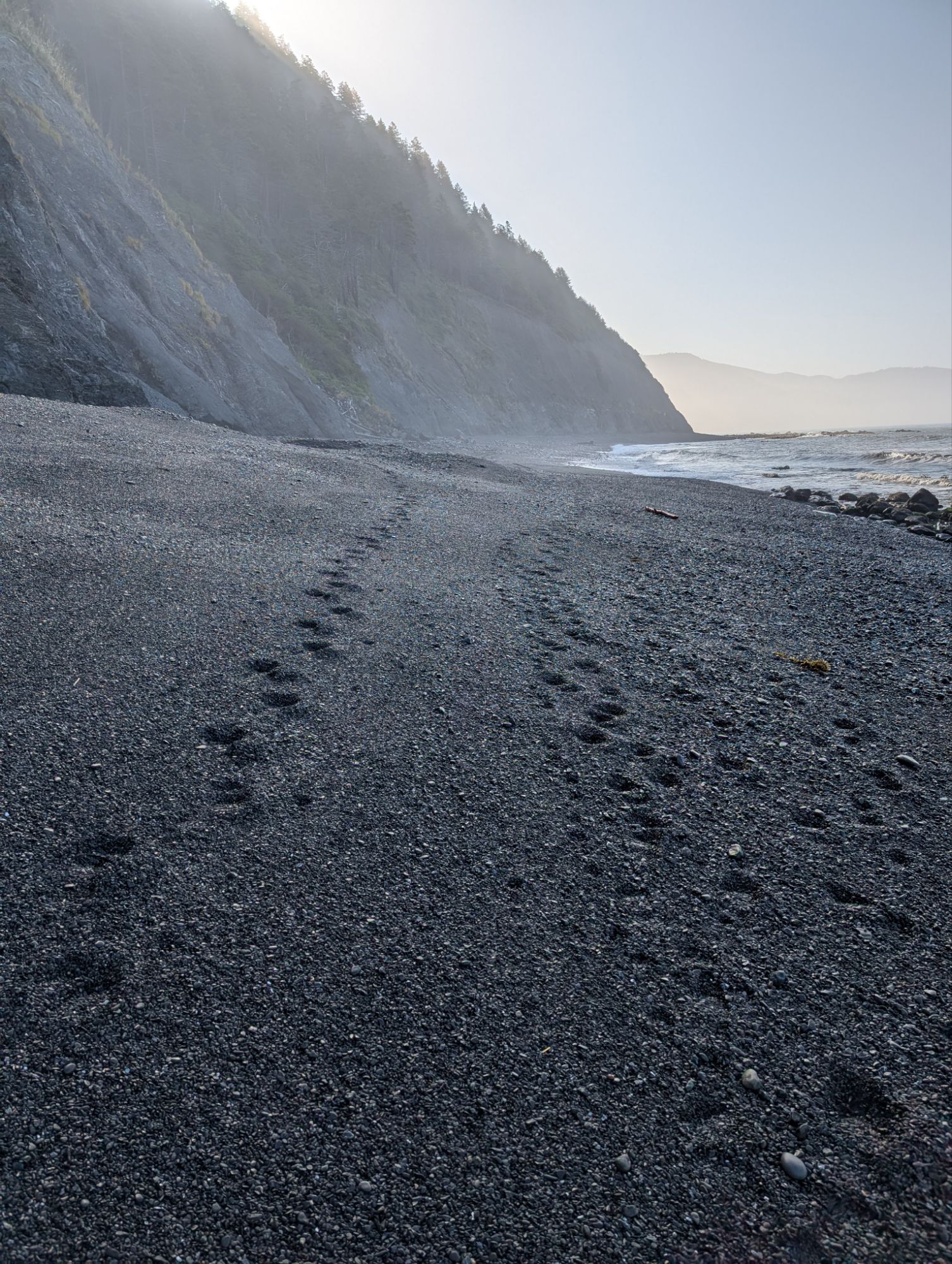
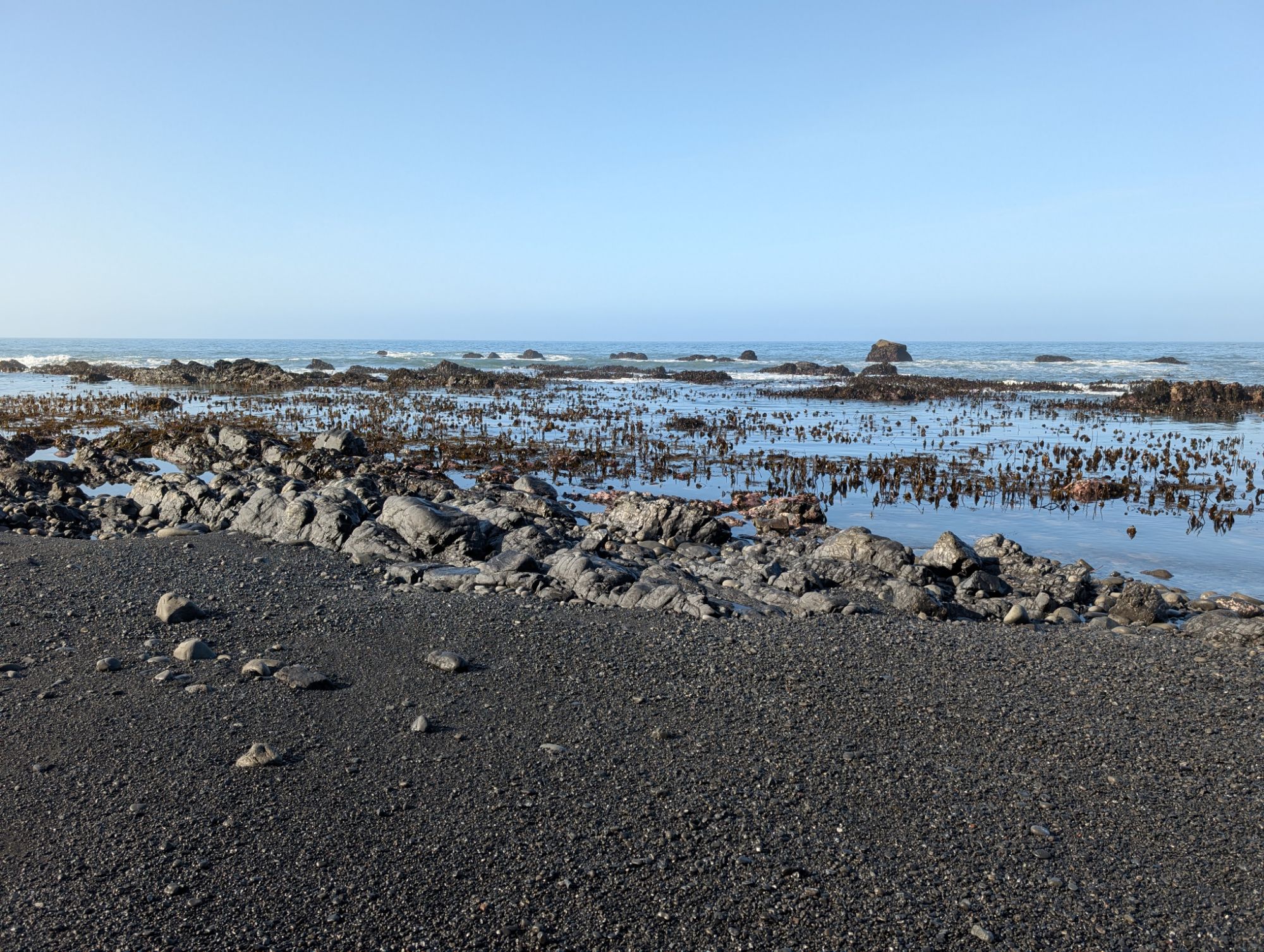
This is the start of a 4 mile beach section that is impassable at high tide. Like a snowboard pipe, I drop into the beach. High tide was around 2 am and is going out to low tide until about 10 am. The sand is wet, wonderfully compact and easy to walk on. But then come the boulders. They appear to be wet but luckily they are not too slippery. With the boulders comes spectacular tide pools that are filled with life and reflect the morning glow. Suddenly, a souvenir presents itself. In this sea of dark and black rocks, there is one tiny orange-colored rock. I pick it up and slip it into my hip belt pocket.


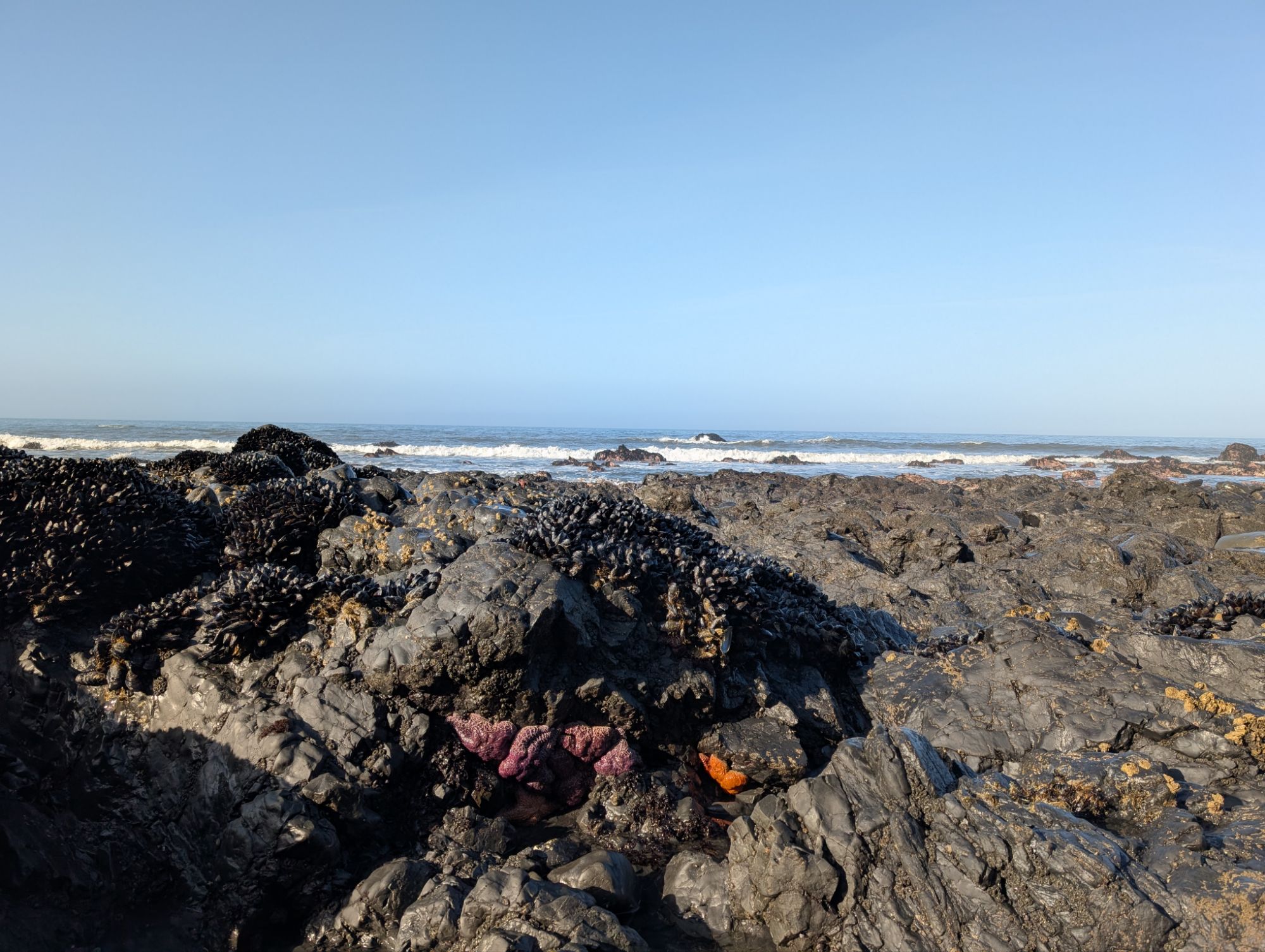

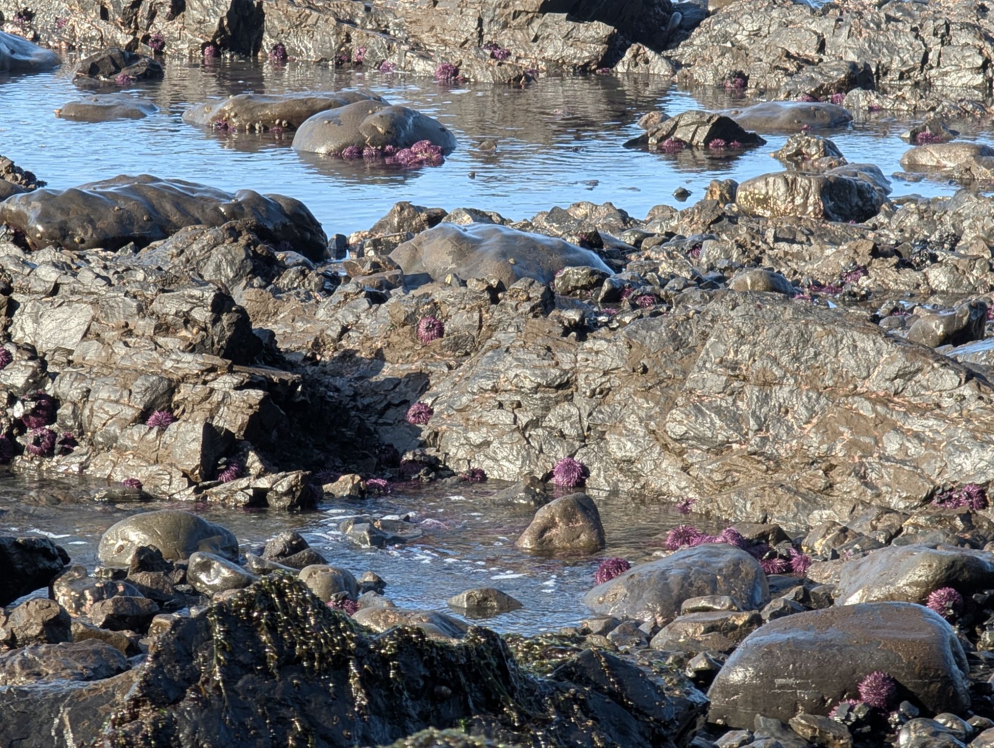
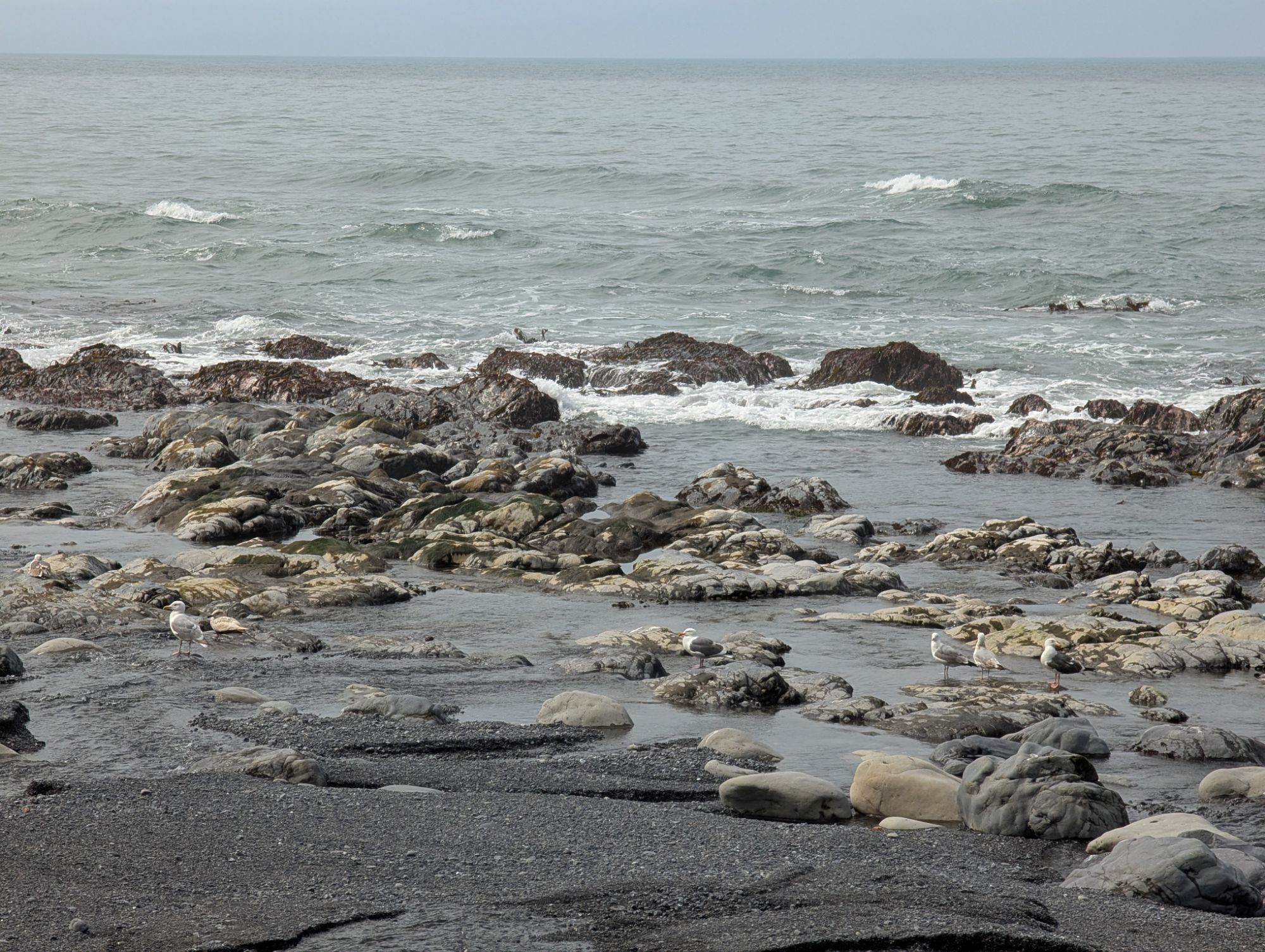
I venture out closer to the ocean as two hikers speed by. I’m treated by finding some Ochre sea stars and lots of urchins. Slowly, the sun begins to reach over the crest and hit the beach.

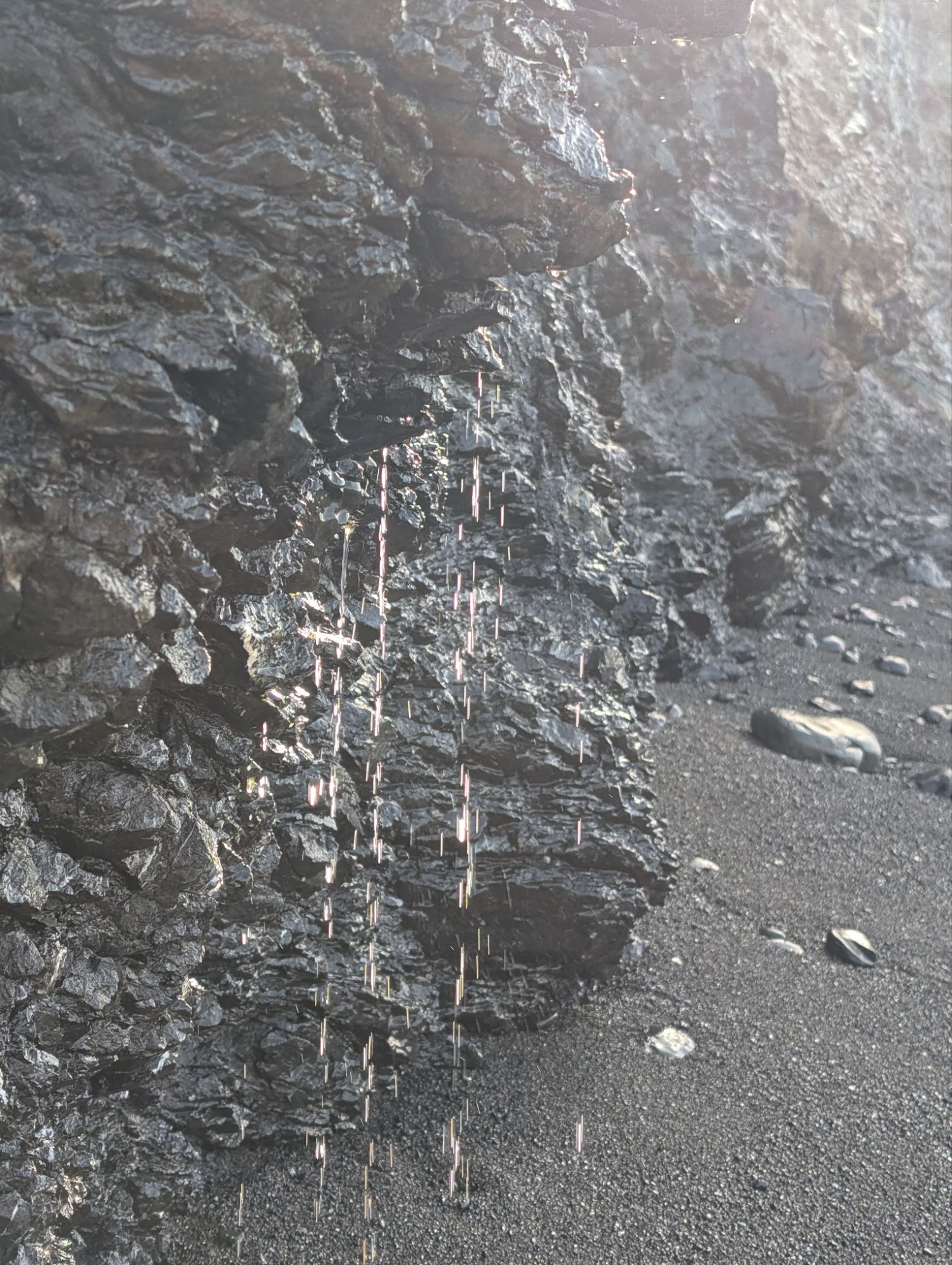
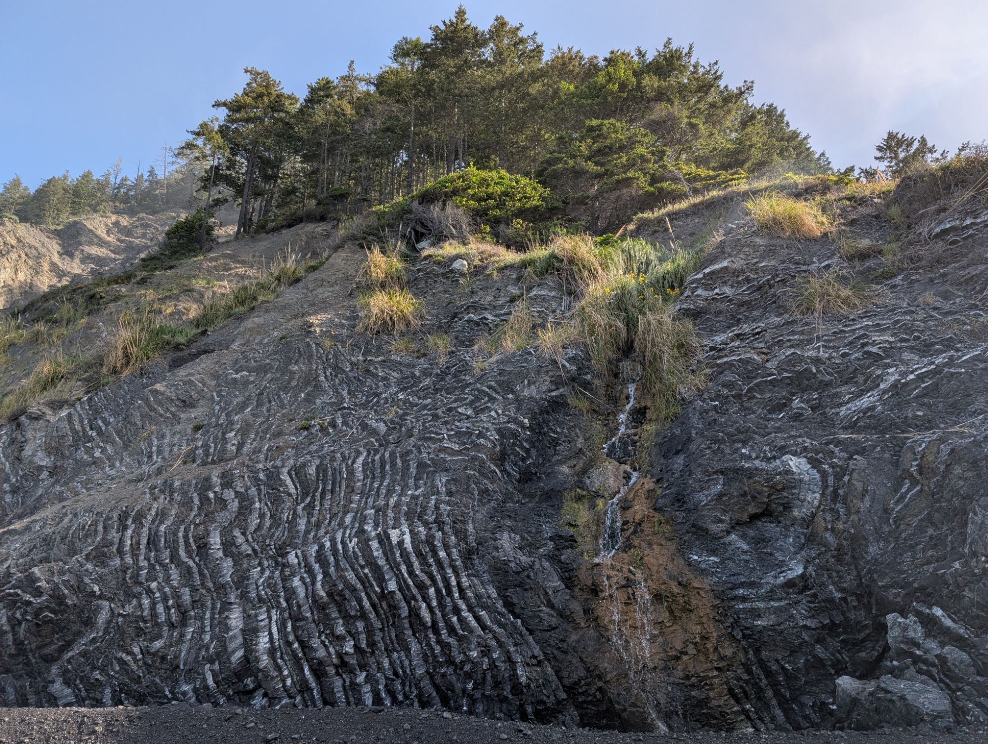
There’s lots of bull kelp throughout this whole section and it always looks like an animal bobbing around out there. There’s also a lot of water flowing into this area off the abrupt cliff face. There’s definitely no need to carry any water in this section during this time of year, although it could be a bit silty. Something red catches my eye and at first I think it is plastic. I pick it up, flip it over, and am rewarded with a beautiful chunk of abalone. I walk towards the cliff and find a sandy ledge to sit on for a break. As I sit there I start to see the tiniest little stones that are a beautiful mixture of white and orange. I pick up a few and tuck them into the zippered cargo pocket of my pants.

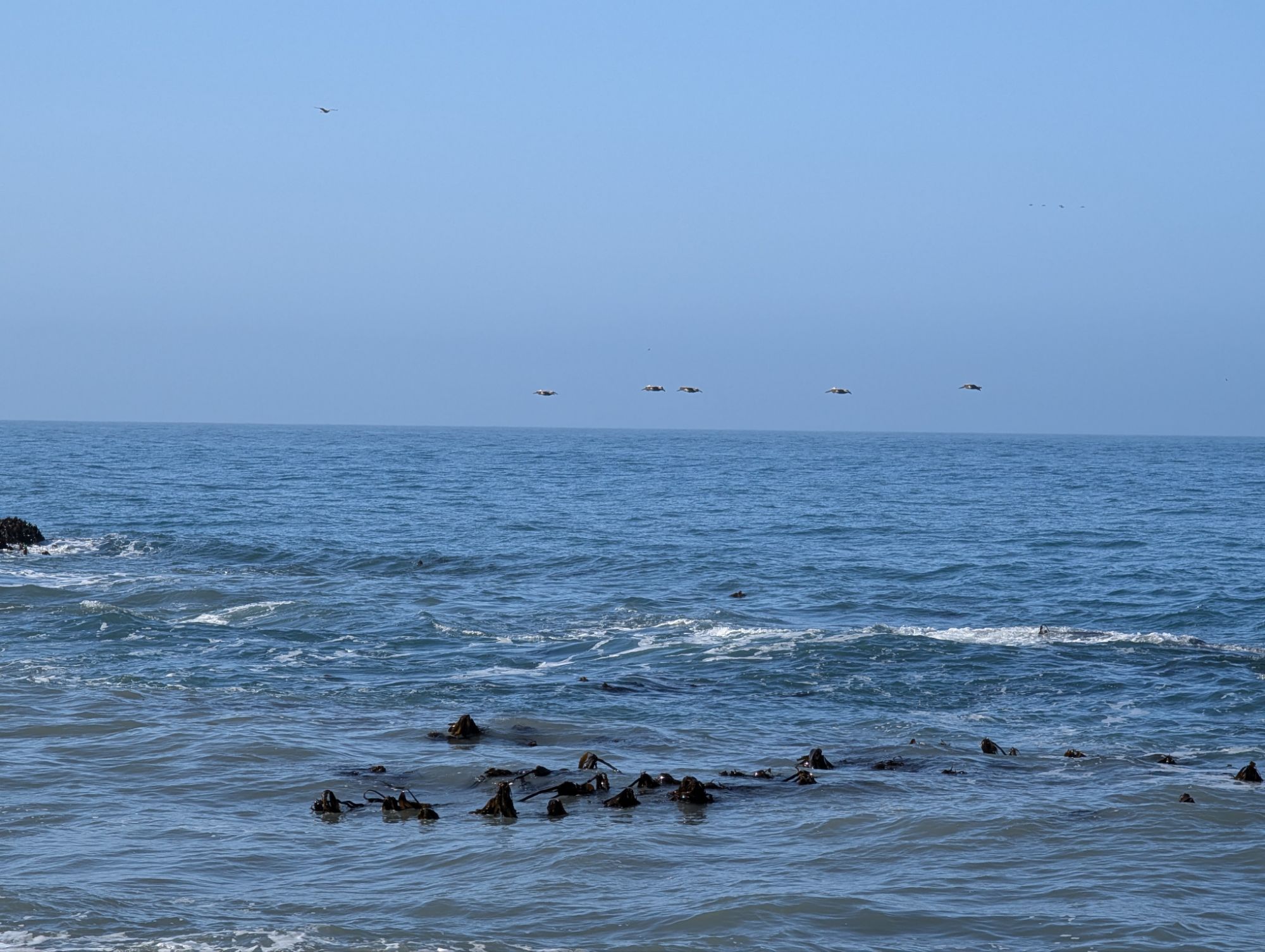
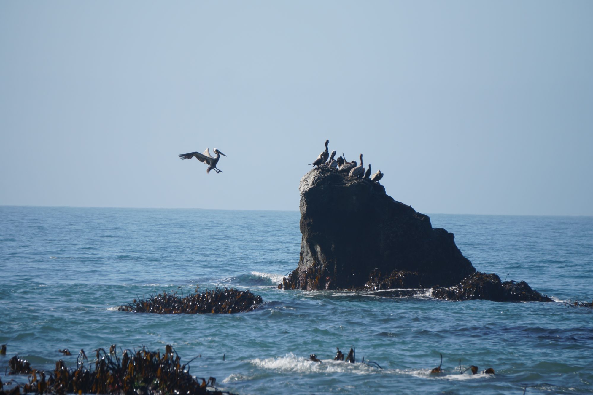
As I hike on, I’m lucky enough to find a few more abalone chunks and orange-colored stones. I see some pelicans fly by and after I walk farther down the beach, it appears that they have all landed on a big rock. There’s one that keeps landing on the rock and then flying off and I appreciate the show. At one point, it even plops in the ocean with a big splash. Just about the time I decide to dig my camera out of my backpack, I hear some sea lions calling. They are not far from the pelicans and are resting atop a rock. It seems like several of the sea lions lift their head to check on what I’m doing.

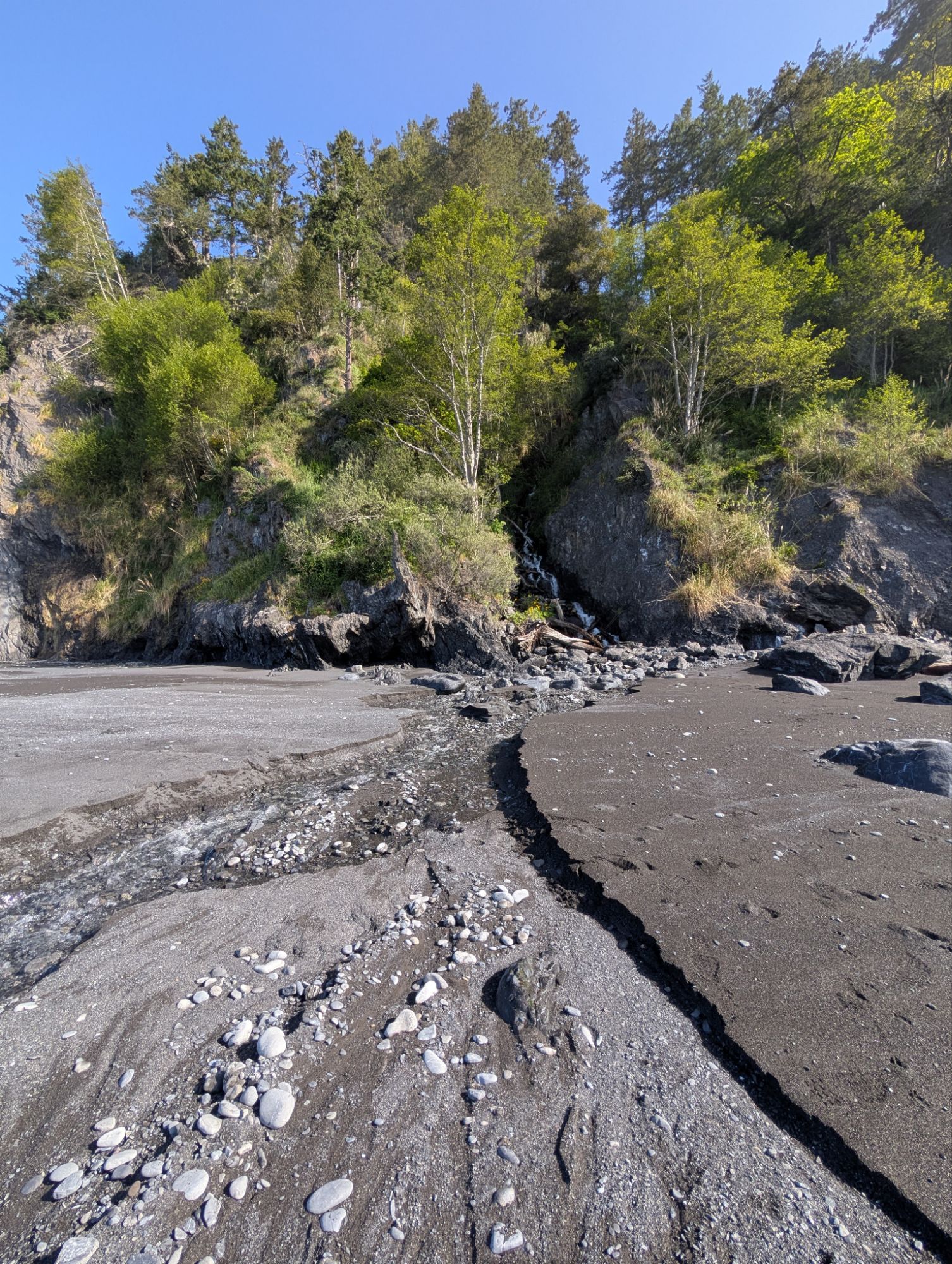

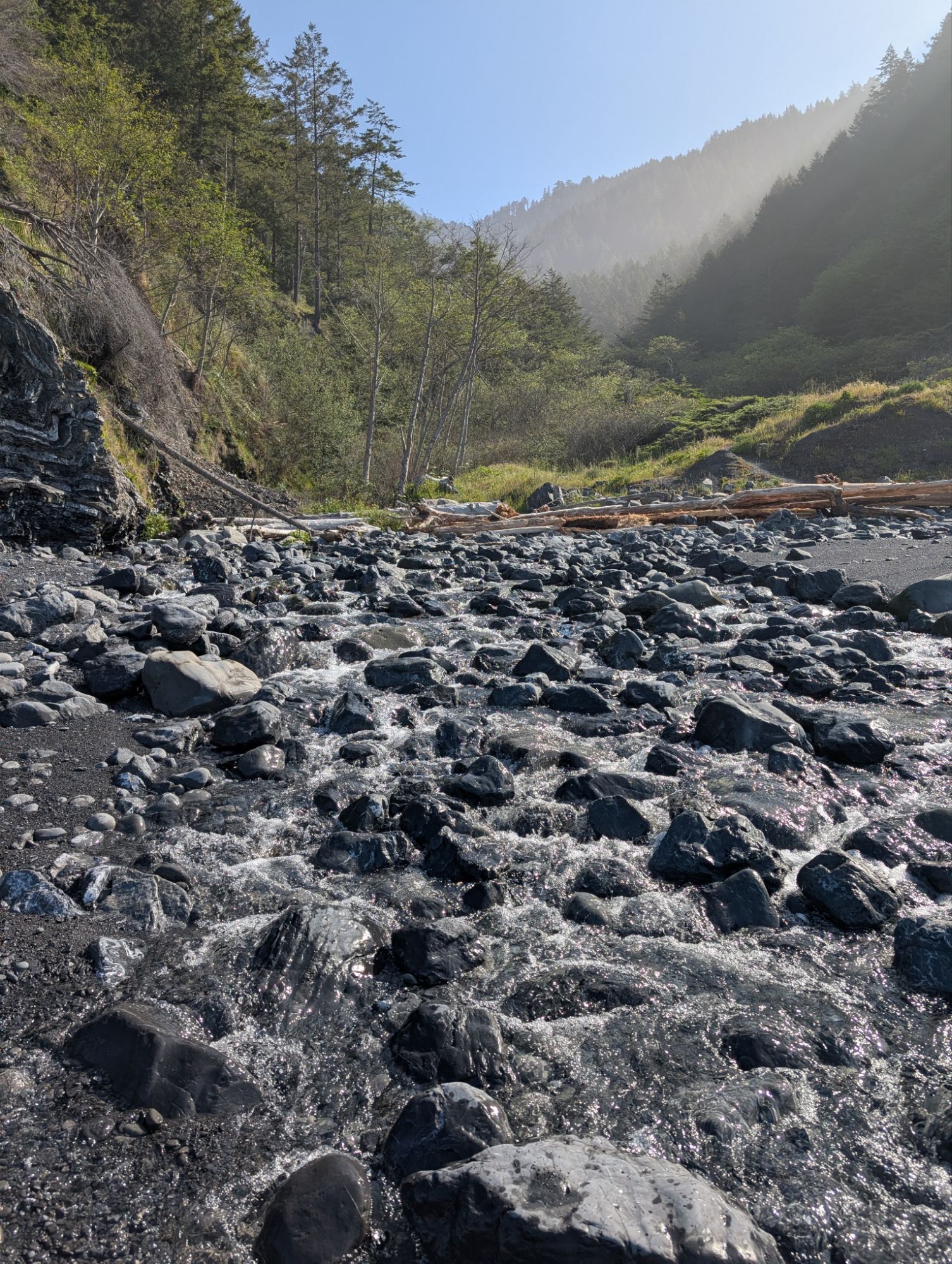
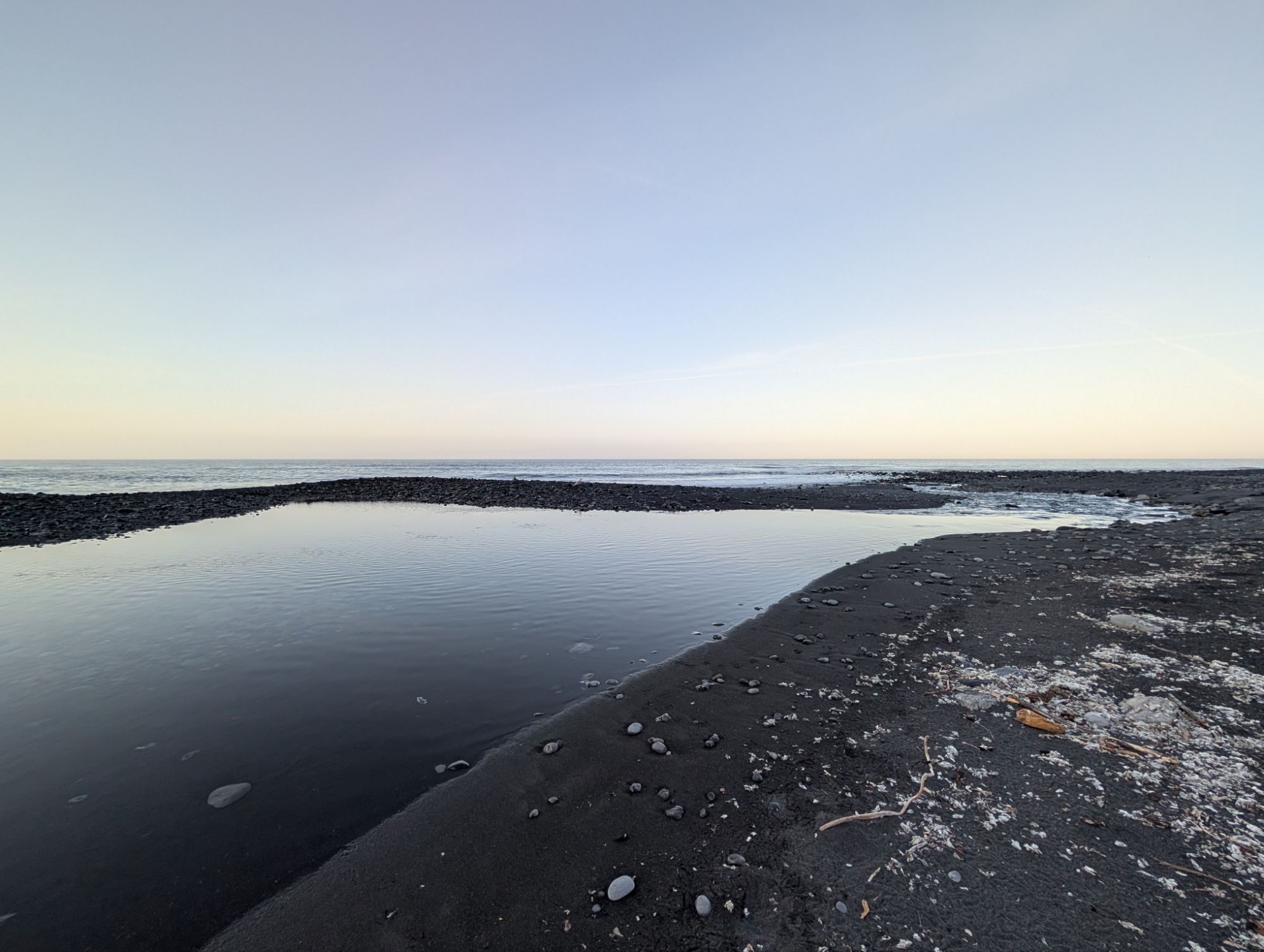
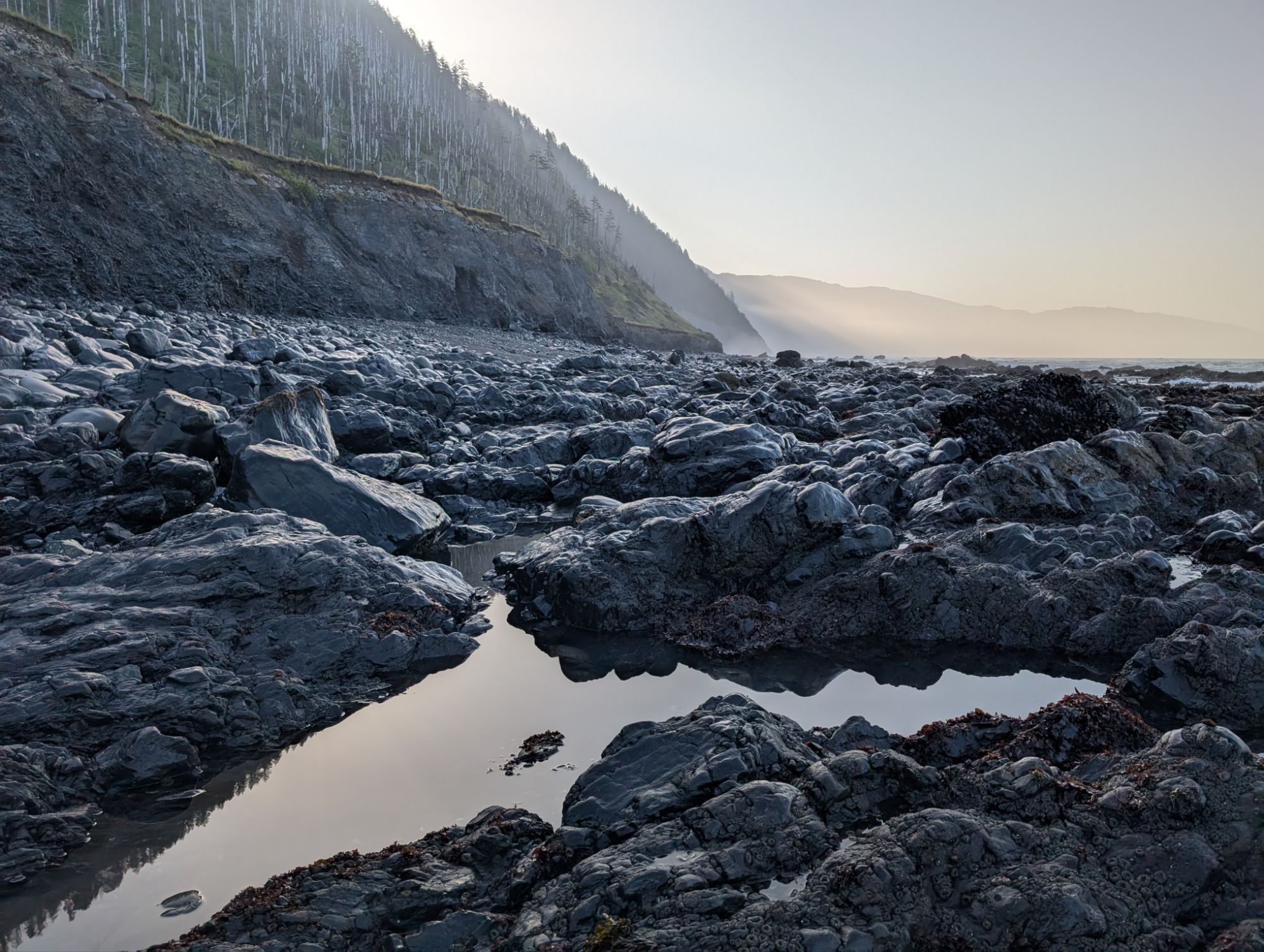
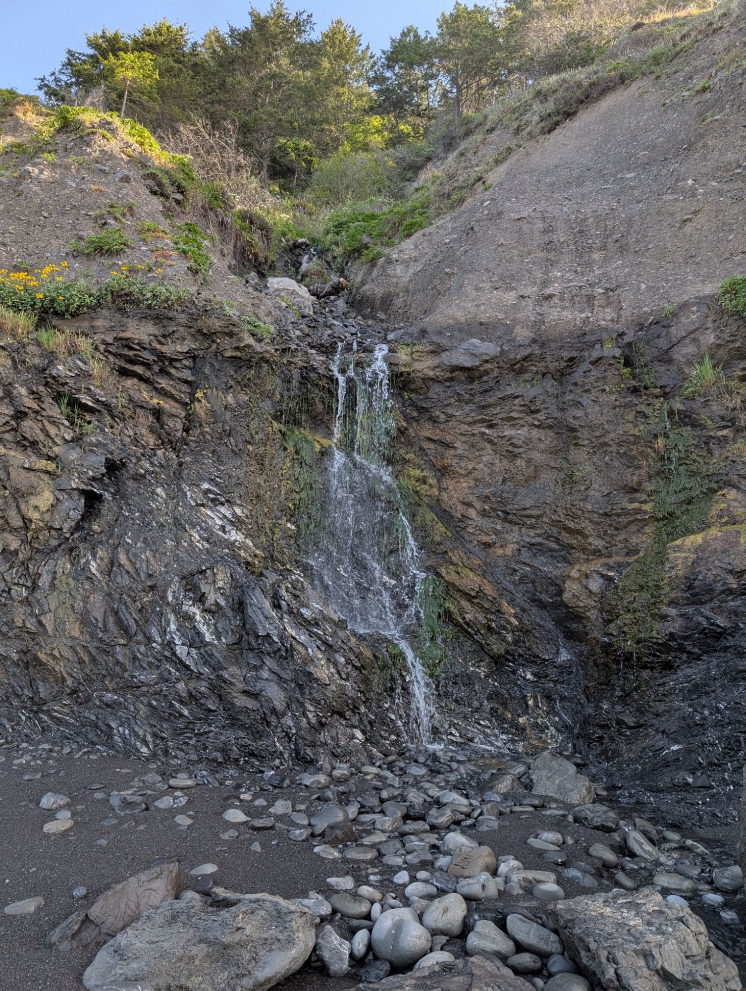
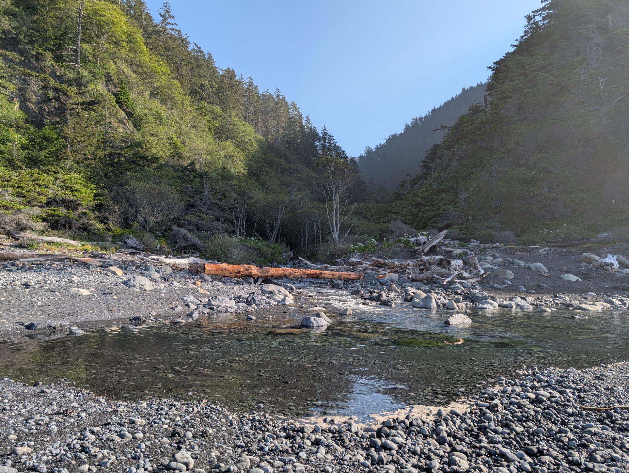
I pass Shipman Creek and other no name drainages that flow out to the ocean. If the inflow is small enough the water usually disappears into the sand and filters towards the sea. The gulls know it’s low tide and gather to check for second breakfast. I come to Buck Creek Trail and it’s another temptation to start climbing. This would be the most direct route back to my truck. As tempting as it is, the guides I’ve read say that it is infrequently traversed. That sounds like a high probability of overgrown trail.
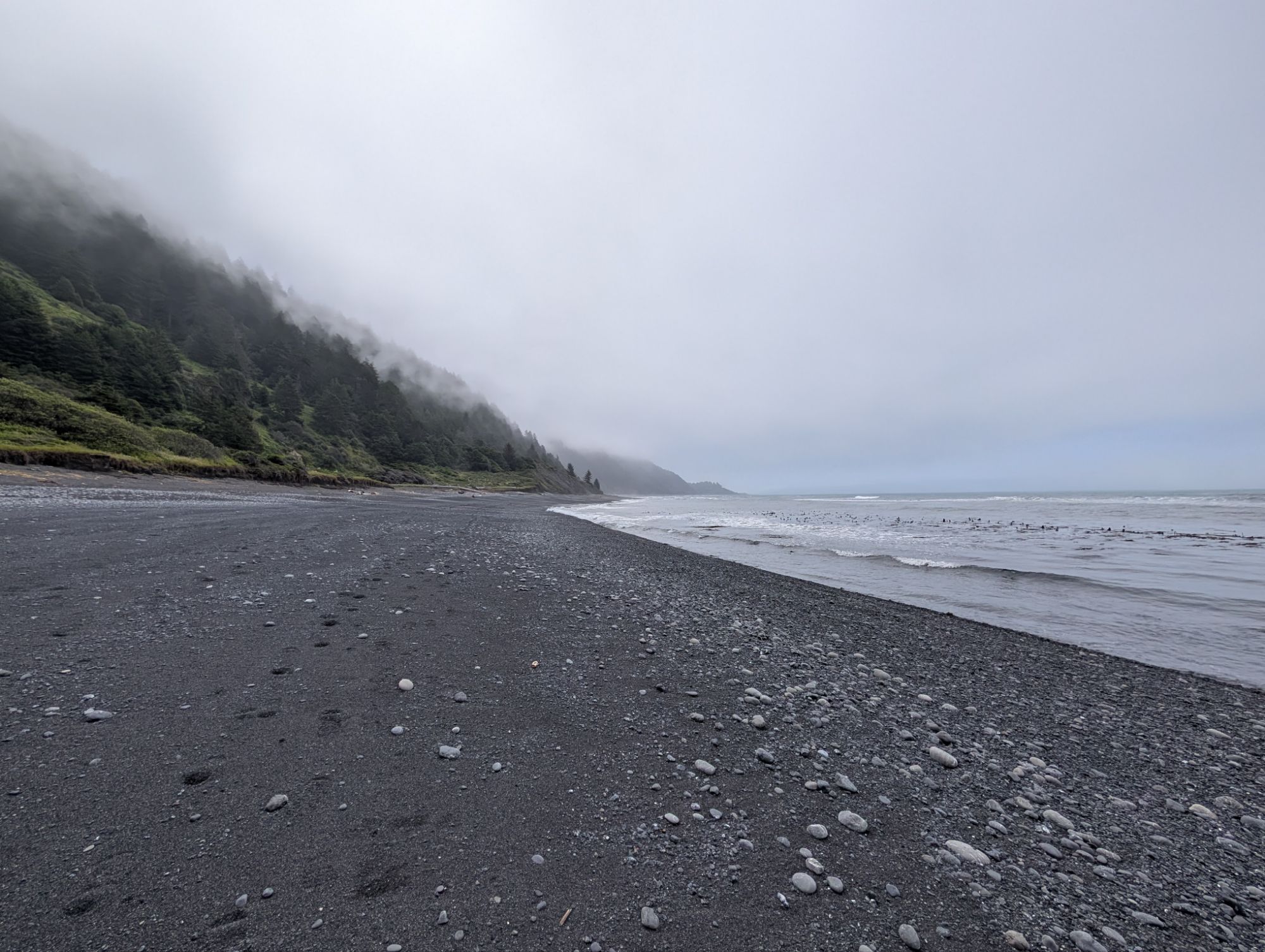

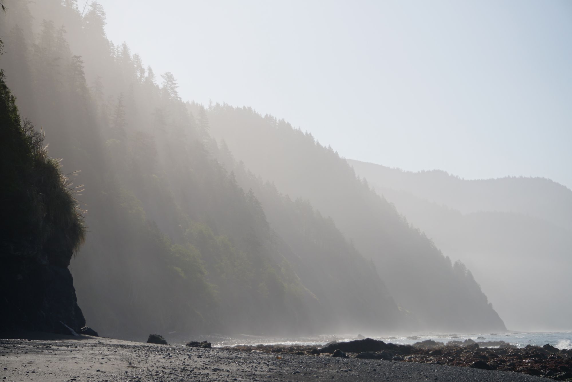
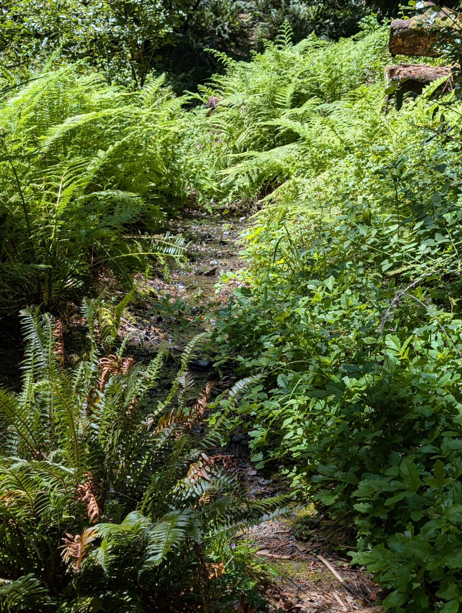
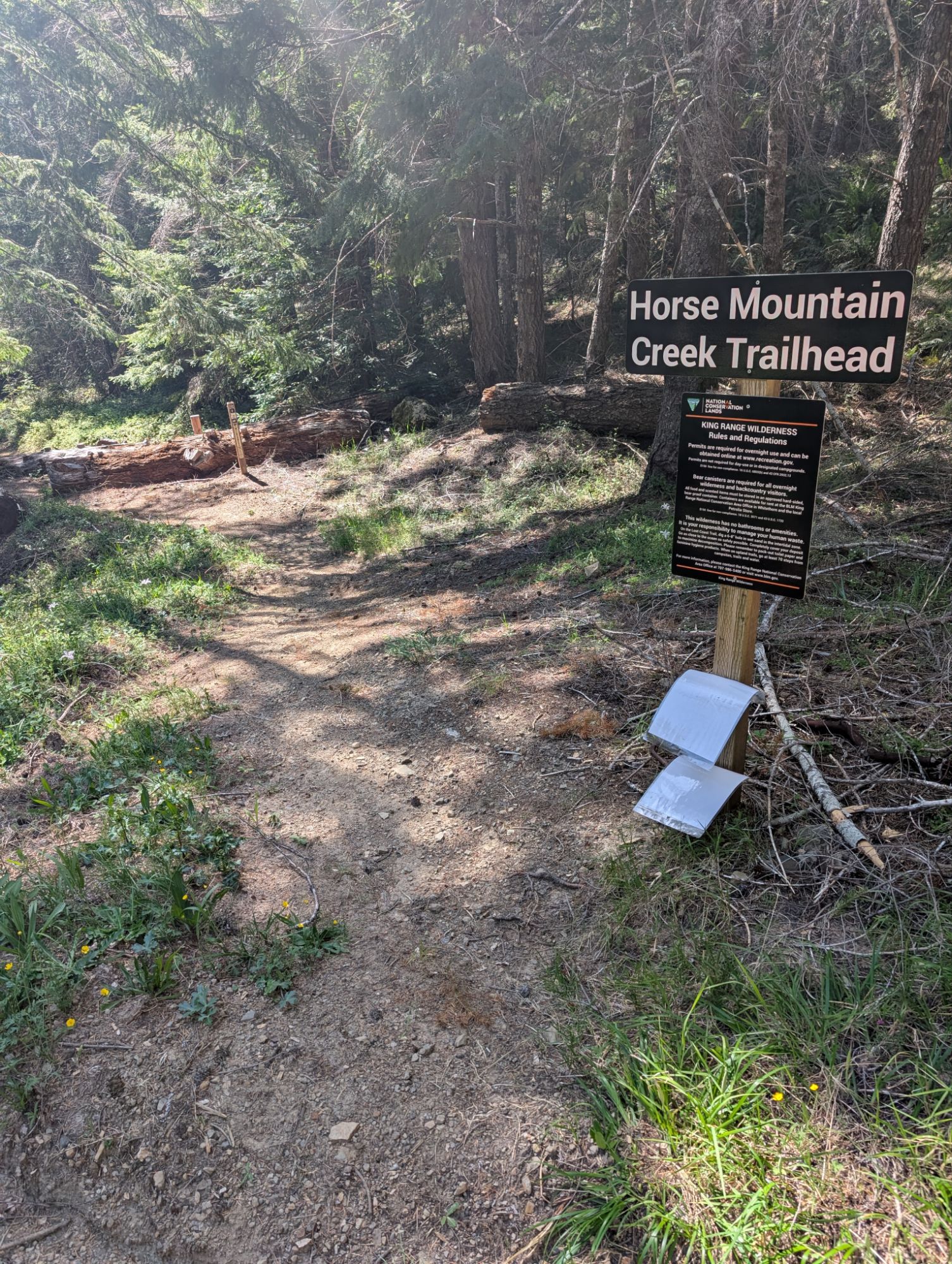
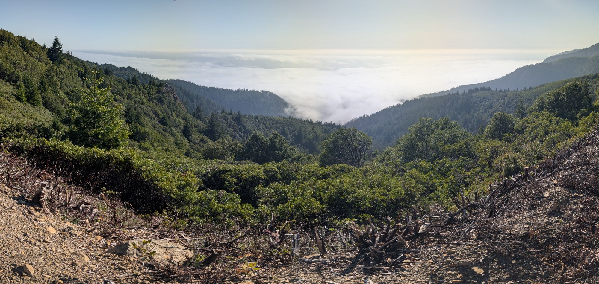
Around 11 am fog starts to envelope the coast line. Without the wind, the marine layer has moved in. You see, it pays to start early. There’s even steam rising from the sand and it floats inland too. I reach Horse Mountain Creek and check my maps. Well shoot. The Horse Mountain Creek Trail starts over a quarter mile back from where I’ve just come. I turn around and hike back to the north. The two hikers who passed me earlier are coming towards me and are curious about my change in direction. I explain about my loop. Now that I’m on the lookout, I easily see the marker for the trail. At 11:30 am and about 9.5 miles into the day, I start up the trail. It is immediately overgrown with vegetation and most problematically, poison oak. Unavoidable poison oak. I do my poison oak trail dance but it still touches me here and there. I move my hand sanitizer out of my toilet bag and into my front utility pouch and use it often. All in an effort to appease my worrying mind.


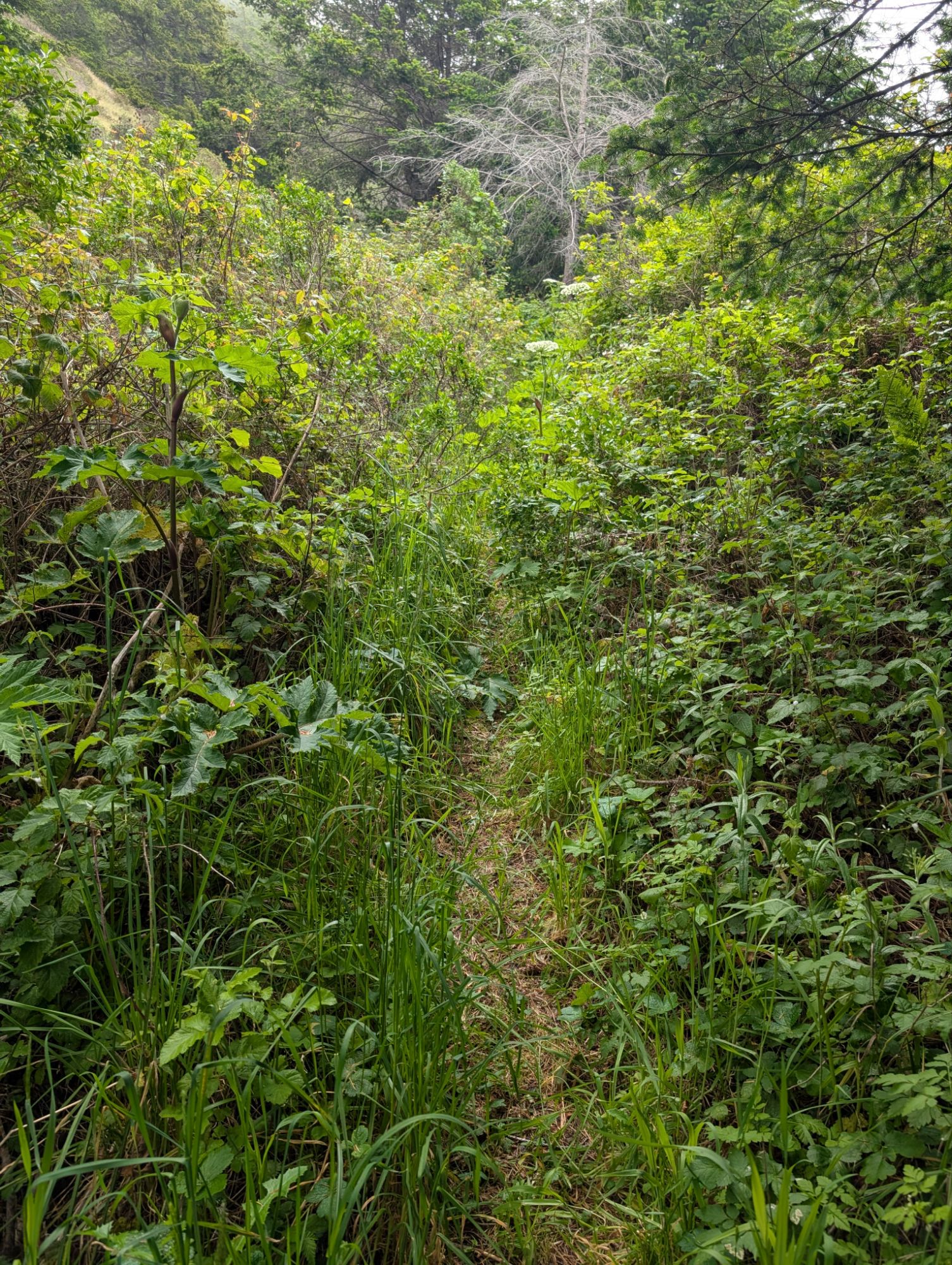

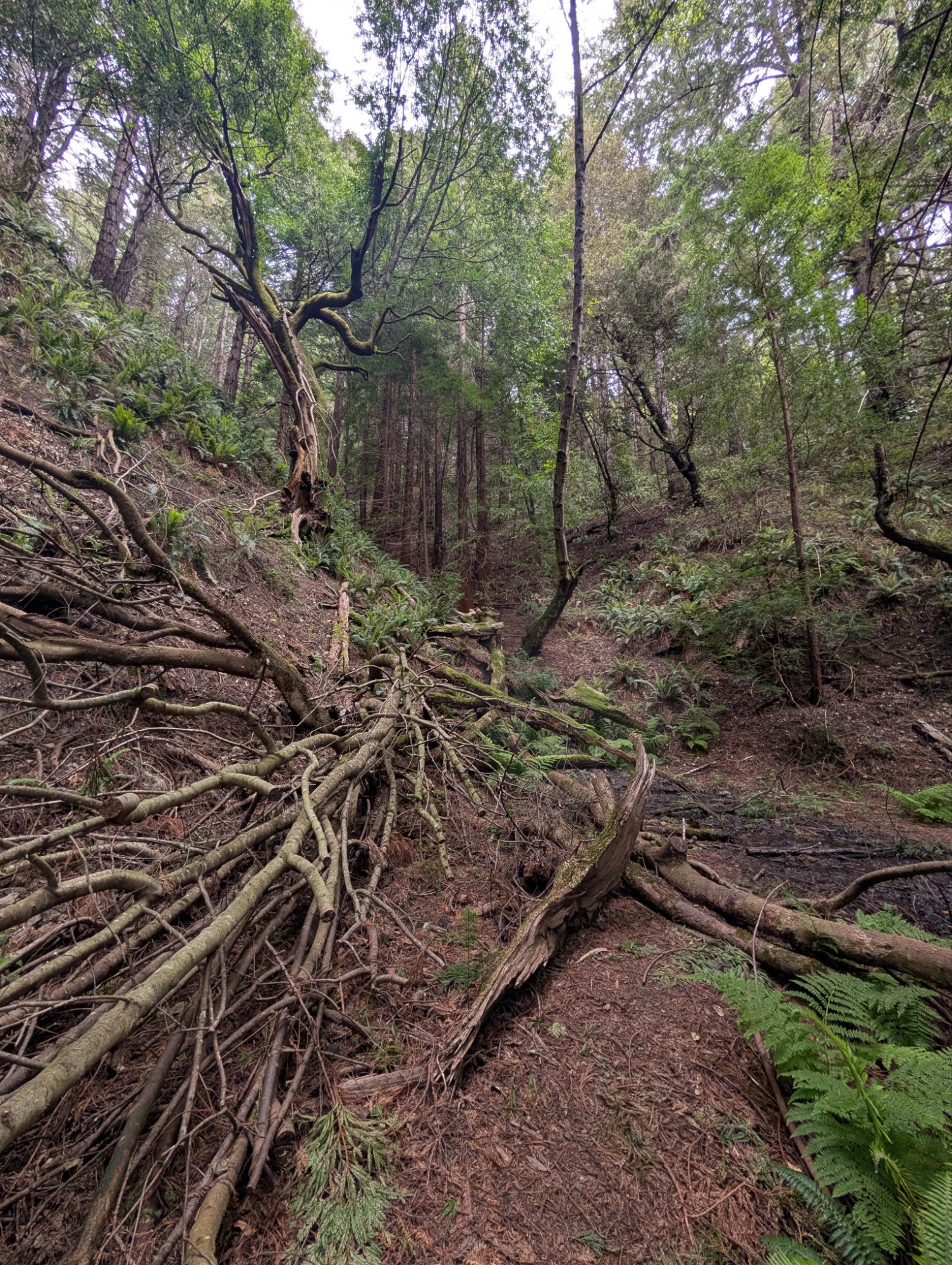
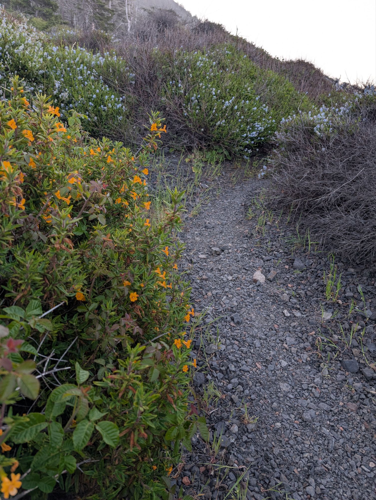
The first bit of the trail is the worst but the first two miles take an enormous amount of focus, concentration and maneuvering. Not to mention that all the dodging is slow going. In a more happy thought, this trail should be called The Trail of 2,000 Iris. I’ve never seen so many and they are everywhere!

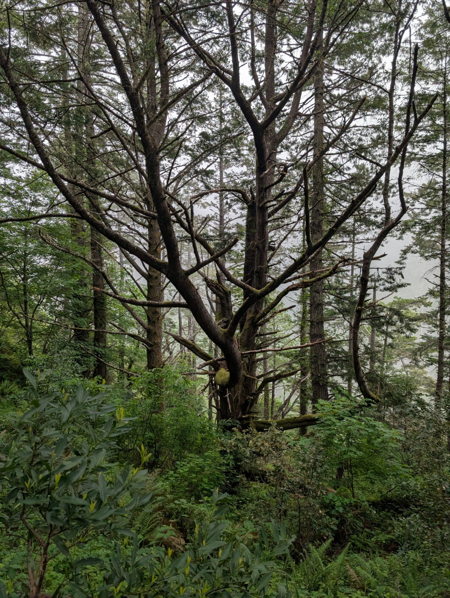
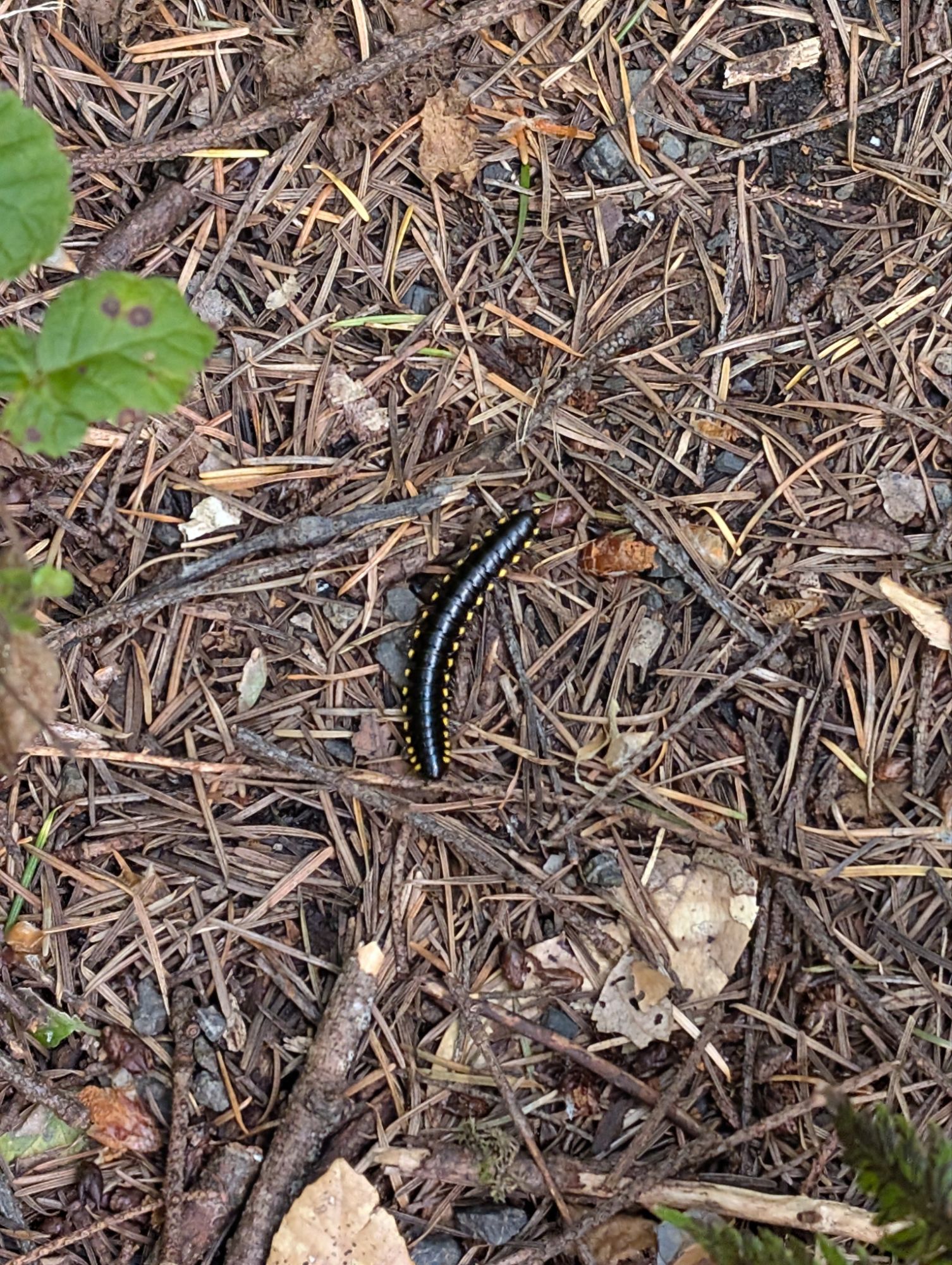
At one point, the trail is covered with Yellow-spotted millipedes and I have to be careful not to step on them. What is this, some millipede convention? I feel something at my neck again but upon investigation, I think it’s just a previous tick bite.There’s a short section of road and I’m so grateful for the extra space and the chance to rest my mind. I crest a little ridge and hear something ahead of me. Just a quarter mile back, there was a giant well-aged pile of bear scat. The forest goes quiet as I start my usual “Hey bear, it’s me Lionheart” call and subsequent story telling. I keep it going into a drainage where water has pooled and is flowing downhill. I keep my eyes glued on the banks surrounding me.
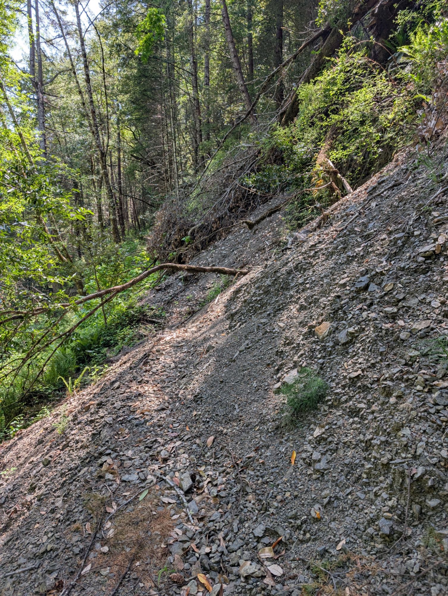
I continue to move slowly as the trail traces along the mountainside. I come to a slide and there’s a faint path that treads around and through its base. I hear a rustle in the leaves and see a massive gray squirrel bolt for cover. Hmmm, maybe that’s what I heard earlier.
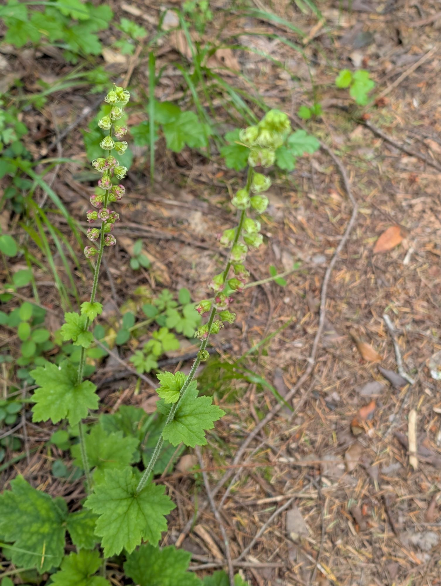
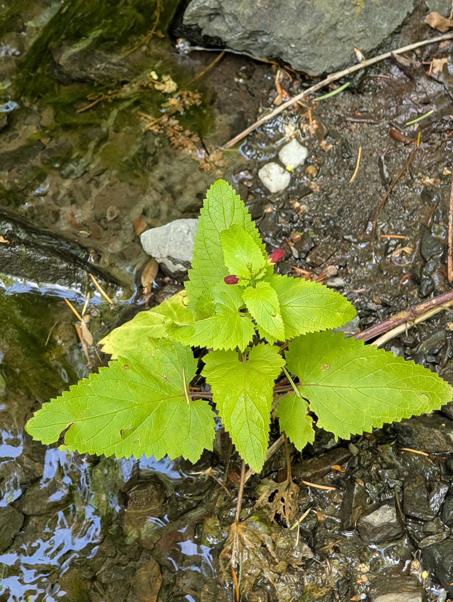
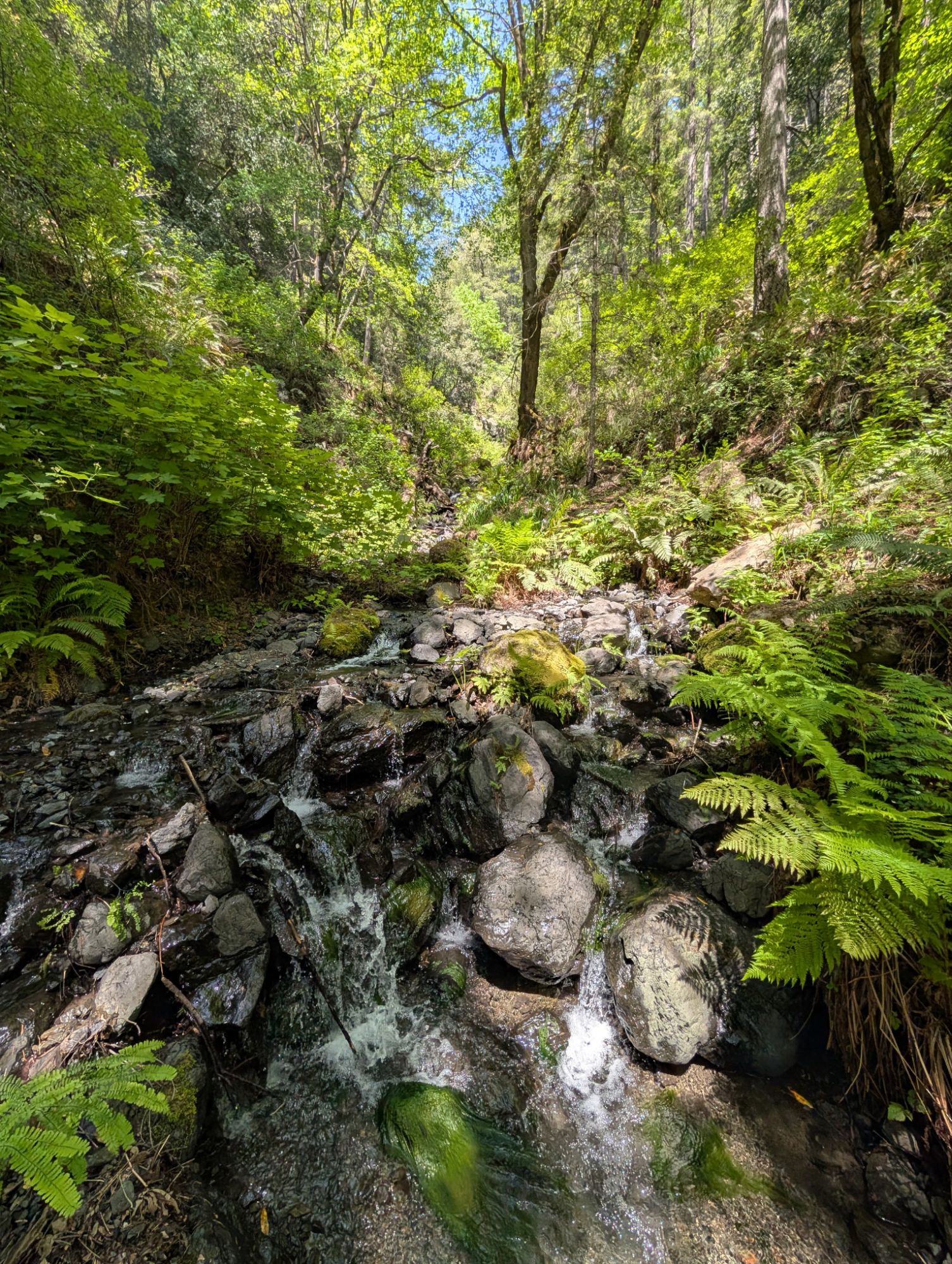
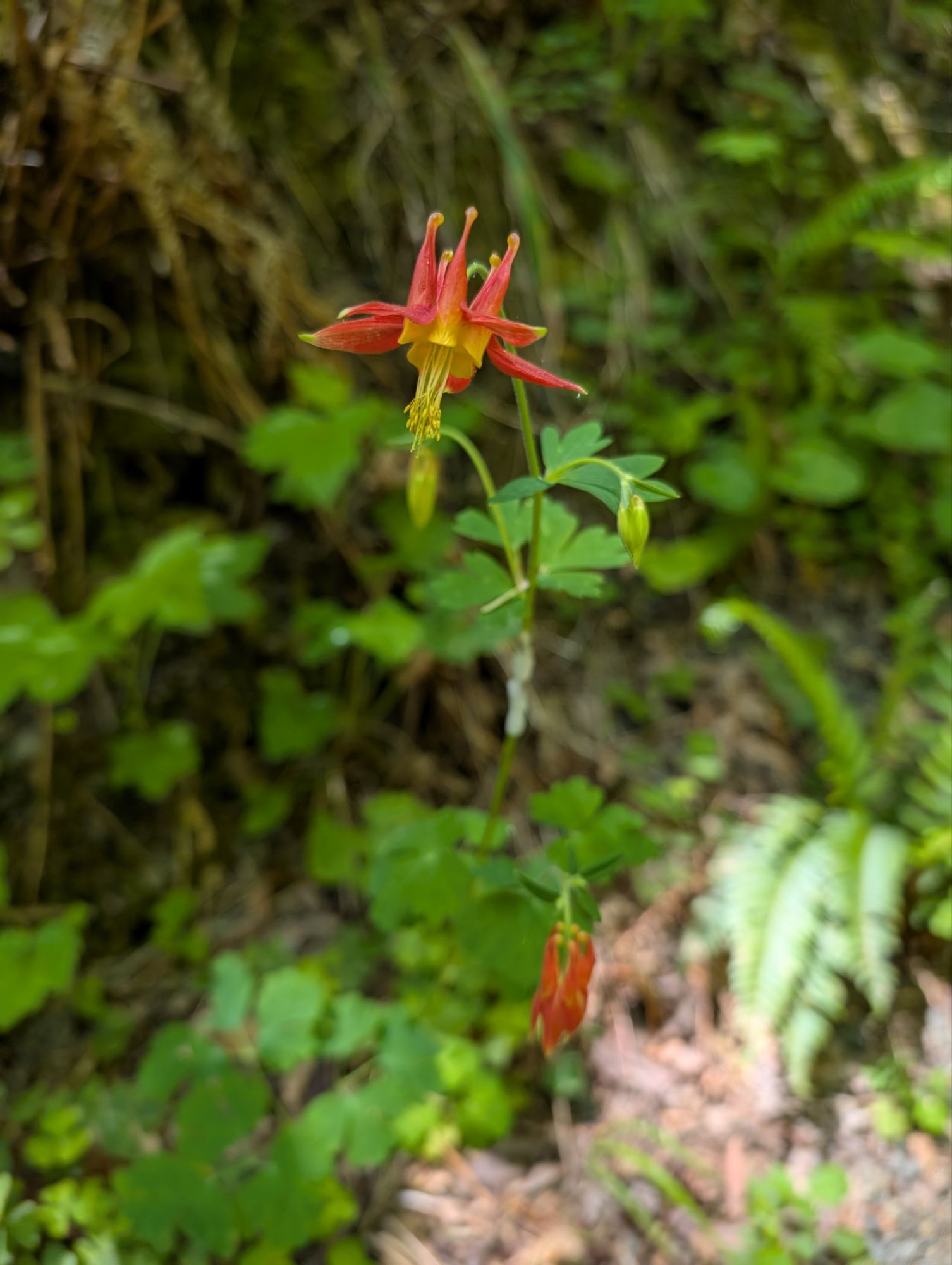
There’s lots of little creeklets along the route and I take a break at one with a single Western columbine plant. Also at this creek I see one California bee plant. I find a rock to sit of for snack break and morning medication and before long I see a tick on my pant leg. Ok, time to go.


I trudge uphill, absolutely unable to increase my pace. I never see it but I hear a bear run off in the ravine below me. I drag myself into the Horse Mountain Creek Trailhead at about 3:15 pm, nearly 4 hours after starting the 4.2 miles trail. Ouch, that was slow!
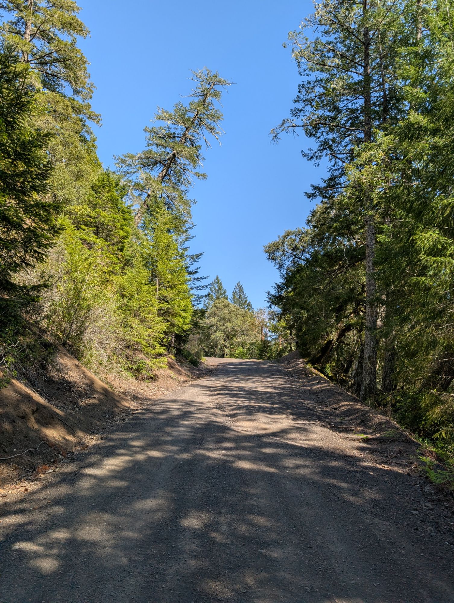
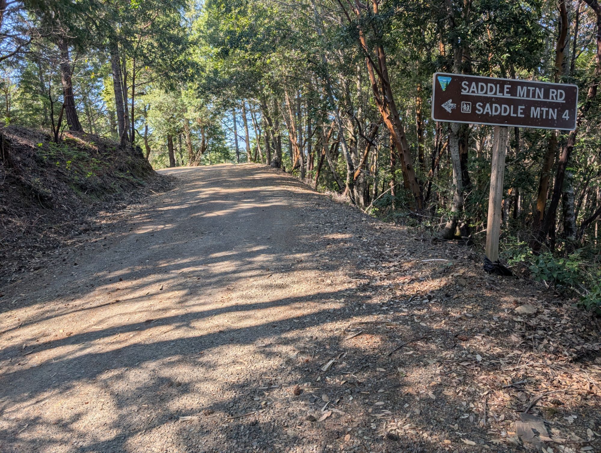
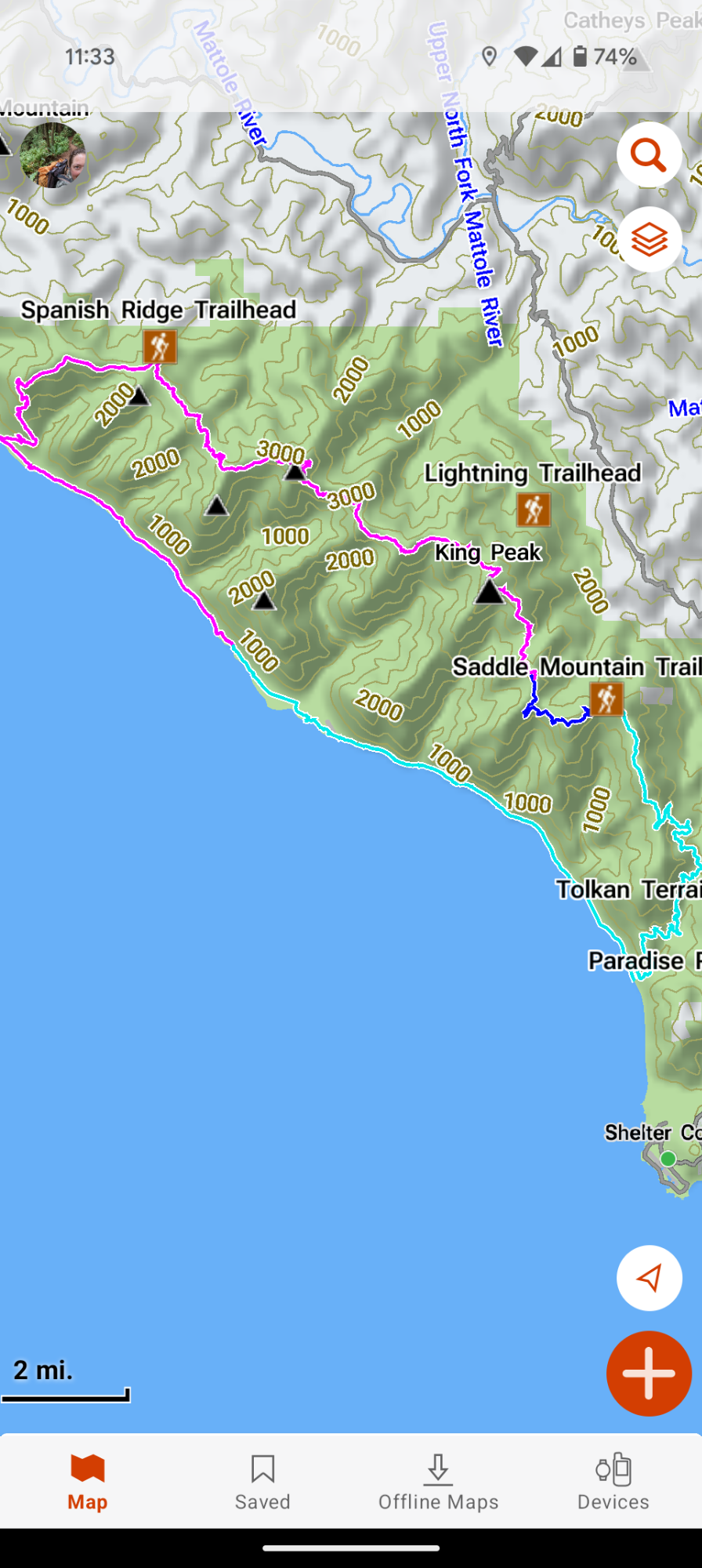
On my drive in a few days ago, I had seen flowing water along the road. I hike the short distance and collect water that’s flowing off of the hillside. I sit down for a short break while I daydream about a truck driving by and giving me a ride. The road gently climbs and I’m grateful for the sections of shade. After a shorter distance than what’s listed on the map, I arrive at the junction with Saddle Mountain Road about 4 pm. I make the turn and start the steep climb. This is the section where I needed 4-wheel drive a few days ago and I plod along every so slowly. I’m surprised when a couple big trucks pass me as they descend the road.

It takes me 40 minutes to reach Spanish Ridge with the amazing view of the ocean. The big difference from a few days ago is that the wind has stopped and the marine fog layer is sucked into the mountains. I guess enduring the wind is a small price to pay to have had all the incredible views the last few days. I have cell service and send out a few messages as I keep climbing along the sunny ridge. Time seems to stretch on forever but just after 6 pm I can see my truck parked at the Saddle Mountain Trailhead. Almost 48 hours since my arrival, the forest is now quiet and the trees stand motionless.
I change my clothes and throw potential poison oak covered gear into my truck bed. Unfortunately, I don’t have any clean pants to put on. So in an abundance of caution, I shed my hiking pants and put on my sleeping base layer. I even have a little stick of deodorant with me and now I feel super fresh. At 6:40 pm I am relieved when my truck easily starts. This would be a bummer place to have vehicle troubles. I start the long drive back to Hwy 101 and then north. I’m so dazed from the hiking that I can’t really focus well on my driving. I just kind of sit there hanging onto my steering wheel with my mouth hanging open.
I don’t really feel hungry but I start to daydream about food that I could get in Eureka. Then I remember In-n-Out. Yes! I pull into the drive thru around 9:15 pm and there’s at least 15 cars in front of me. Despite the hour, they’ve got someone taking orders in person which is helpful because I need a lesson on “eat in your car” vs “to-go.” I haven’t gotten fast food in years but $7.33 for a cheeseburger and fries seems like a deal. It takes about 10 minutes to get my food. I put the basket of food on the top of my center console and start stuffing fries into my face. At the next stop light I dig into the burger. They’ve made it correctly (without the sauce) and it tastes so damn good. I alternate between fries and burger all the way home, inhaling food as if I haven’t eaten in a week.

One thought on “King Crest Lost Coast Day 3: The Early Bird Gets The Lost Coast Serenity”
Comments are closed.