Thursday, July 17
Start: Little Echo Lake (7296′)
Stop: Stuart Fork Trailhead (2709′)
Trinity Alps Wilderness
Shasta-Trinity National Forest
Unceded land of the Wintu, Hupa, Yurok, Karuk and Chimariko peoples
15.75 miles
2002′ ascent
6560′ descent
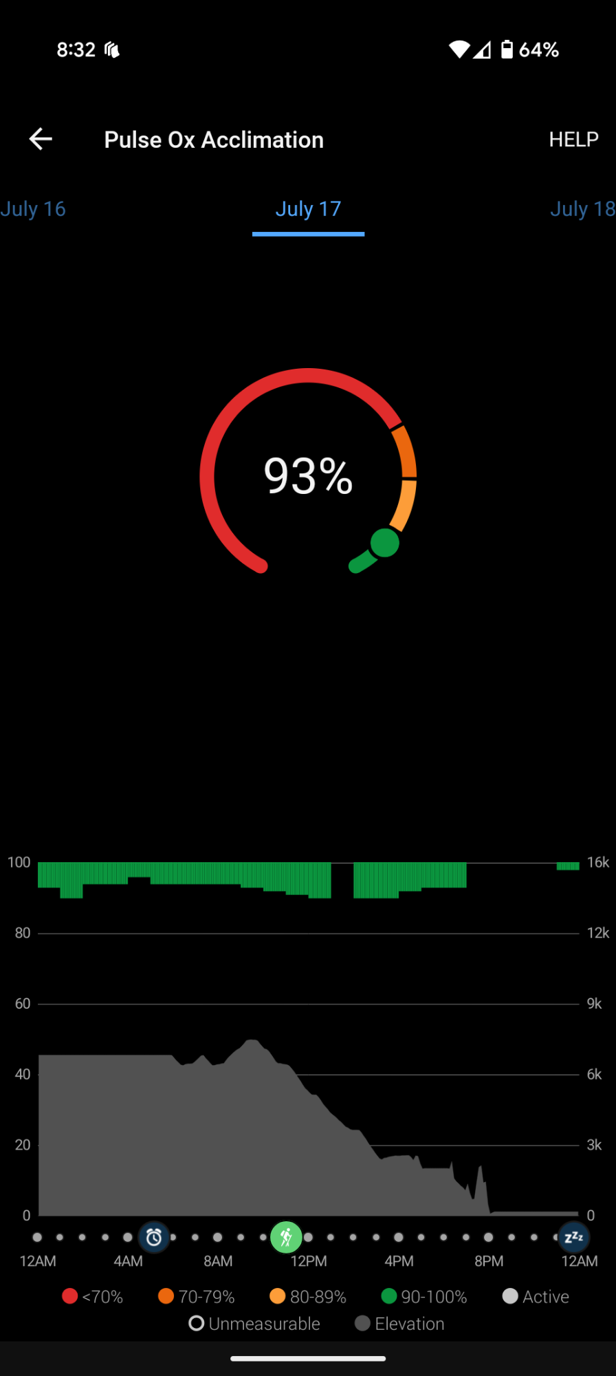
I am harassed all night by rodent friends scurrying on and around my backpack. Every time I get woken up I reach around and shake my backpack through the mesh of my tent. I double check that my trekking pole straps are tucked away as best as possible. Rodents, and especially deer, love to chew salty trekking pole straps. Each time I wake up I check on the position of the big dipper as it moves closer and closer towards the horizon. At some point, the moon is shining brightly too. I snooze my 5am alarm before pushing to life. Yesterday, I loved the light weight coverage of my new sun shirt and put it on again today. I’m only headed down in elevation and it’s going to be hot.
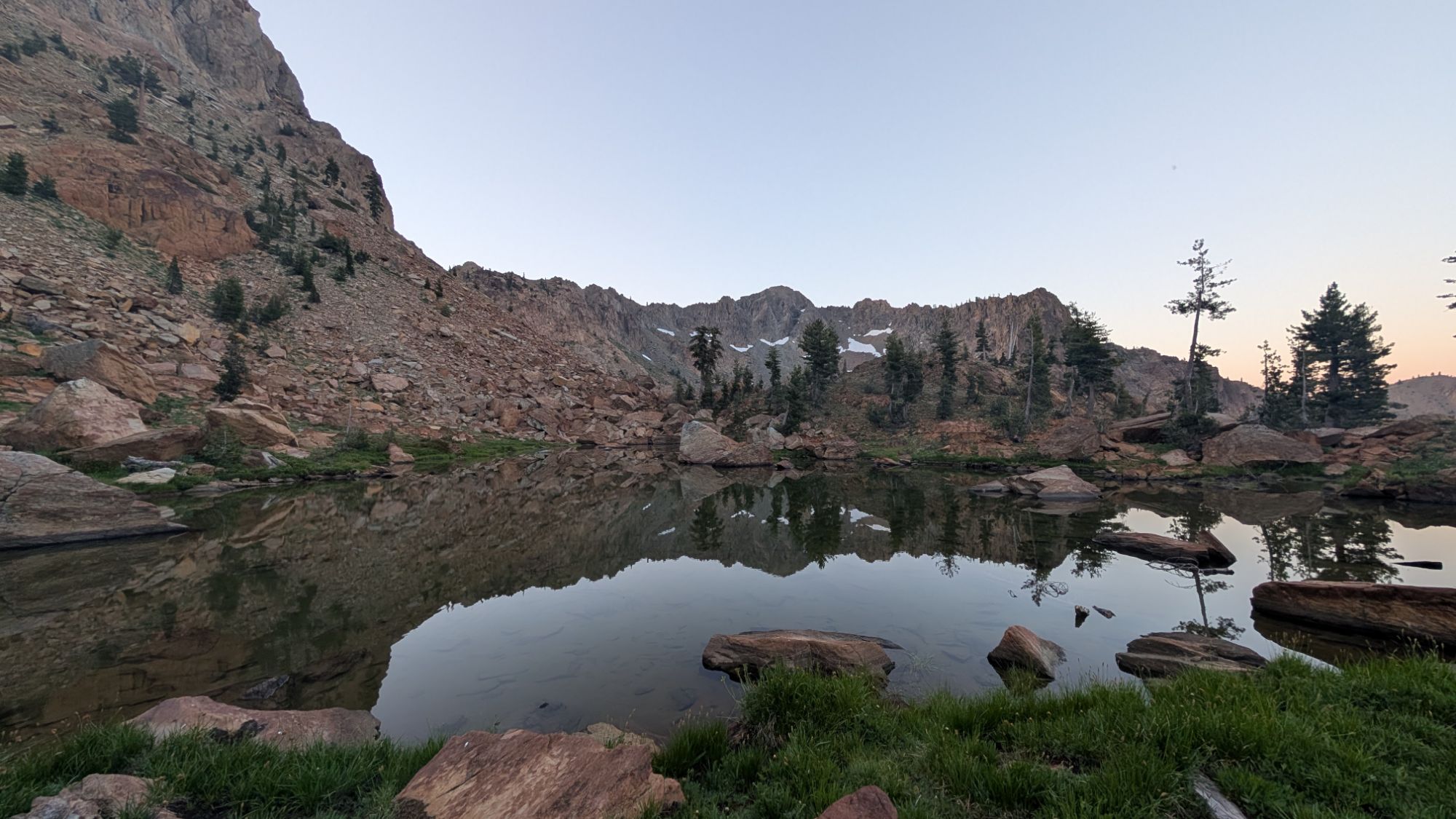
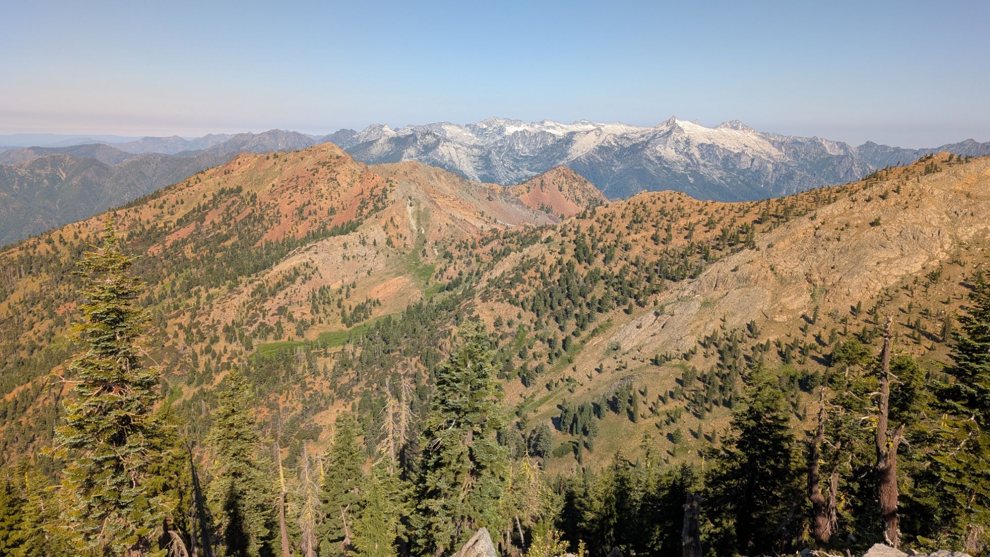
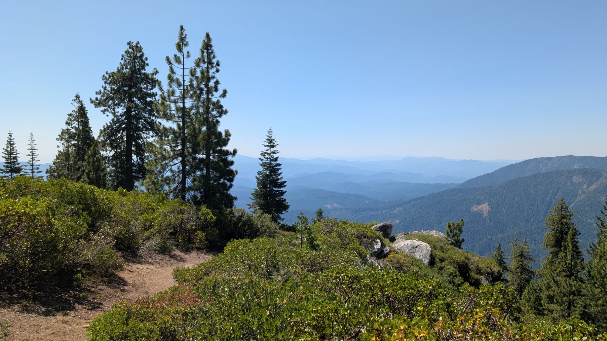
Minutes before 6 am I hit record on my watch and walk around to check out Little Echo Lake which is making a nice reflection. I connect back to the main trail and immediately start descending towards the wet Van Matre Meadows. The tips of surrounding mountain tops turn orange. Seems like I’m walking through the middle of some fens.


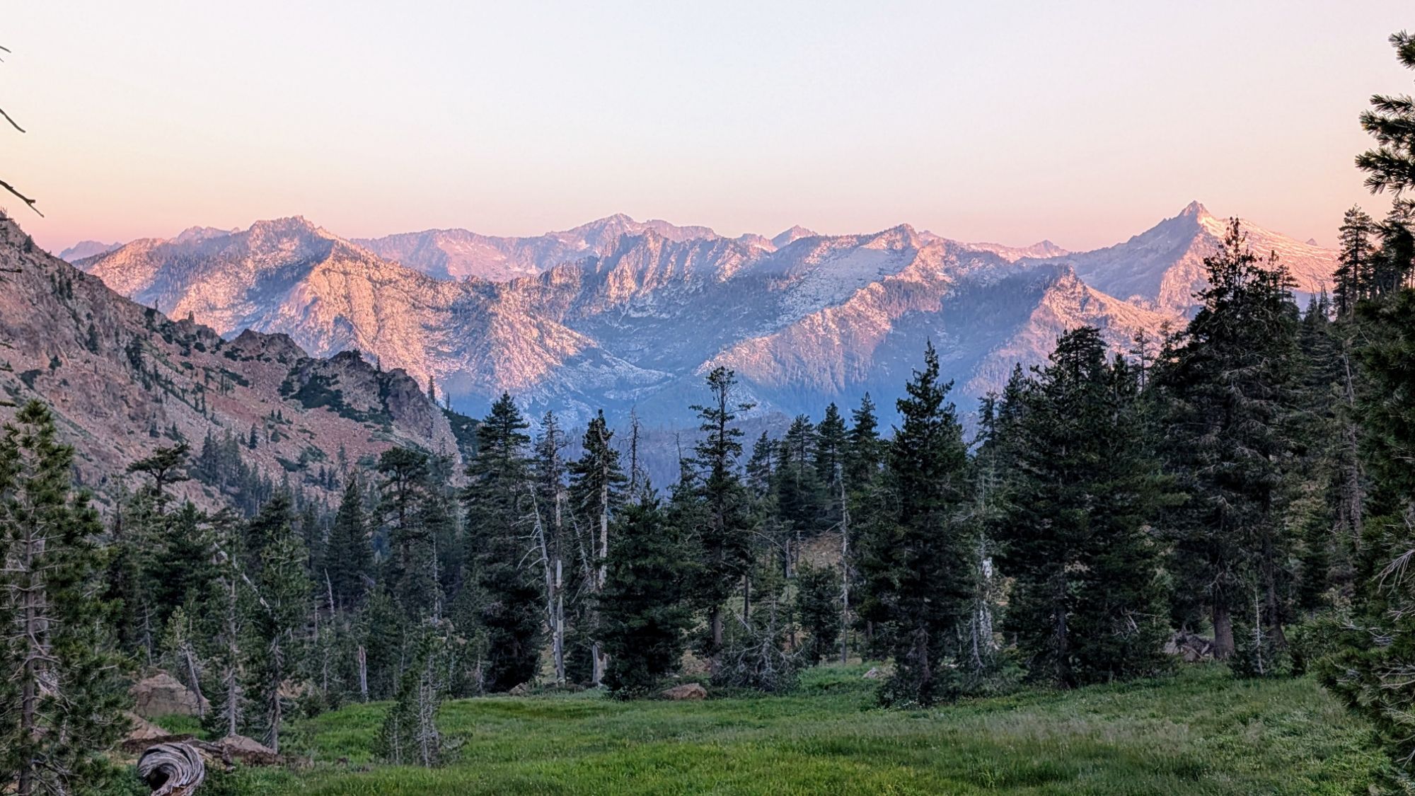
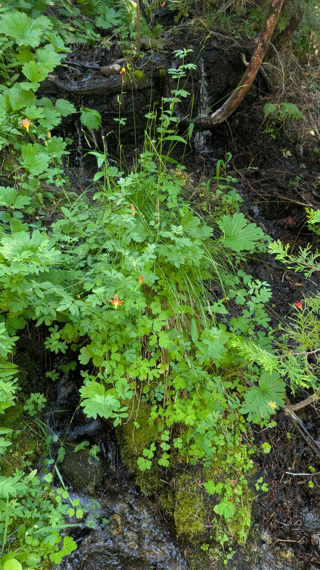
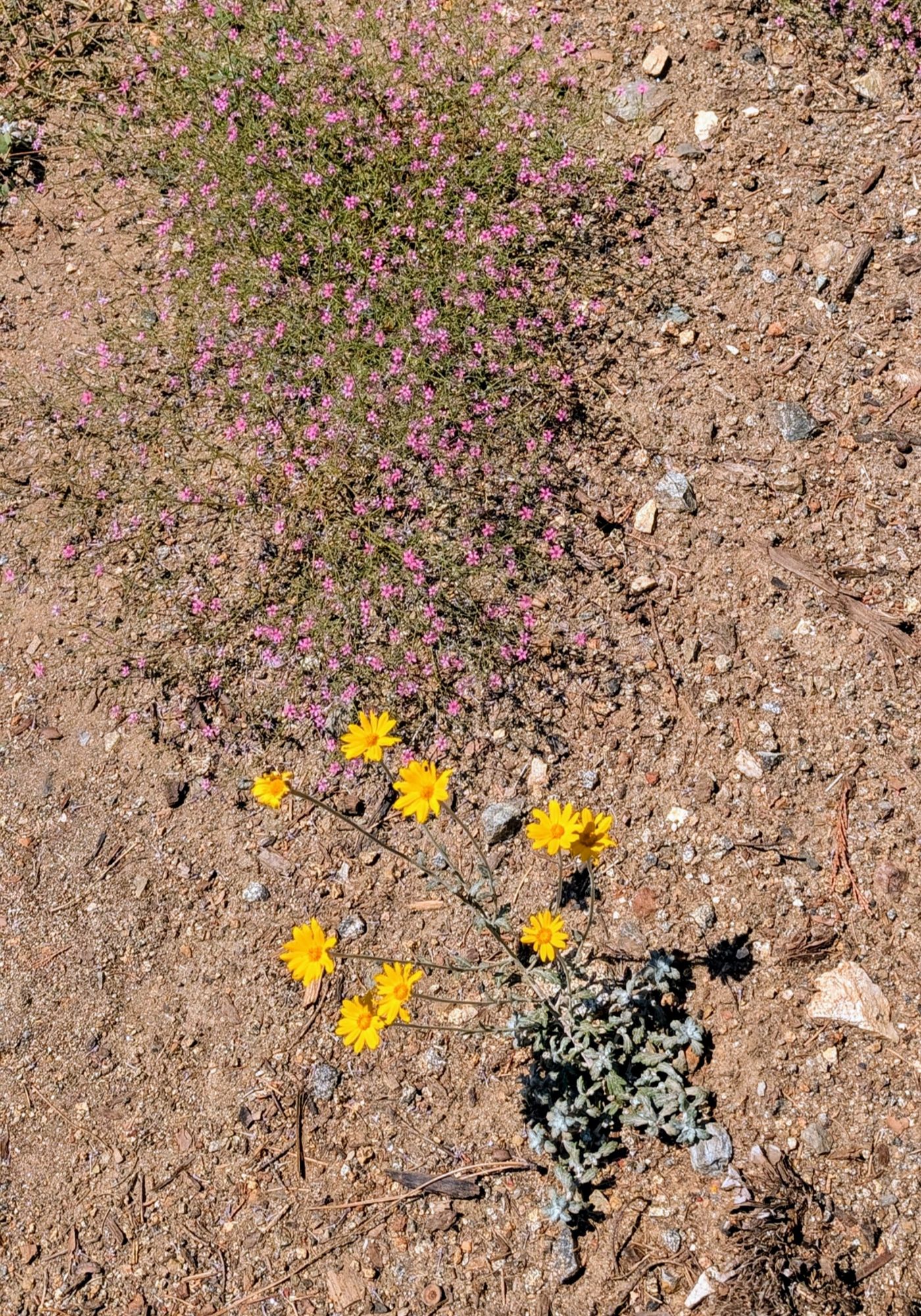
The smoke makes things a bit hazy but the view is still pretty amazing. Check out the obvious fens below me! Fun with fens! There’s ice cold water flowing across the trail so I stop for a break and breakfast. I sip mocha and munch an oat bar as I watch sunbeams fan across the peaks.

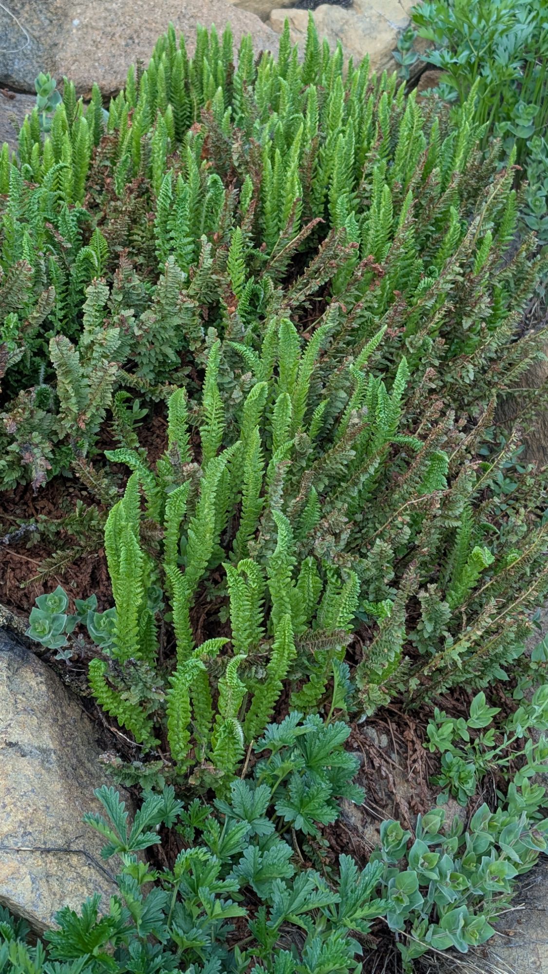
Above: Looking back towards camp and Little Stonewall Pass. Right: Lemmon’s Holly Fern
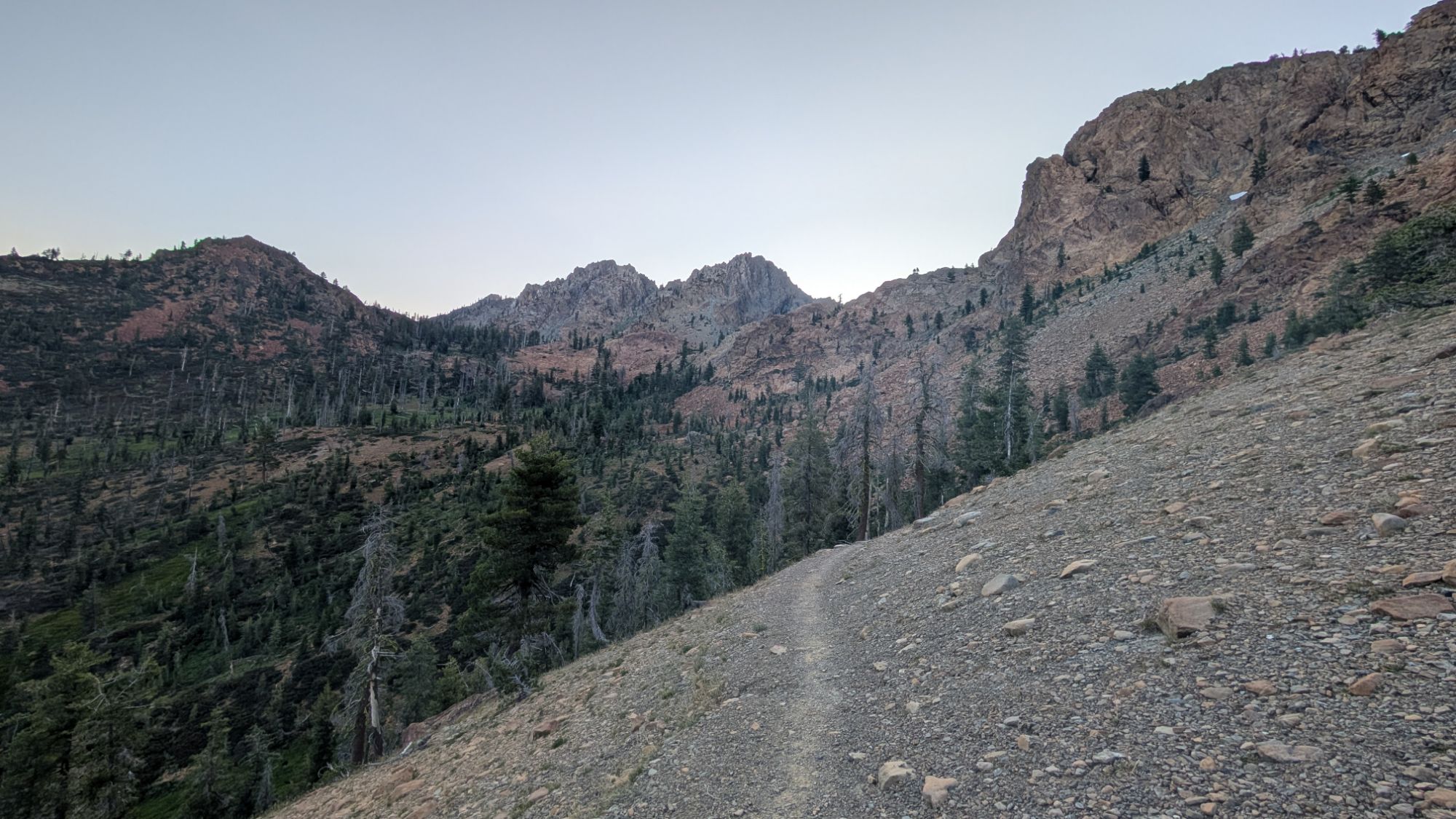
Below: Approach to Stonewall Pass before looking back again.

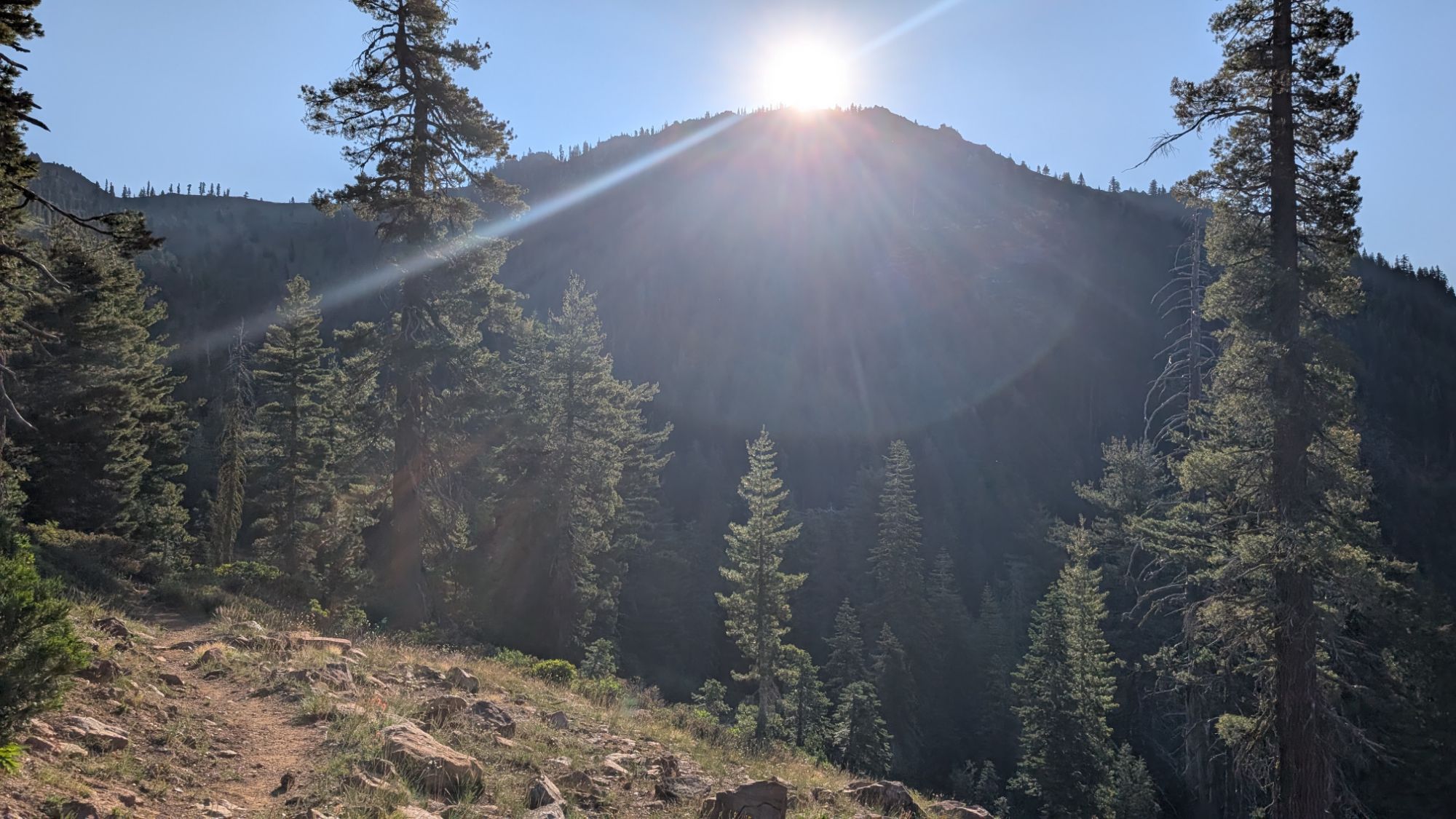
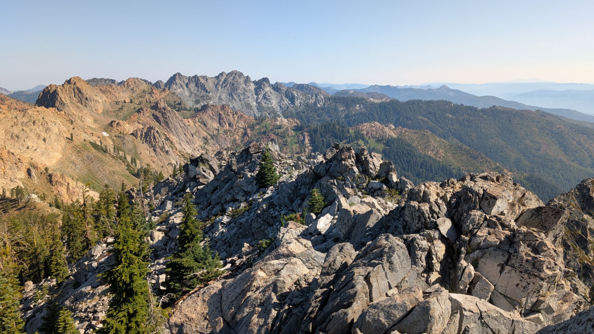
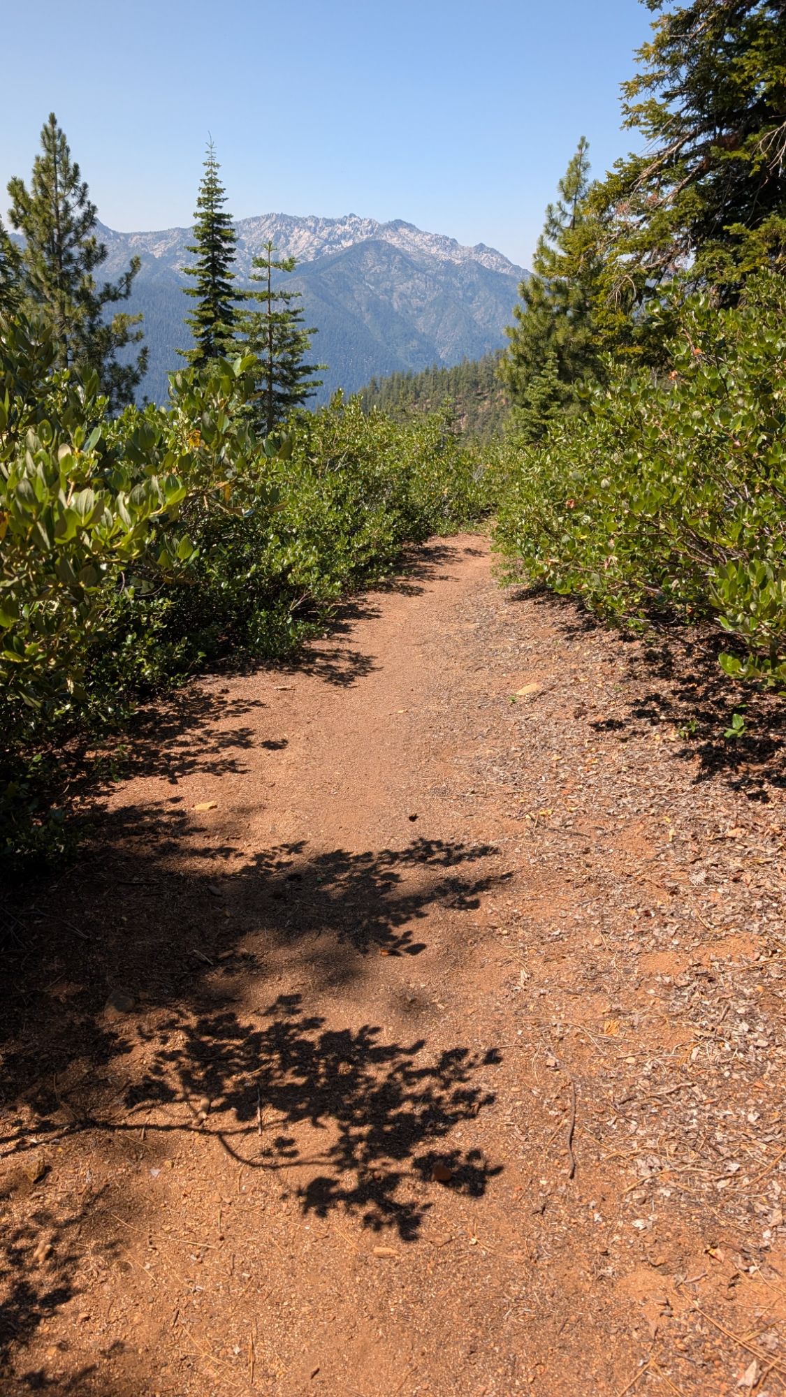
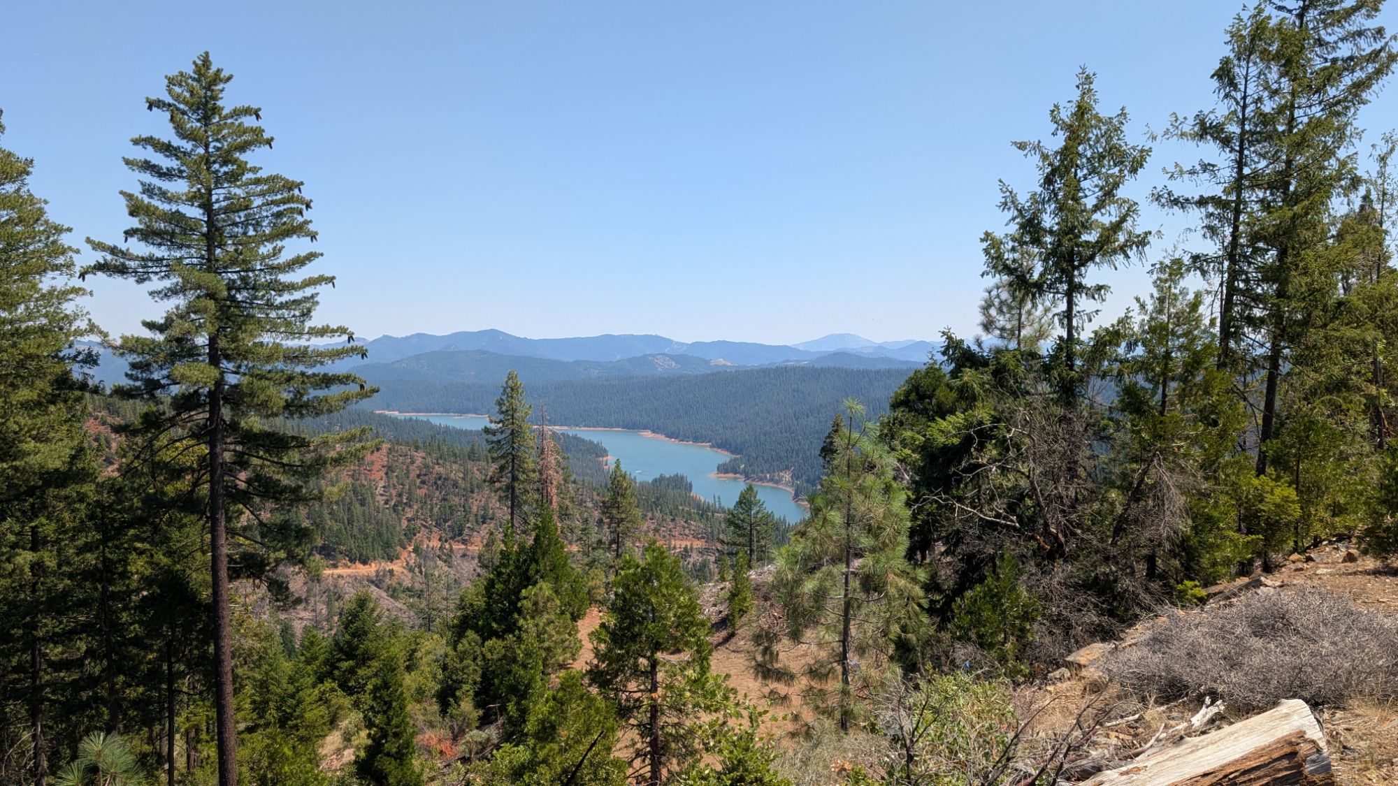
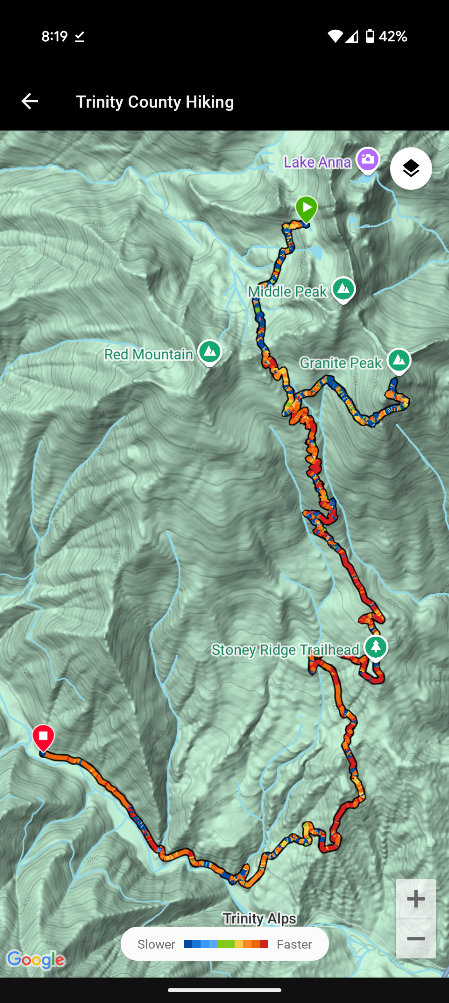
I cross Stonewall Pass about 7:20 am and I’m blasted by the sun. I start trotting down the trail as Trinity Lake becomes visible. I check my map several times because I’m keeping an eye out for the junction to Granite Peak. Ok, just a few more switchbacks. Ironically, the sun is beaming directly across Granite Peak.

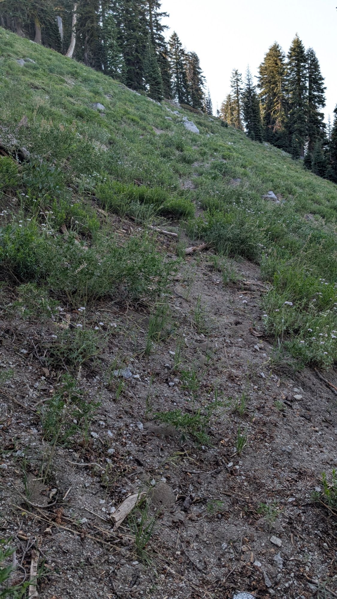
My diligence is a good thing because the junction is not obvious and not signed. There’s a faint tread and I follow it away from Stoney Ridge Trail, pictured below. I know that going up Granite Peak will only add to all the descent I have to do today but here goes nothing!

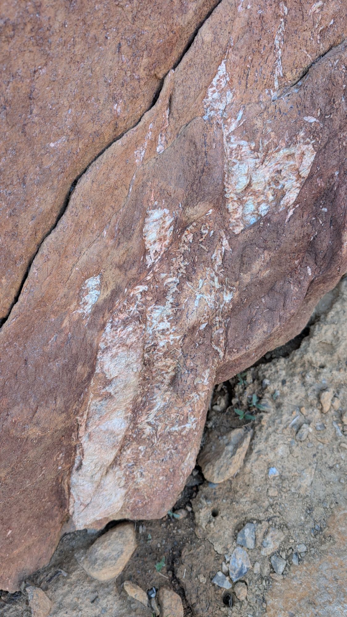
I decide that I will follow the faint trail as long as possible. As the trail approaches the headwaters of Stoney Creek things get a little confusing. I gingerly push through tall blades, careful not to step into the water. I see a rock cairn and head up the hillside. I walk a bit farther and then just feel lost. I check my location against my gps app and it shows that I’m above the trail. I head back downhill and think I find another faint tread. Suddenly, there’s a crashing in the thicket below me. Kinda an involuntary reaction, I react with loud yelling and hit my trekking poles together. I’m sure that I’ve startled a bear until I see a giant buck run out of the bottom of the thicket. I’m super relieved because I was imagining that I might need to abandon my Granite Peak attempt.
Once my pulse slows, I turn and follow a faint tread into the forest. I hike a short distance before setting down my pack. I chug some water before putting my Inreach into my cargo pants pocket and cell phone into my back pocket. I leave everything else behind except for my trekking poles and start climbing. I climb over and weave around trees while ascending steadily up through the forest. Looks like the deer are the only ones maintaining this trail!
I’m grateful for my gps app which helps me catch the subtle nuance of a few switchbacks. There’s only one time that I really get off and just climb straight uphill.


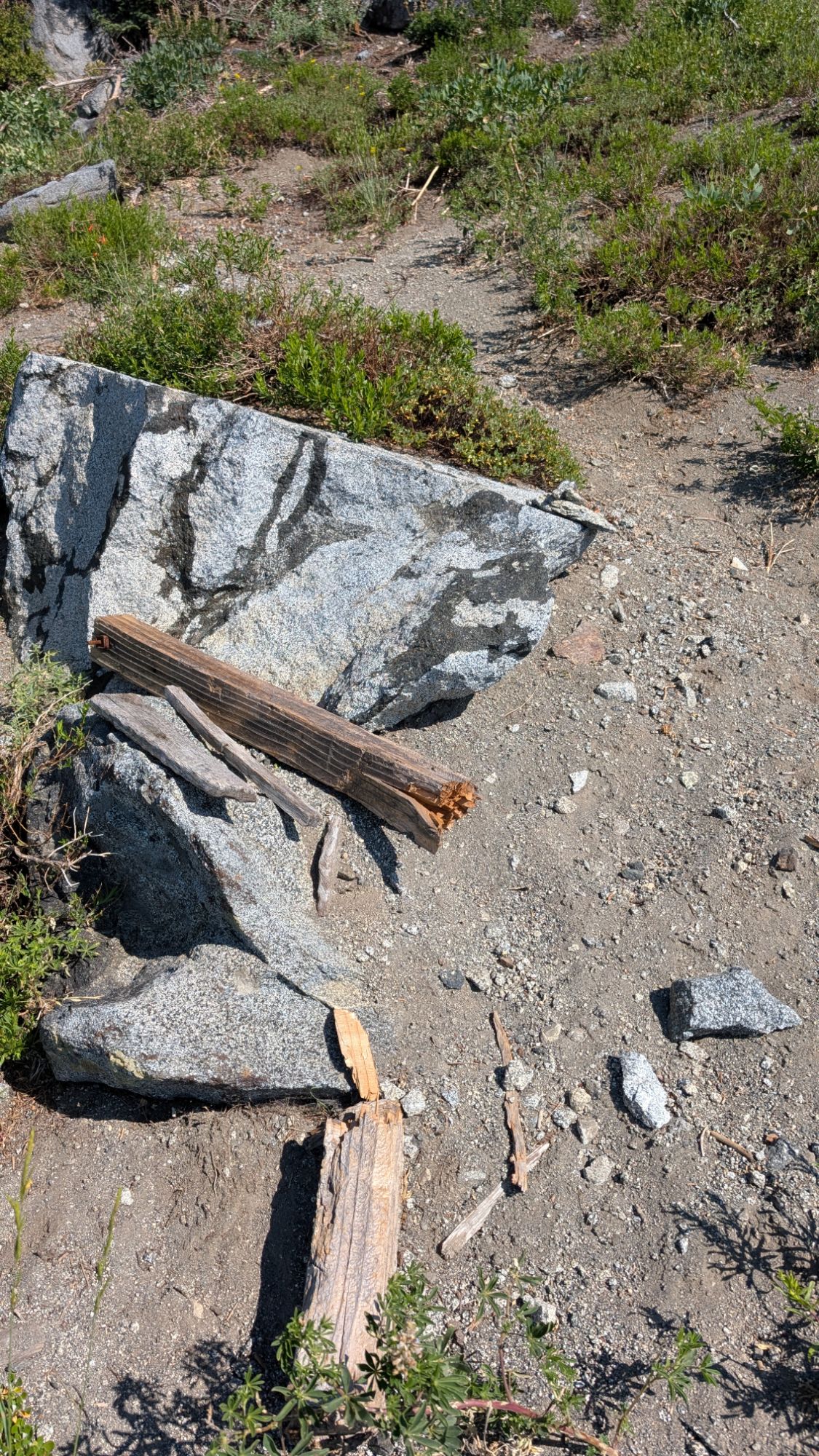
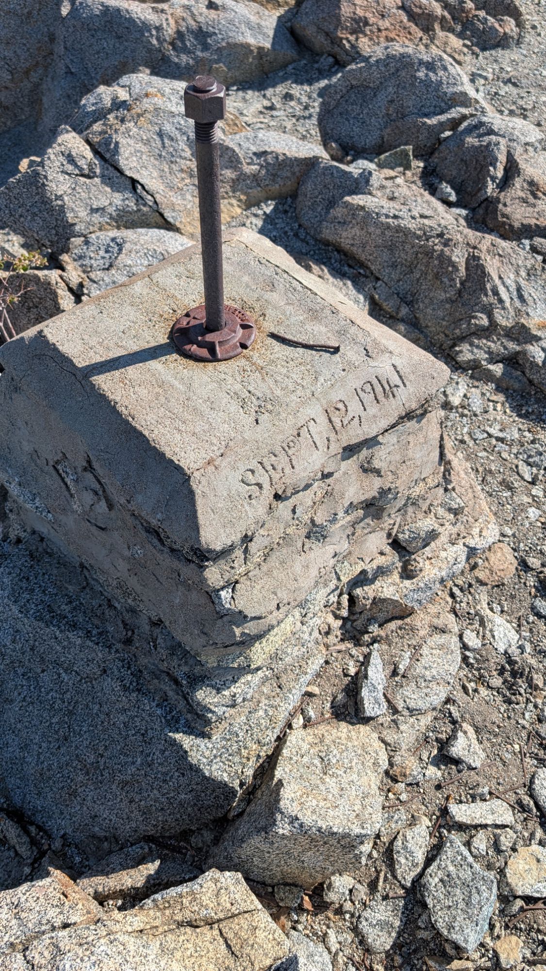
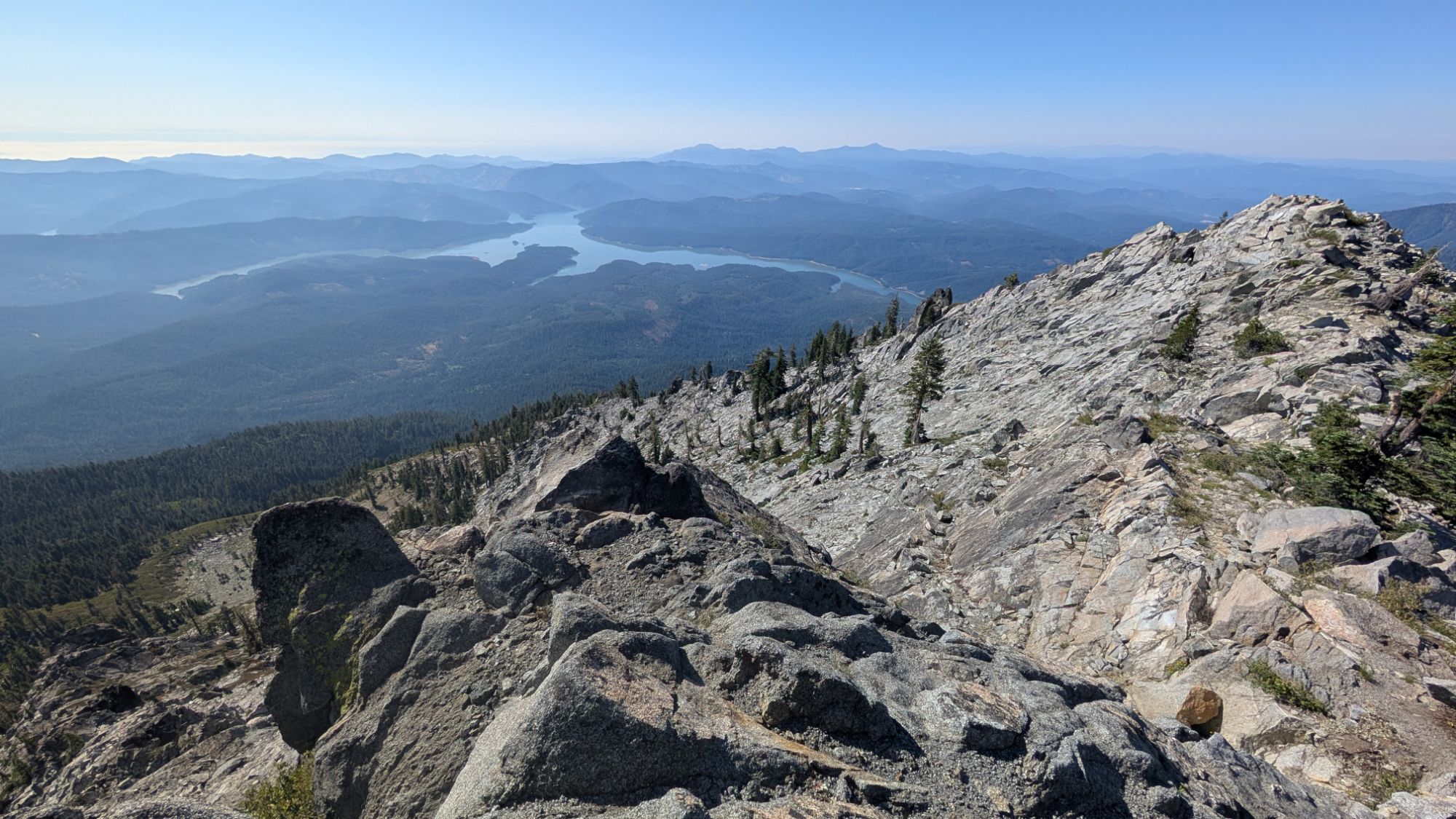
Not long before 9 am I reach a crest and Trinity Lake fills the horizon. I hit a contour and follow more faint tread to the junction with the main Granite Peak Trail. This junction’s sign is disintegrating on the ground. I turn left and start following fairly obvious switchbacks. Within 20 minutes, I reach the summit and immediately see the remnants of the old fire watchout dated September 1941.
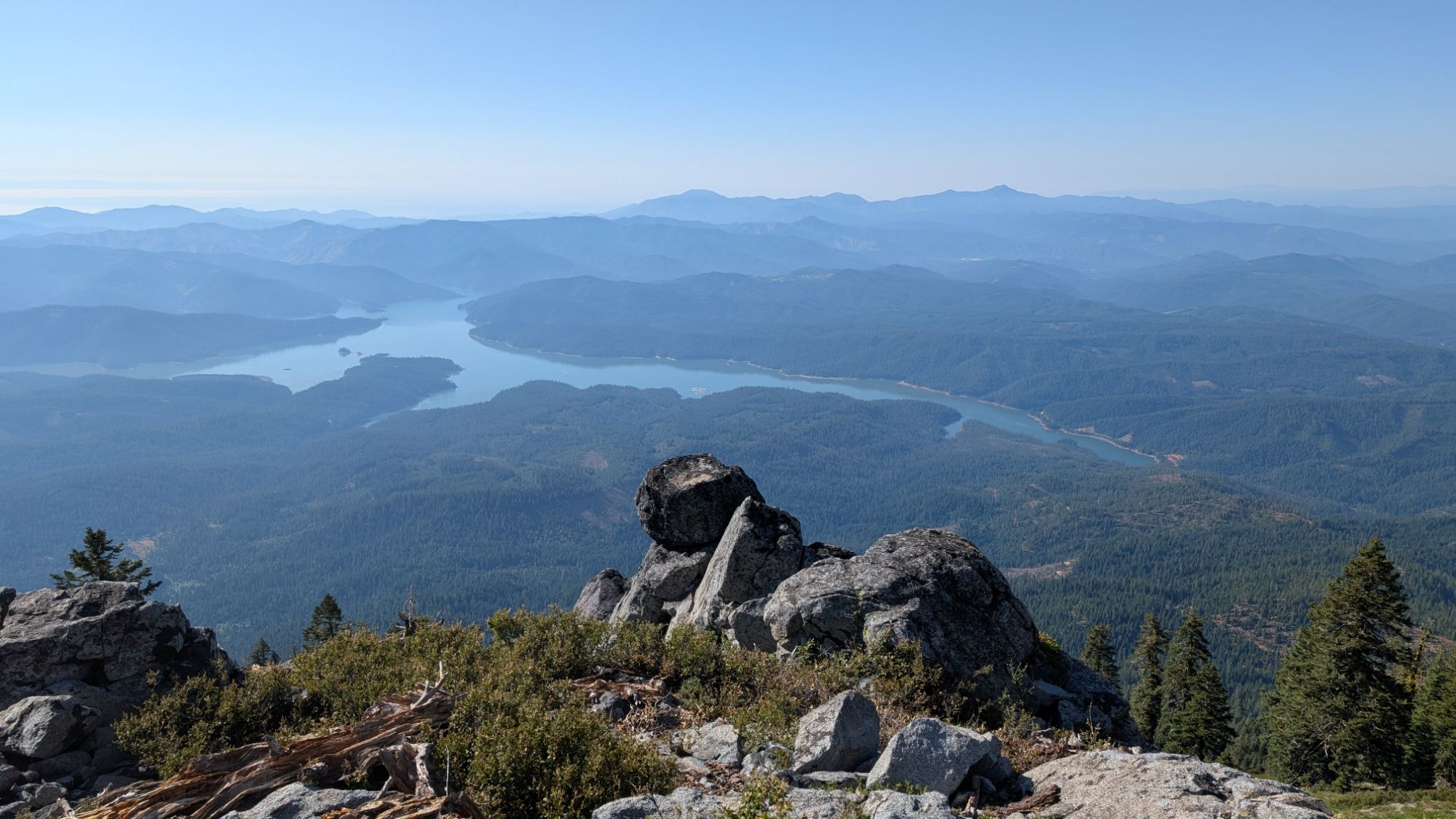

Above: Looking East-Southeast with Trinity Lake
Below: Looking West
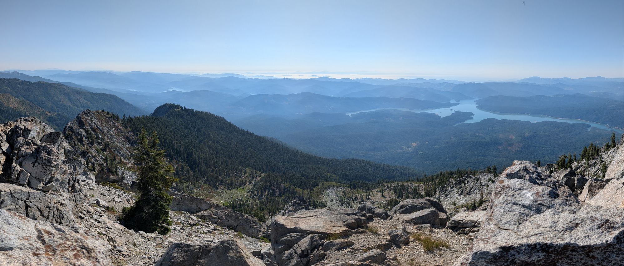
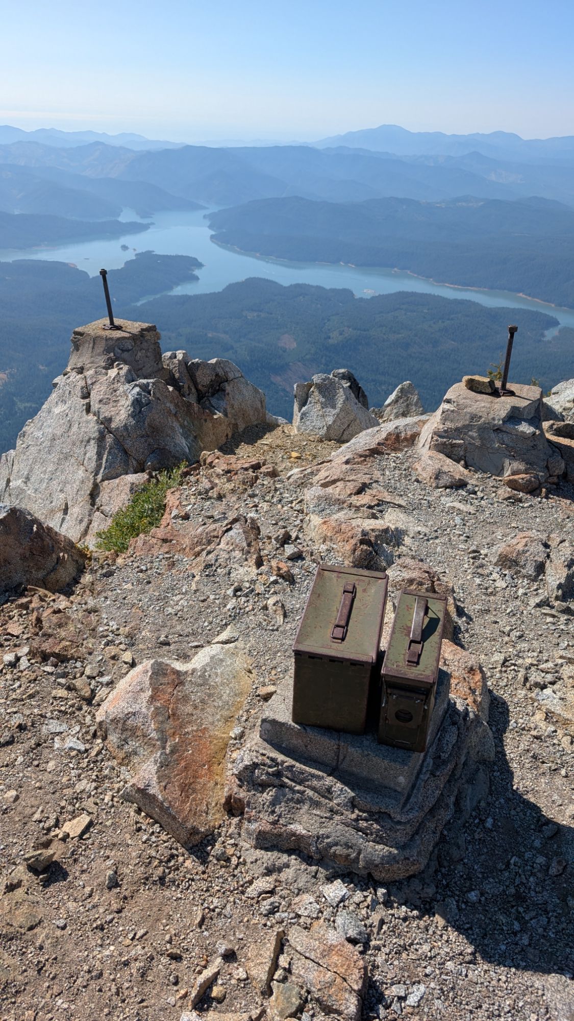
Below: Looking North. Looks like I need to keep going to the real summit. I push on and eventually drop my poles because it’s just a rock scramble to the top.


Above: Looking Northeast. Unfortunately, there’s just enough hazy smoke that Mt. Shasta is mostly not visible. If you look closely, you can see her!
I retrace my steps and luckily, manage to find my poles.
Below: I check on the summit register and add my name.
I check and find that there’s cell service. Days of messages start to flood in and I send a few out too.


By 10 am I return to the trail junction and head back across the contour. I hit the switchbacks again which are a bit more obvious when descending. I hear a rhythmic bird call that catches my hear so I stop and turn on Merlin. Wow, Northern Pygmy-Owl. This is my first time hearing a Northern Pygmy-Owl outside the Redwood Forest. Not much farther down the trail I find a broken bird egg.


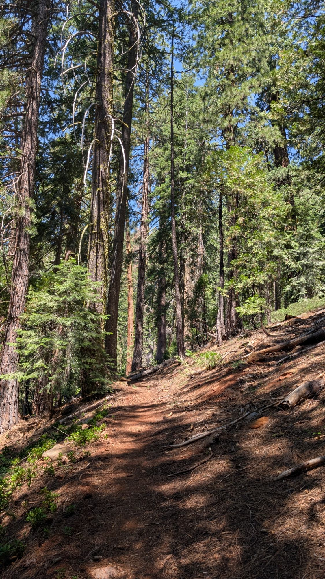
I make quick tracks down the trail and I’m relieved to find my backpack and everything intact. I sit down on the exceedingly steep hillside and suck down almost a whole liter of electrolyte water, mocha and an peanut butter oat bar. Time to push. I hike a short distance and then decide that I better fill up on water. I drop my pack and yoga into the little rivulet to get water. I hike uphill and knock down the misplaced rock cairn. I step over bear scat for the second time, just before I get back to the junction with the Stoney Ridge Trail. I turn downhill just after 11 am. There’s a few trees for shade but it’s warm out. Engage town legs! I hike fast and fly down the switchbacks.
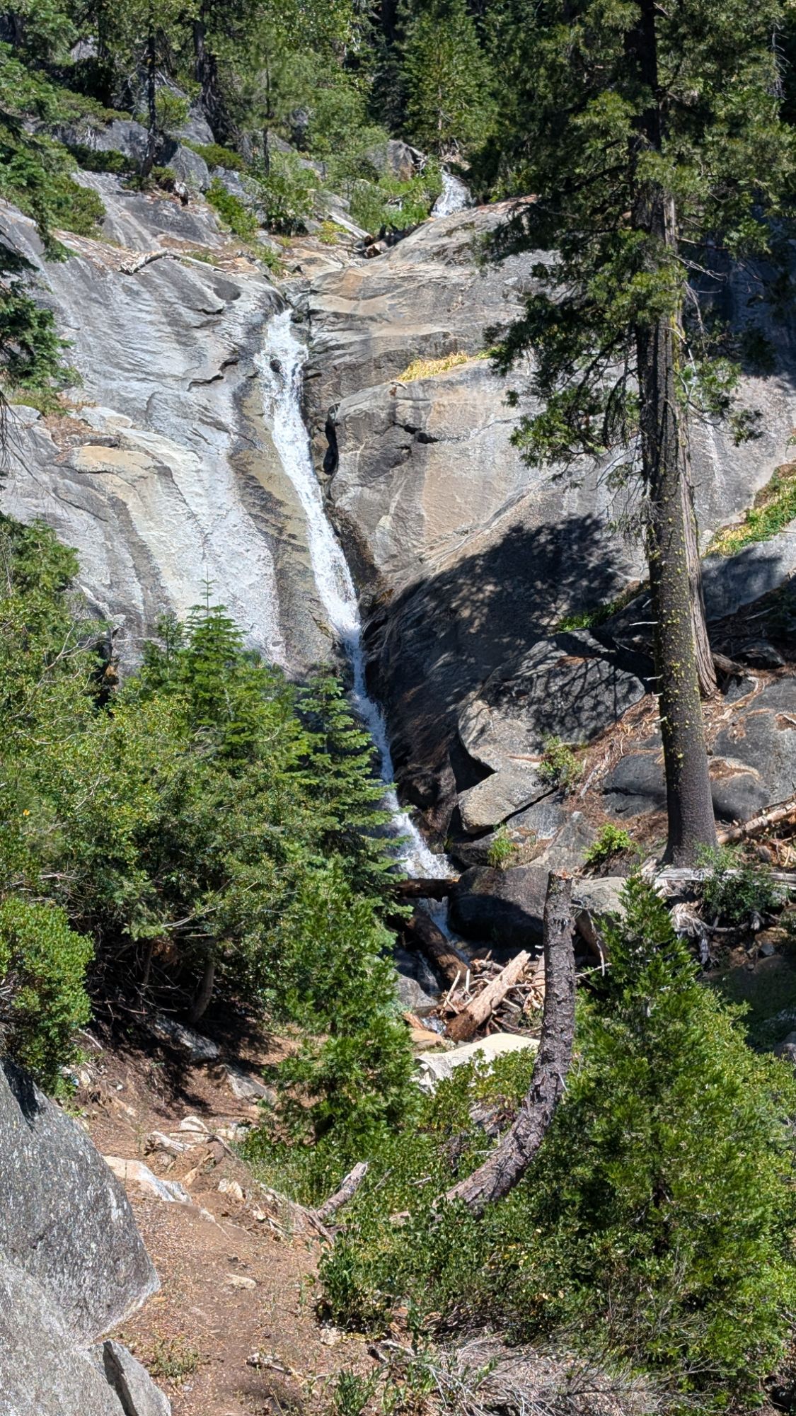
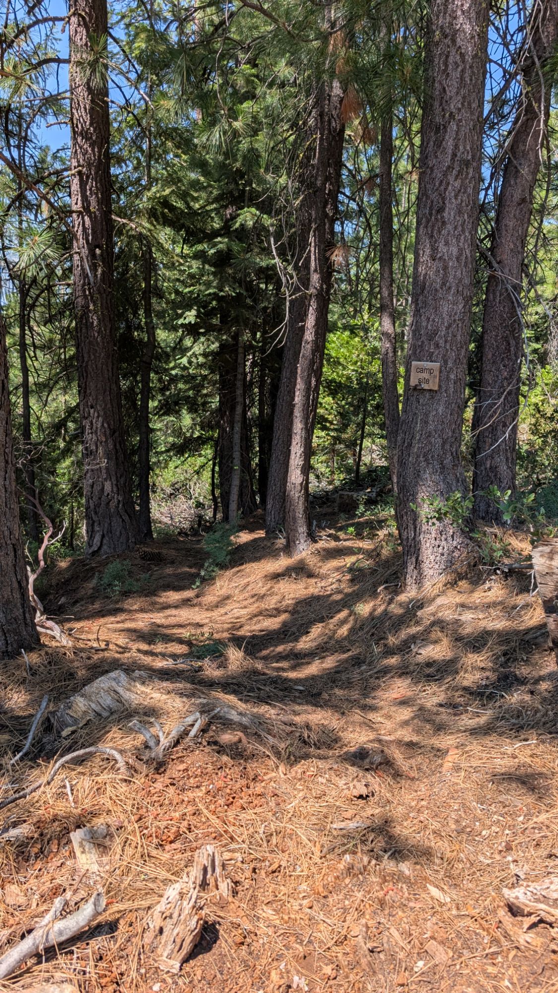
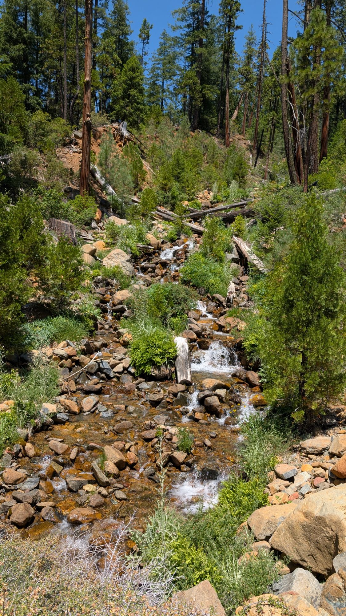
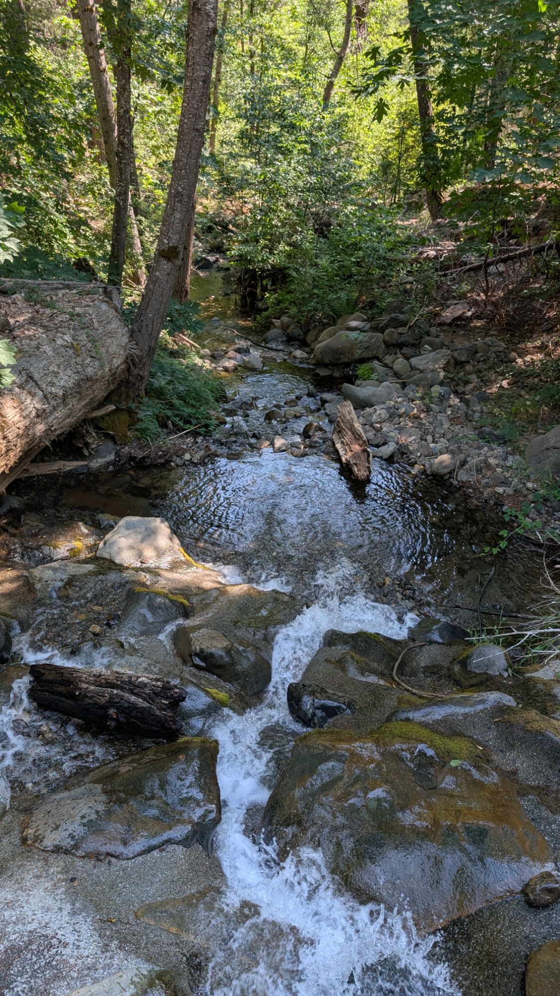
Almost an hour later I can hear loud water and leave the main trail on a spur trail to find a beautiful waterfall. It’s so tempting to stop but I decide to push on. At the end of a long switchback there is a sign “camp” but I do not go and explore it. I continue to make quick tracks as I pass a young three woman group. We exchange a brief hello.
I drop more into the forest as an older couple approaches me. We stop and chat about trail plans and compliment each others Dirty Girl Gaiters (Dirty Girls are the best, last for a long time and have fun colors and prints!). She says that she has this same pattern as well! Yay! I come to a creeklet and stop for a standing break. I soak my quick dry towel in the ice cold water and clean my legs, arms and cool my face. I drape the towel around my neck as I collect some fresh water. I am renewed as I continue my march down the mountain.
White-headed woodpecker catches my attention and I pause to watch him circle around the tree. He taps the bark with his beak on the search for food.


It’s about 1pm when I reach the Stoney Ridge Trailhead. There’s a travel van parked off to the side and a car parked nearly in the middle of the road. Hmmmm. I start down the road and the sun is blasting hot. I crank my arm back and desperately try to get my umbrella out without stopping. Damn. Don’t break it. I stop and pull my beloved Golite umbrella out of the side pocket of my backpack. I’m instantly grateful as the ‘cooling’ effect kicks in.


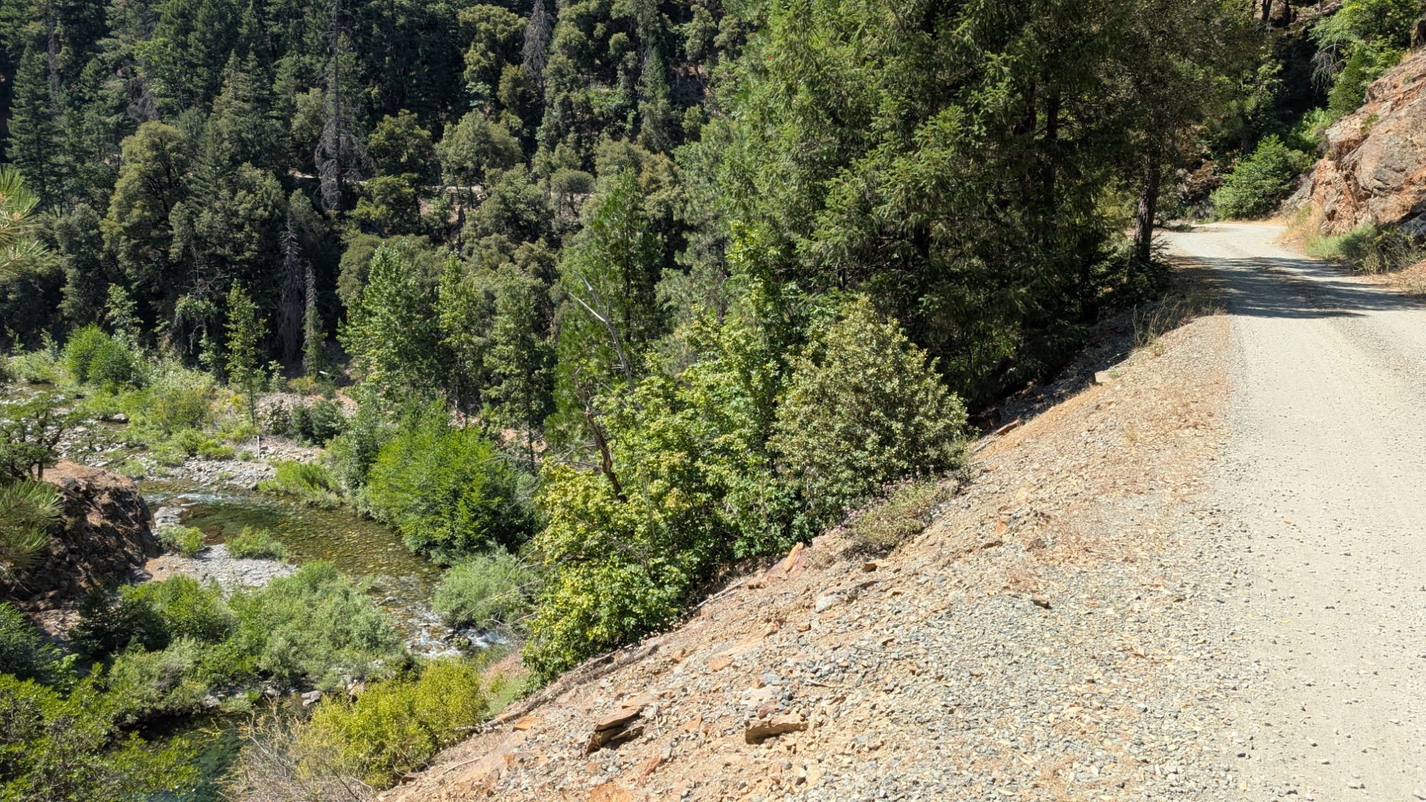
I pass lots of road intersections. A huge creek taunts me and flows under the road. I hike for about 50 minutes before I reach the junction that will head me towards Stuart Fork. I pass around the yellow gate and hike a few curves before I throw my mat down in the shade. I get horizontal and it feels so good. I think about taking off my shoes which are tied way too tight but opt to save the time. I suck down more water and snacks. My left shoulder is hurting so I decide to stow my sony camera inside my pack. I hope for the best and put my sunbrella away too.

I am temporarily renewed as I head downhill on shaded road. But the road bends back into burn zones and the radiant sun makes my mind go gooey. I trace around, grateful for gps because there are so many little roads that go here and there. I move from one shade patch to the next as I try to protect my cooked calves.
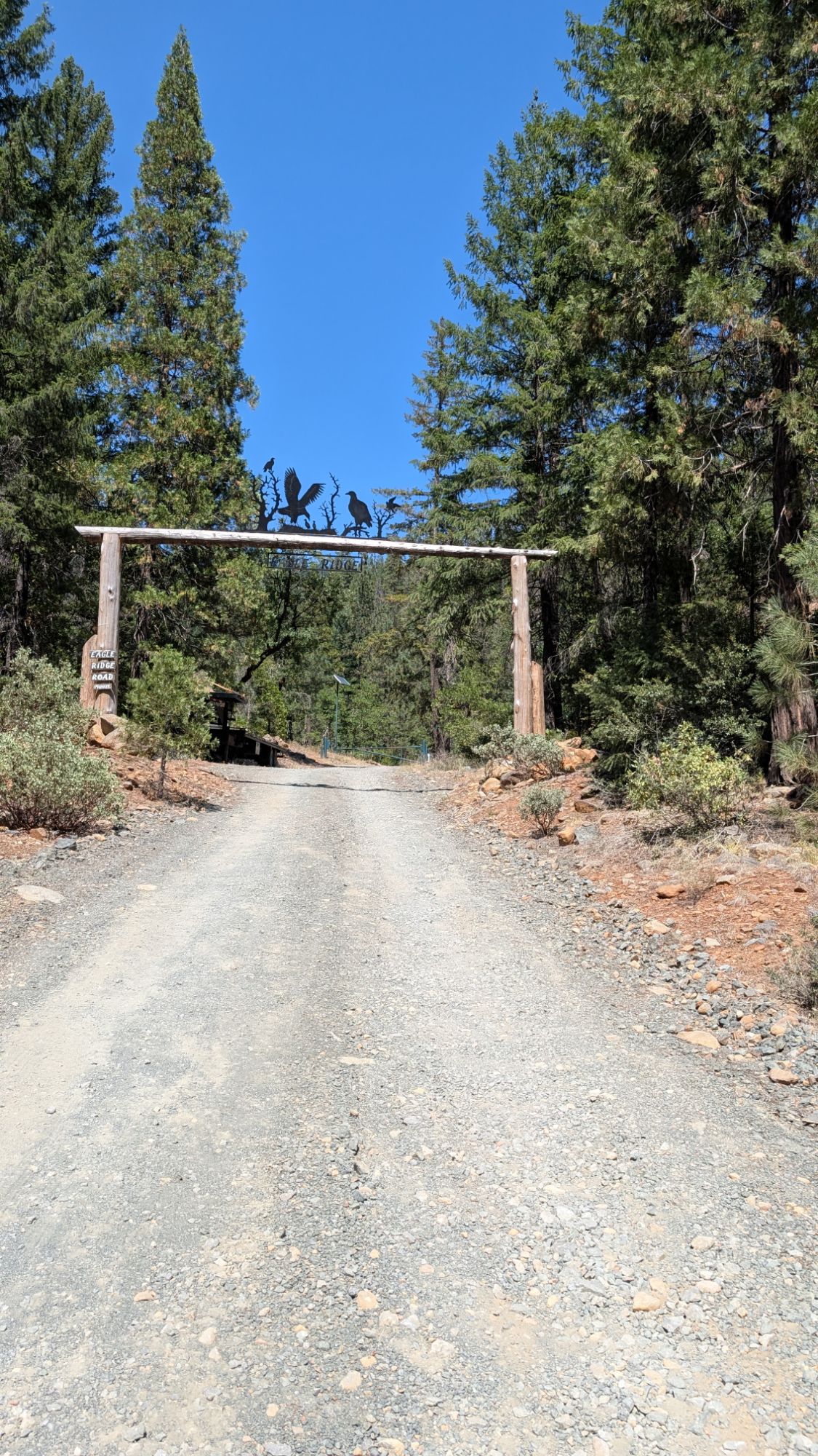
It’s about 3:15 pm when I pass under the Eagle Ridge Gate…..which says private road. Well, I wasn’t trying to trespass and it doesn’t say anything about that at the top of this road network.
I turn right onto Trinity Alps Road and follow Stuart Fork on my left. I weave from side to side to optimize my shady moments. I pass tributaries to Stuart Fork and I daydream about cooling off. Kids on bicycles and a couple cars pass by.
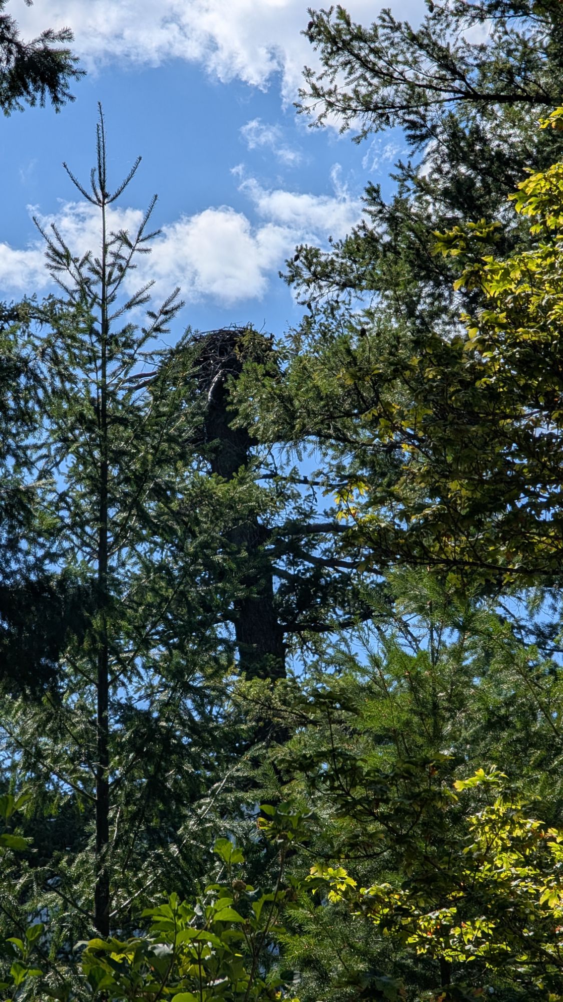
About 3:40 pm I think I hear an Osprey and stop in a shady section of the road. I soon see an Osprey circling above its large platform nest. I watch for about a minute before an Osprey calls and flies over me. Next thing I know, there’s a second Osprey and they are both circling above me. I don’t speak Osprey but I can tell they want me to move along sooner rather than later. They circle and issue their alarm and low grunting guard calls. I make a poor attempt at videoing them (below) while imagining them descending on me with talons out. I’m enjoying watching them but reluctantly start to hike down the road again. One Osprey continues to circle and follows me for almost a quarter of a mile. This interaction makes the hot afternoon hiking worth it.
Just a few minutes after 4 pm I am happy to see my truck still safely parked at the Stuart Fork Trailhead. There’s a whole line of vehicles and randomly mine’s the only one getting blasted by sun right now. I dig out my keys and open up my hot truck. I’m kinda dazed but slowly get myself organized. I get out a bottle of red gatorade from the back seat of my truck and suck down half of it. I change out of my soaked bra and sun shirt and put on a new set. I change out of my shoes into chacos and my toes and ankles are so dusty and dirty. I munch down on a few fritos chips that I saved as I get my backpack stowed inside my truck. Dig out my little front and rear speakers and I’m ready to go.
I drive down Trinity Alps Road and look for the Osprey. But from my side of the vehicle I can’t see their nest. I drive even slower through Trinity Alps Resort because there are kids wet from the river riding their bikes. I do kinda think that the guests here forget that this road goes through their vacation. I follow the pavement and turn right onto Highway 3. Within a few minutes, there’s a Caltrans vehicle hot on my tail. Looks like they’re trying to get back to Weaverville by 5 pm. At the next opportunity, I pull out and they go flying by.
It’s not that far to Weaverville but I’m having a hard time keeping my eyes open. Plus I’m daydreaming about what food I can find. I go back and forth trying to convince myself to just tough it out and wait to eat until I get home. I remember the burger I had after finishing the Wonderland Trail and that sounds so good right now. I turn right onto Hwy 299 and when I see Trinity County Brewing, I pull into their gravel parking lot. I’m still wearing my hiking shorts but at least I have a clean cotton shirt on. But then there’s the issue with my hiker feet. Well, I figure this is Weaverville and I can probably get away with going in this brewery looking like I do. I walk through the large outdoor seating area and go inside. First stop bathroom, second stop the bar where I order a burger and a hazy IPA. It’s all self serve here so after I order, I grab some napkins and ketchup and find a table. As I wait for my coaster pager to signal that my food is ready for me to pick up, I notice there’s a big Pacific Crest Trail map and picture collage. Turns out that the owners of Trinity County Brewing met each other when they hiked the PCT in 2011.
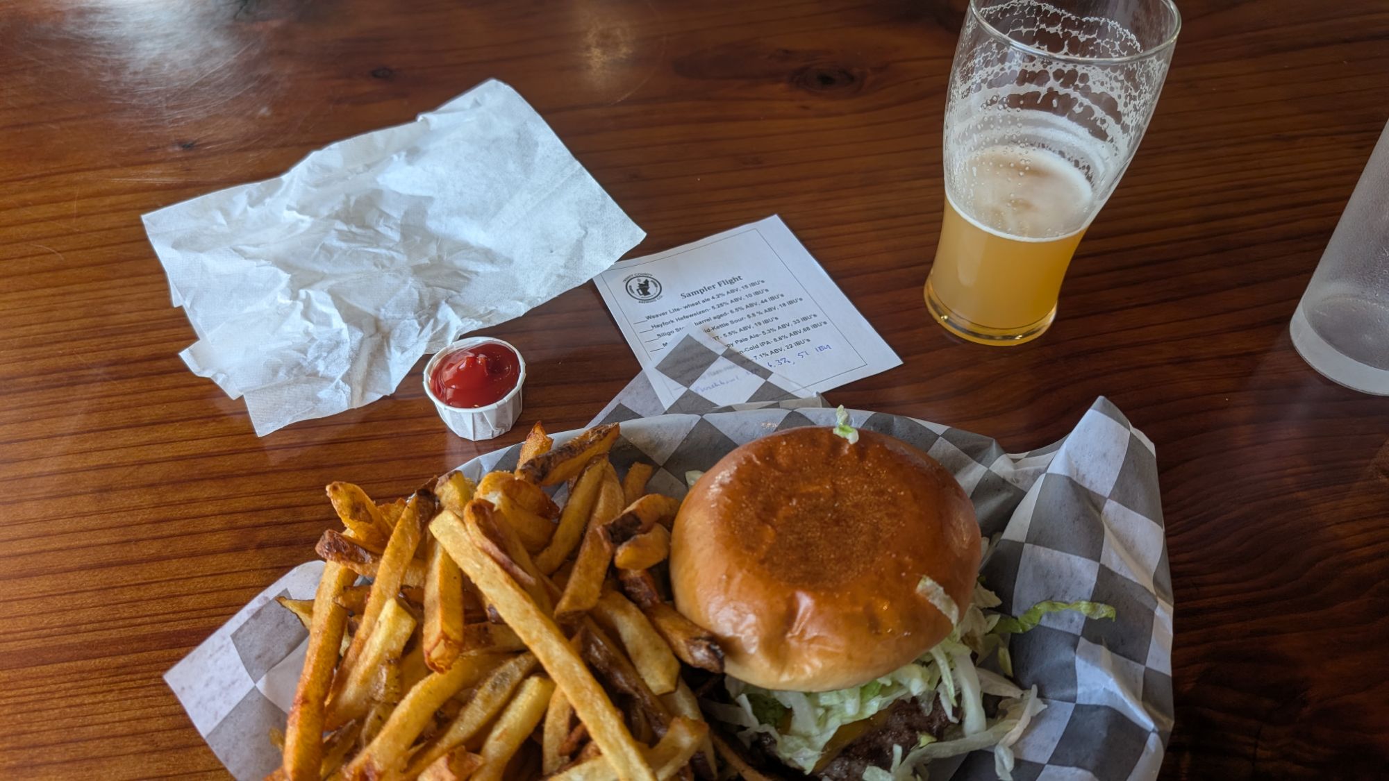
The hot and large amount of fries make up for a pretty basic and kinda small frozen patty hamburger. Again, why did I not get the double?! Regardless, the hiker hunger pushes on me and I happily stuff my face. Maybe more importantly, I am completely rejuvenated and now alert for my two hour drive home. I reach the fog layer near Blue Lake and descend back into coolness just after 8 pm.


One thought on “Trinity Alps Day 3: Van Matre Meadows, Stonewall Pass, Red Mountain Meadows, Granite Peak, Stoney Ridge Trail, Stuart Fork”
Comments are closed.