Wednesday, April 30
King Crest Lost Coast Loop Day 2
King Range National Conservation Area
Unceded lands of the Sinkyone, Cahto and Yuki Coast peoples
Start: King Crest Trail road
Stop: Lost Coast Trail mile 14.9
23.56 miles
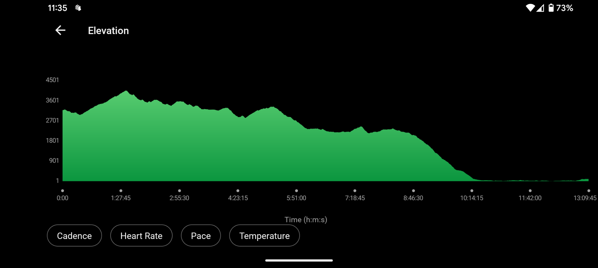
3,553′ ascent
6,666′ descent
The roar of the wind is constant through the night but it only really shakes my tent once. I toss and turn and sleep so-so. My watch starts beeping at 4:30 am and I snooze it for 10 minutes. I rustle to life, get everything organized and change back into my hiking clothes. I find that my cell phone didn’t charge but hopefully it will be enough for the day. I know better than to keep my warm alpaca layer on but can’t resist.

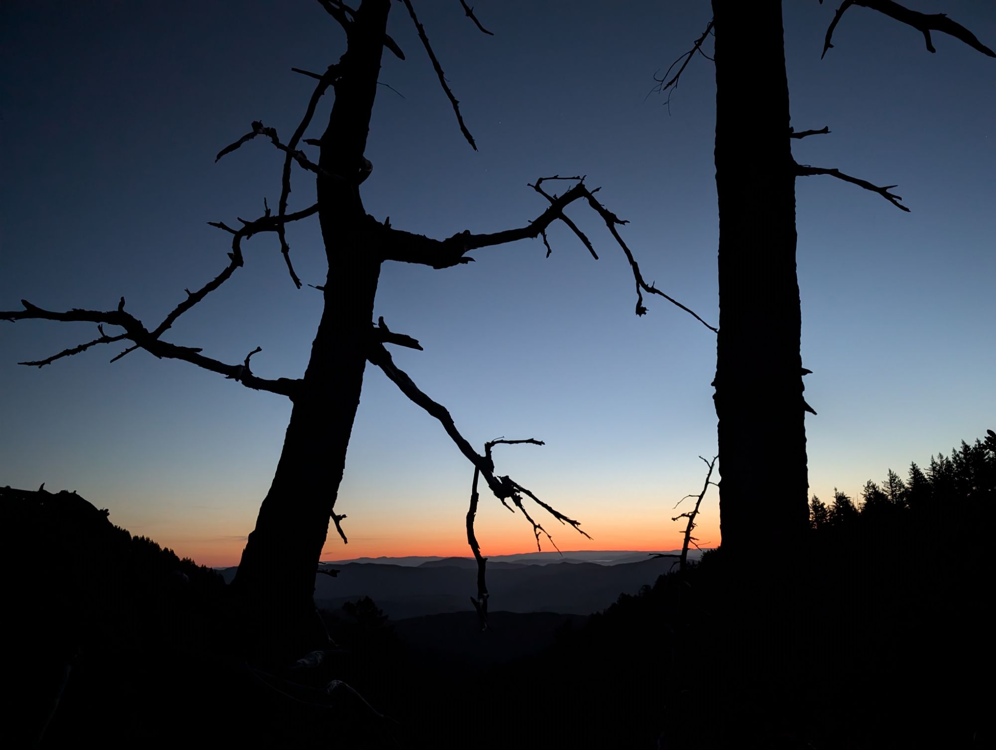
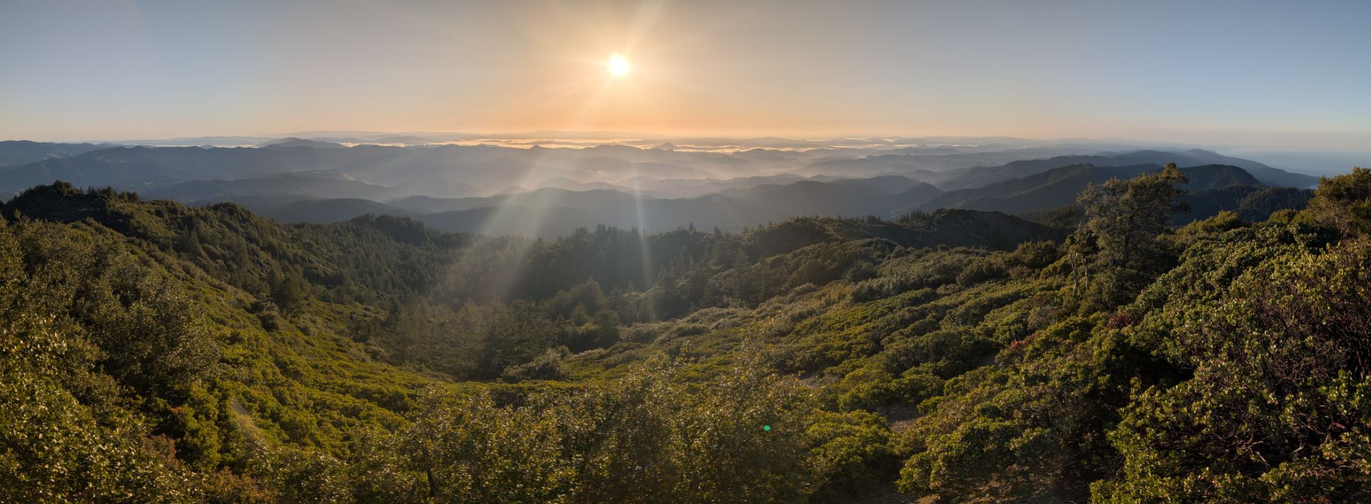
I start hiking just before 5:30 am with my headlamp blazing. I round the corner and get blasted with the wind. It isn’t long before the sky begins to brighten and a beautiful sunrise to the east starts to warm. I don’t hike very far before the road narrows down into a trail flanked by manzanitas.

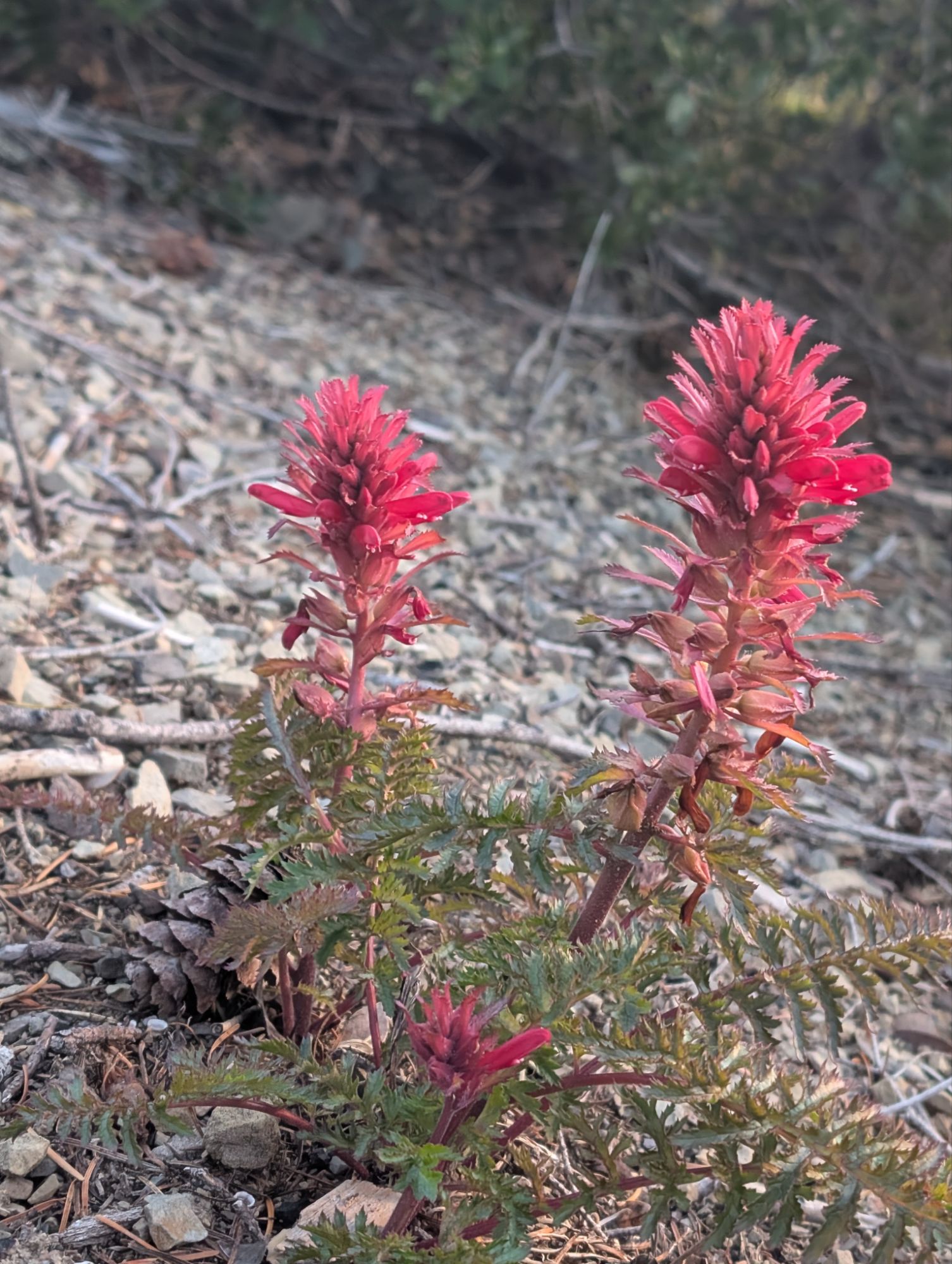
Luckily there are short switchbacks as the trail climbs gradually. The work is enough to make me stop and remove my alpaca hoodie. I turn off my headlamp just before the first sun beam cracks the horizon. I am greeted by bright Indian warrior flowers and I can already hear the bees working the manzanita blossoms. An Anna’s Hummingbird buzzes and flies up to me. She slingshots back and forth until she is between me and the sun. She hovers perfectly in silhouette against the sun and it’s an image I will hold in my mind forever.

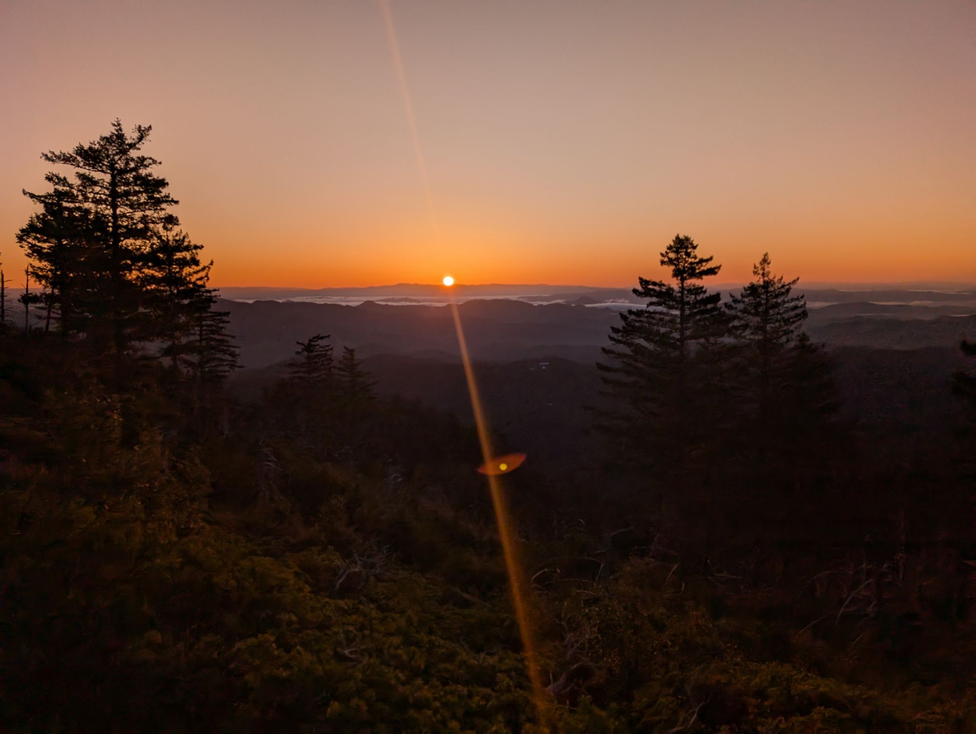


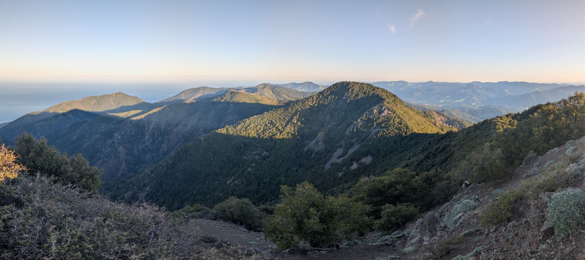
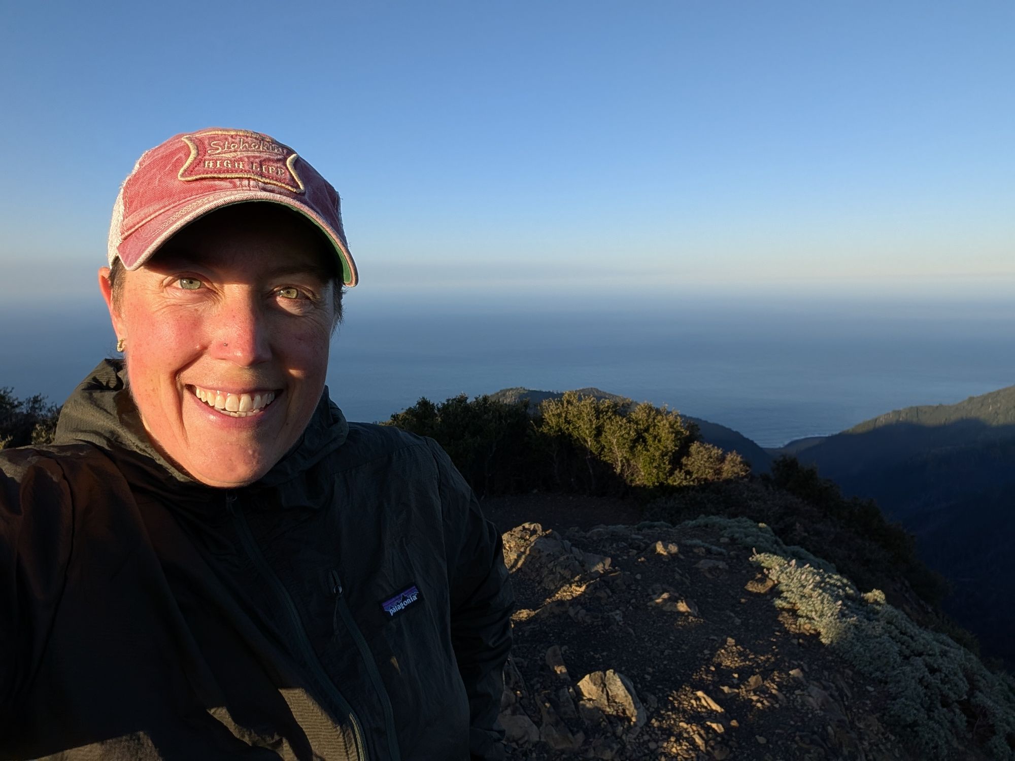
I dodge some buckthorn before hiking through a procession of Indian warriors. The bird symphony is robust with Hermit Thrush, Spotted Towhee, Song Sparrow, Olive-sided Flycatcher, Warbling Vireo, Orange-crowned Warbler, Bewick’s Wren, and Wrentit all singing me good morning. At 6:45 am I hit the junction with the Lightning Trail. I turn left and climb for another 15 minutes to the top of King Peak. At 4,090 ft. plus the wind, I immediately add my patagonia wind jacket.
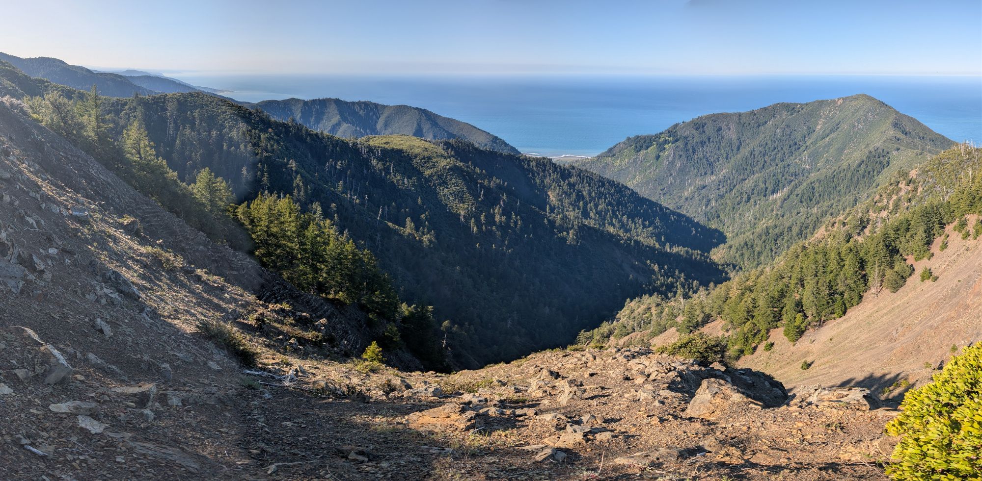
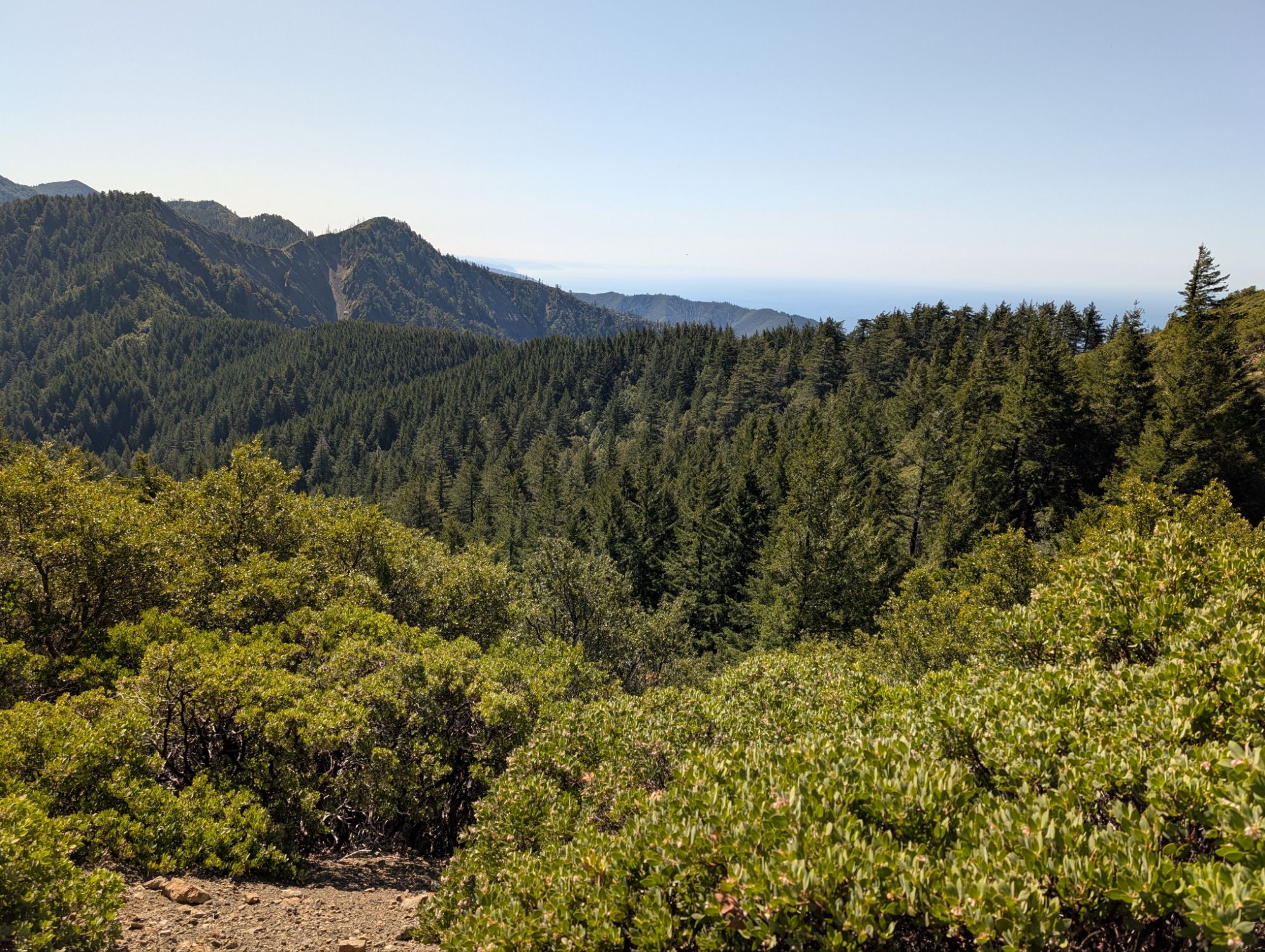
Above: Looking southwest
Below: Looking north
Below: Looking east and wondering how far I’m able to see on this clear morning.
After taking some pictures and exploring the platform, I sit down for a breakfast break. My dang mocha bottle has leaked a little bit again. Man, I really can’t use this bottle any more but it’s such a perfect size. Not surprisingly, there’s cell service all the way up here.


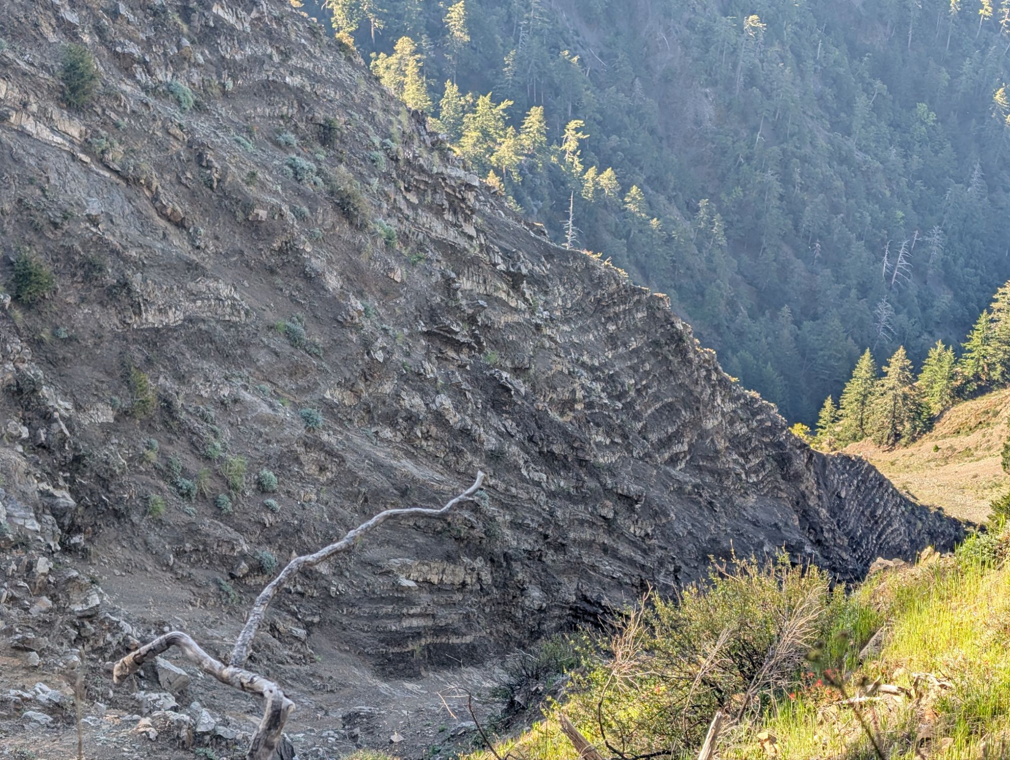
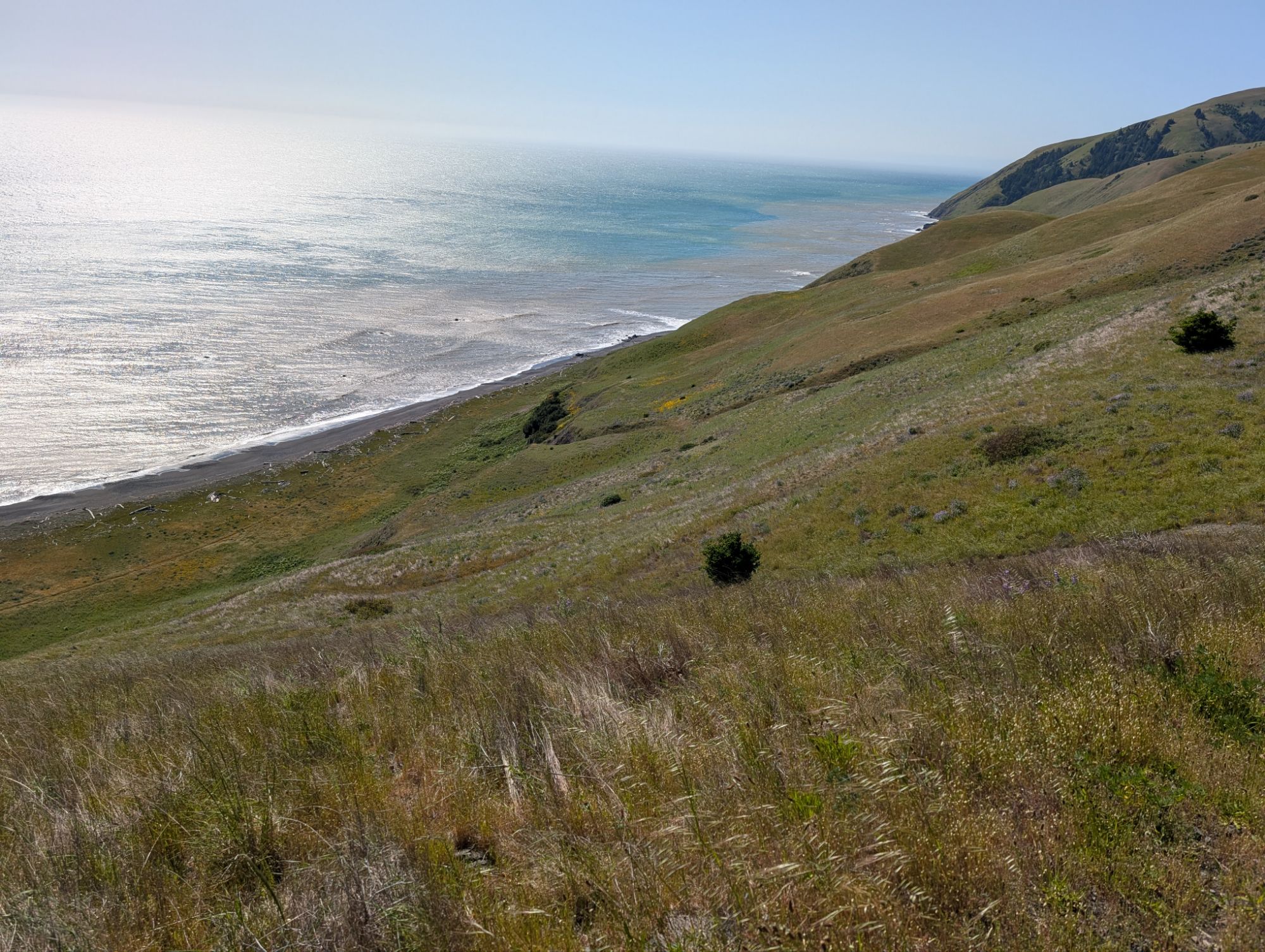
About 7:30 am I continue on the King Crest Trail and start to descend from the summit. I realize that I forgot to take a video at the summit but it’s too late now. I descend for about 15 minutes before reaching the northern junction with the lightning trail. Continuing on the crest, I pass through shady mixed conifer forest. The trail is cut into steep banks. The kind of steepness that with any wrong move you will fall for a long time before you’re lucky enough to hit a tree.


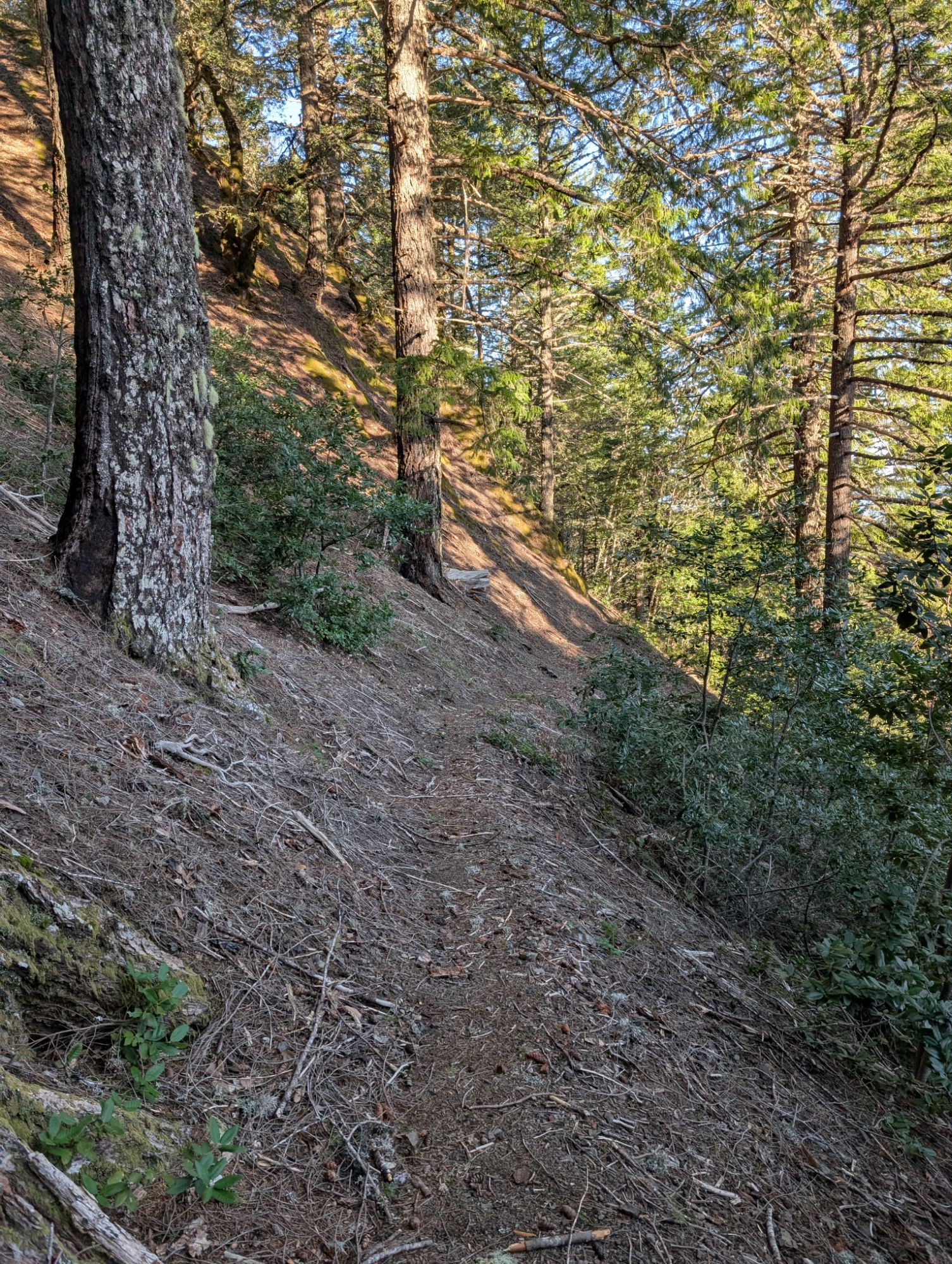


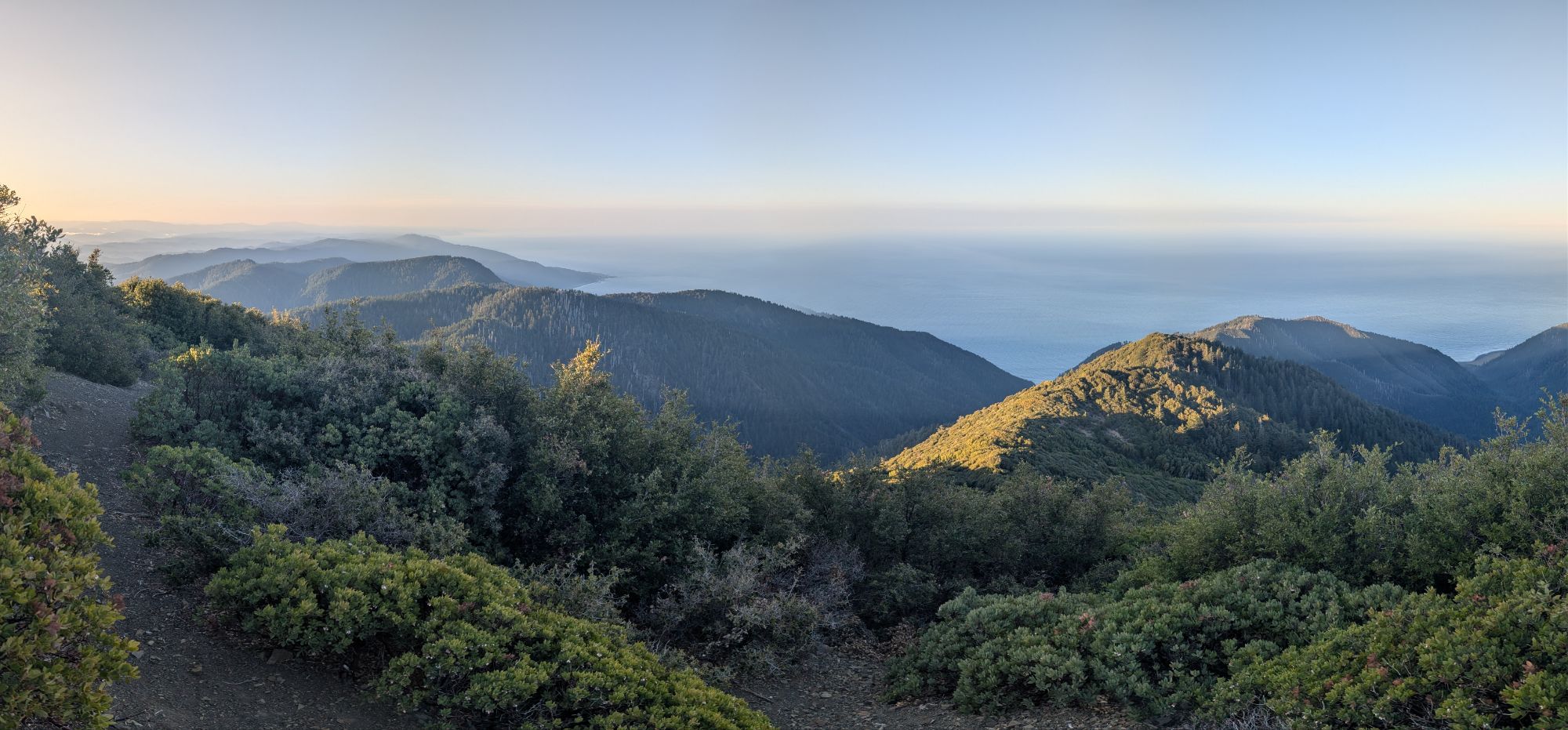
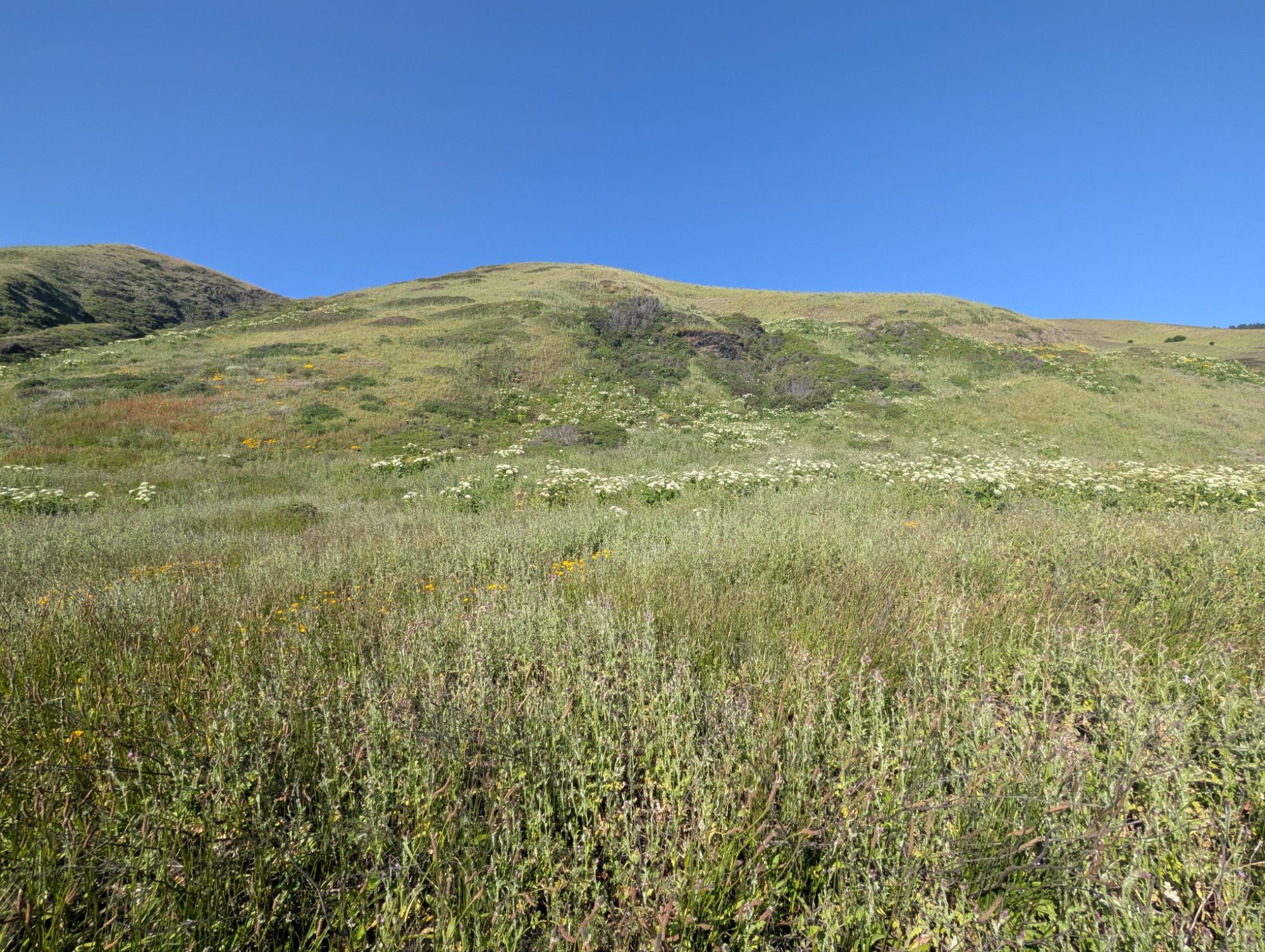
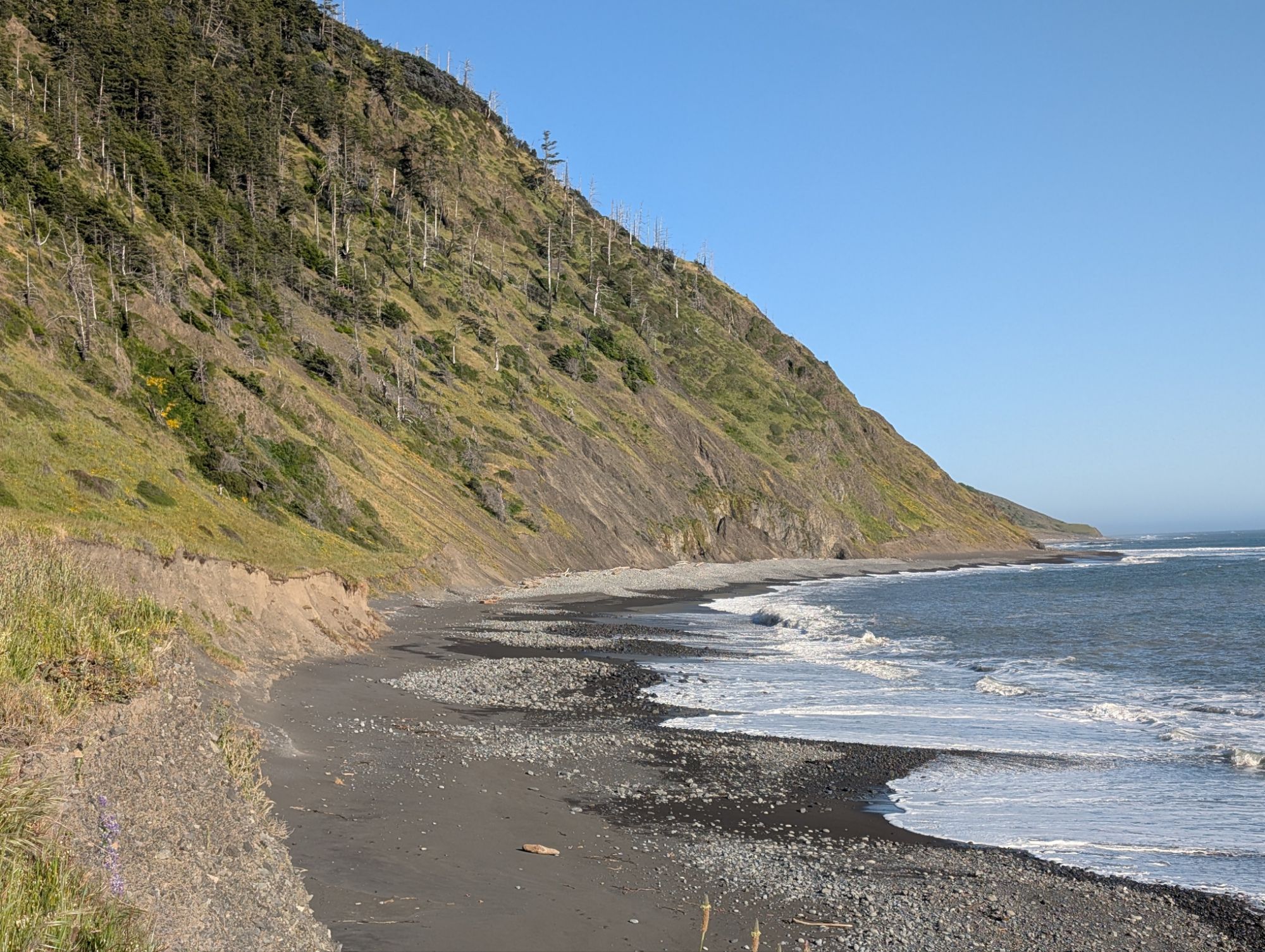
The trail stays mostly to the east of the crest. The vegetation isn’t quite the same, but I can’t help but have flashbacks to the Southern California section of the Pacific Crest Trail. The trail is pretty cruiser and has been well maintained. The tread climbs and descends gradually as I cross ridge after ridge with views to the ocean. There’s even a madrone butt clothed in bark.


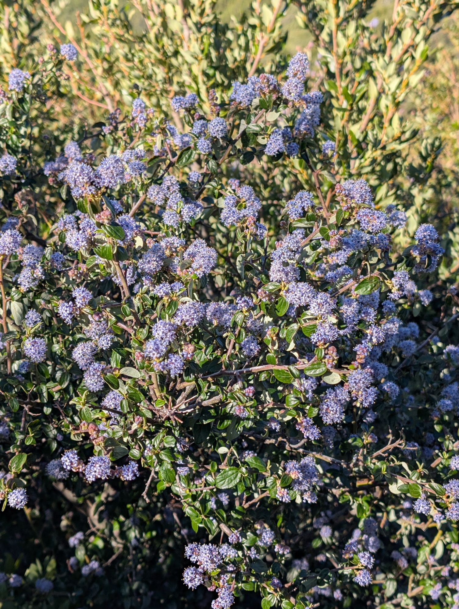
The trail is really alive! Oregon grape, manzanita and ceanothus in full bloom, views of the ocean and trail tunnels. Yellow-rumped Warbler, Hermit Thrush, Black-throated Gray Warbler, Dark-eyed Junco, Wrentit, Orange-crowned Warbler, and Western Tanager all sing about the beauty of the day.


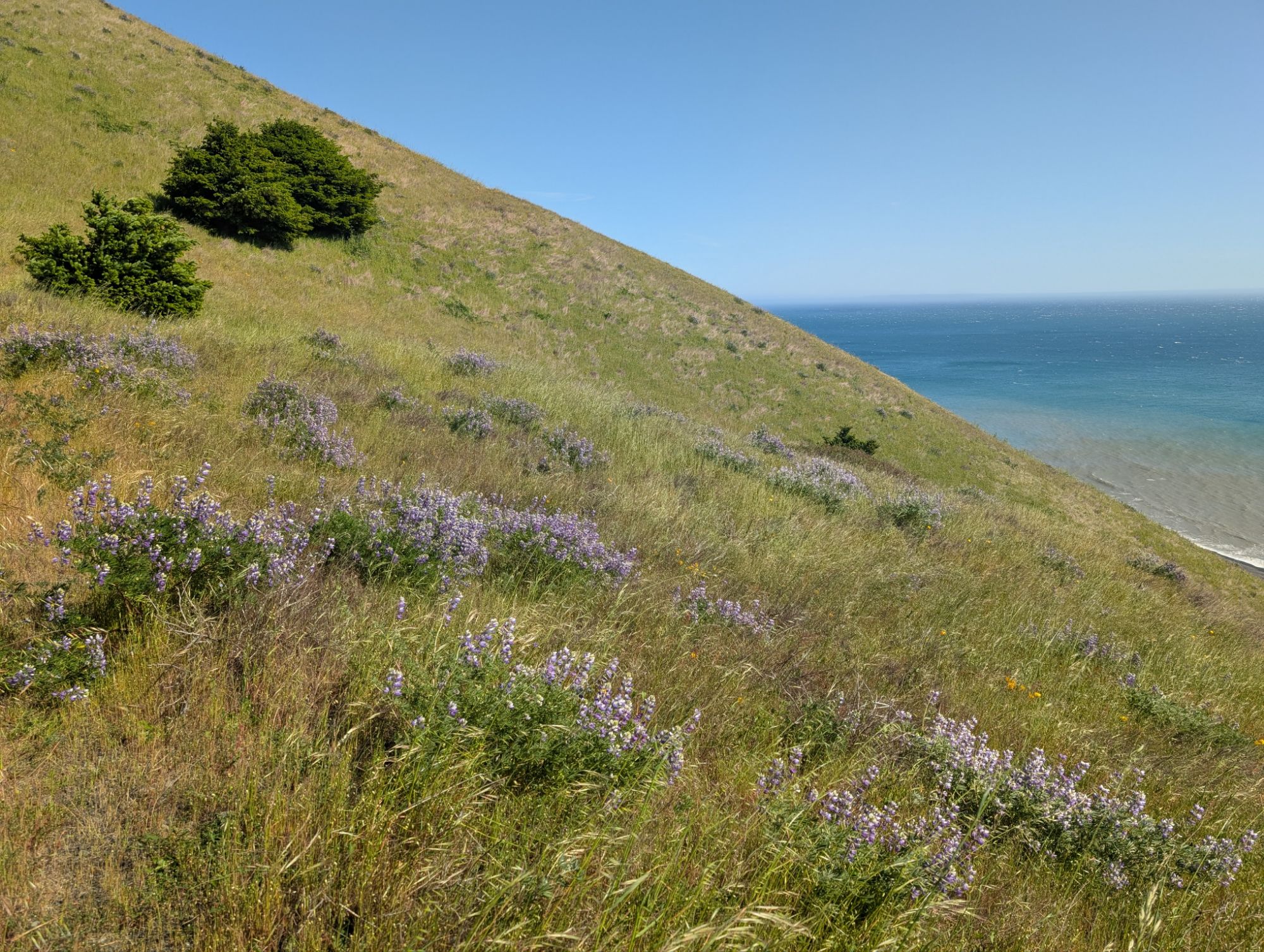
I come to the Rattlesnake Trail junction and it’s so tempting to start my descent to the ocean a bit early. But alas, I push forward on the crest as Douglas Iris smile from the trails edge. The King Range lies in a very tectonically active area which contributes to rapid uplift and steep mountains. The Mendocino Triple Junction, where the Pacific Plate, North American Plate and Gorda Plate all meet, lies just offshore from Petrolia. Despite the predominate and highly erodible Franciscan complex, metamorphosed outcrops can be found.

Just before 9:30 am and over 6 miles into my day I am suddenly launched forward and come to rest on my back three feet below the trail. I first register pain at the my left ear and feel that my earring is gone. Then my garmin watch starts to beep and I cancel the accident alert. My left arm rests firmly against the small trees that have stopped my fall. I check my zpacks front utility pouch and confirm that my phone and Inreach are still there and have not been ejected. I make a few attempts to get up but can’t move. I zip my front pouch closed and then undo my waist and chest traps. I slowly pull myself out of my backpack and crawl back to the trail. Still quite stunned, I step back down into the hole, grab my backpack and hoist it onto the trail. I check body parts and can feel that the neck injuries from my bicycle accident last Monday have been reactivated. My left knee, right elbow and right wrist are scraped and bleeding slightly. I take my phone out of its case and clean off the dirt and grass that is sticking out. I stand dazed for a while and feel quite defeated. I’m really tired of hitting the ground hard so many times lately. I search around for the culprit and find a small sawed off trunk sticking up out of the trail that’s covered by grass. Gotta love that trail work but damn. I’m top heavy with the bear can strapped on top of my backpack and that didn’t help either. For a short moment, I contemplate returning to my truck. I’m not really injured but mostly just feeling sorry for myself. And I’m not here to give up so easily. I hoist my pack back to my shoulders and continue down the trail.

I hike with caution because of the pain in my neck and the small toes of my right foot. I try rotating my neck back and forth slowly to stretch things out. There’s a section of the trail where I have to push through trees and brush and this gets me so down. The contortions hurt my body and my shirt has filled with little ceanothus flowers. I hike on slowly as my muscles feel exhausted and quivery. I’m almost scared as I pass sections of trail that drop away to nothing.
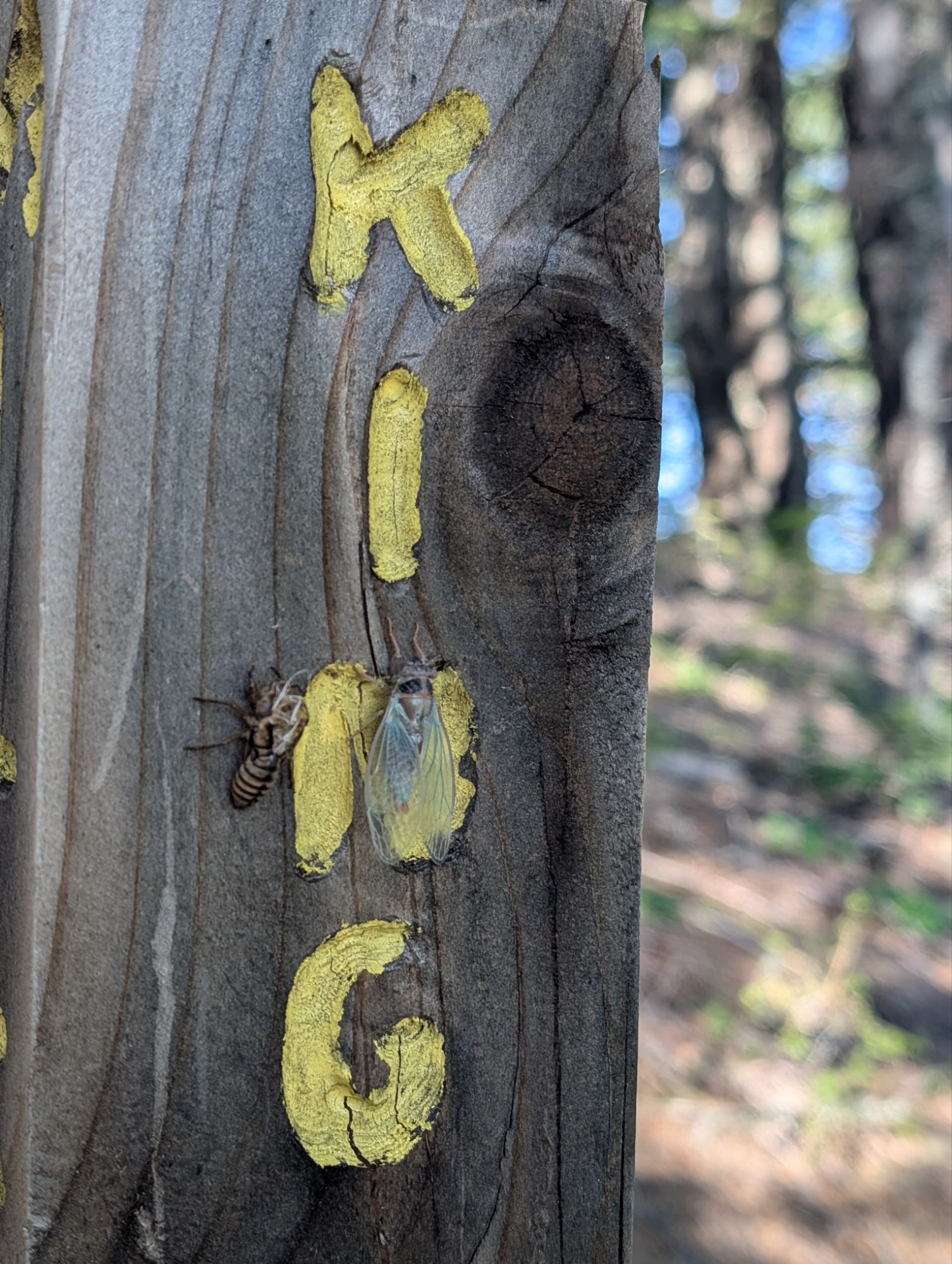
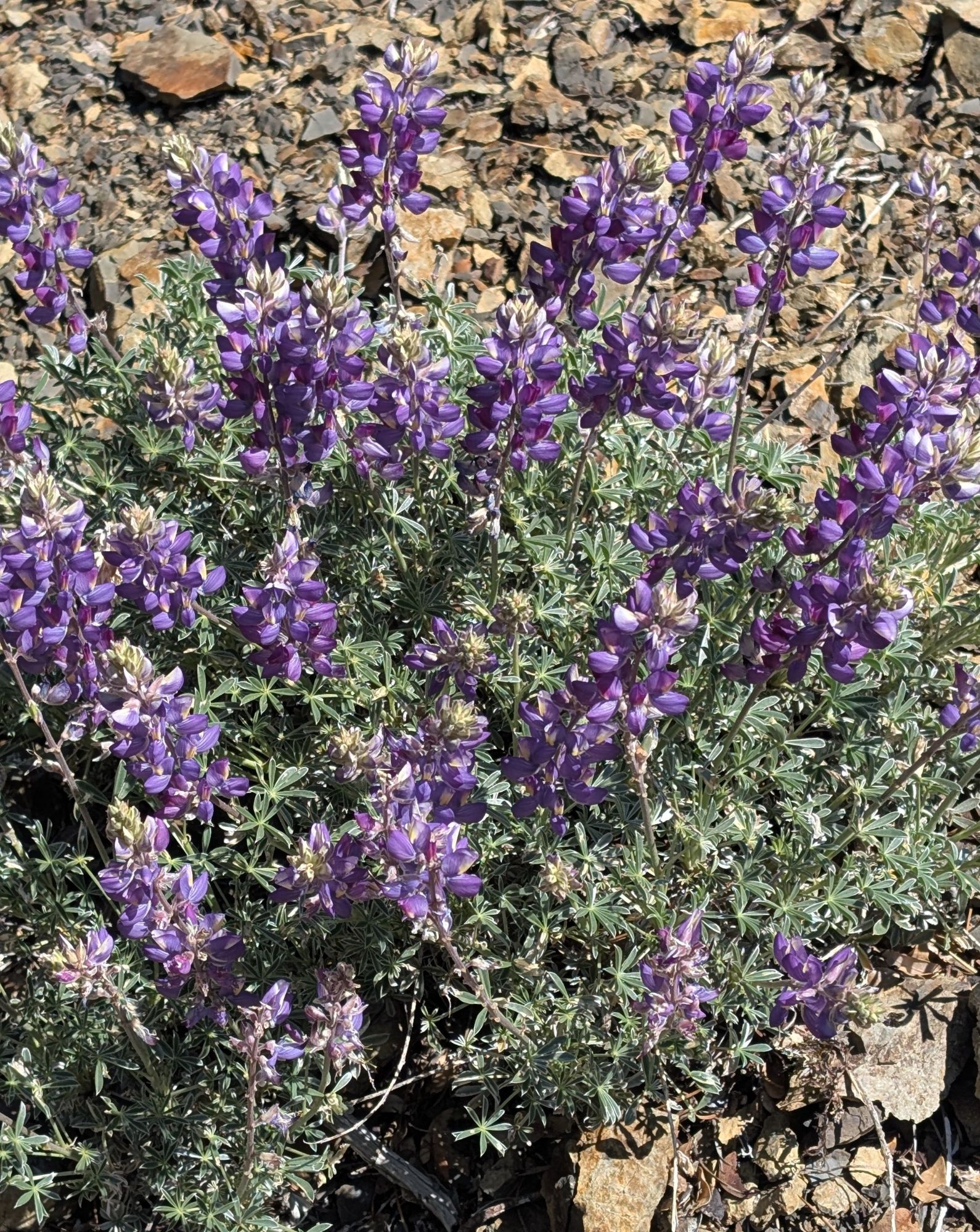
I reach the trail junction with the Miller Loop and see a molted cicada exoskeleton. As I lean in for a closer look, I see that the live cicada is right next to its exited exoskeleton. I continue climbing north, through manzanita, buckthorn and lupine. There’s even some small 5-needle pine trees but I can’t find any cones for identification. I hike along trying to breathe through my nose and keep my mouth closed. There are thousands of tiny little insects that fill the air and fly into my face.


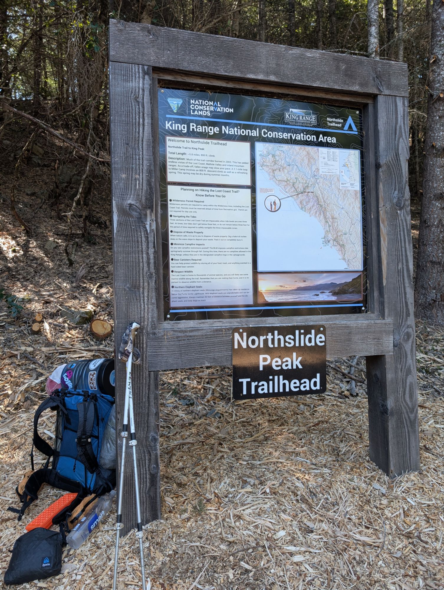
It’s about 11 am and 9 miles in when I finally arrive at the Northslide Peak Trailhead. I sit down for a snack break and something draws my attention to my waist. I dig into the hip belt of my pants and find a tick already attached and another trying to run away. Geeze. I twist the fucker out and then start searching around for more ticks. I find the backing of my earring in my bra which reminds me that I forgot to look for it. Oh well, not going back. Yet another loss to this beast. I take my morning dose of calcium as well as 800mg of vitamin I. The flies keep flying into my face and I’m fully over this break. I momentarily think about turning around but hoist my pack and push on.
I’m grateful for the ease of the relatively flat road walk. I come to a view point to the west and something is bothering my neck. I figure out that it’s a tick and then take my pack off. I twist that fucker out and search around for more. Sheesh!


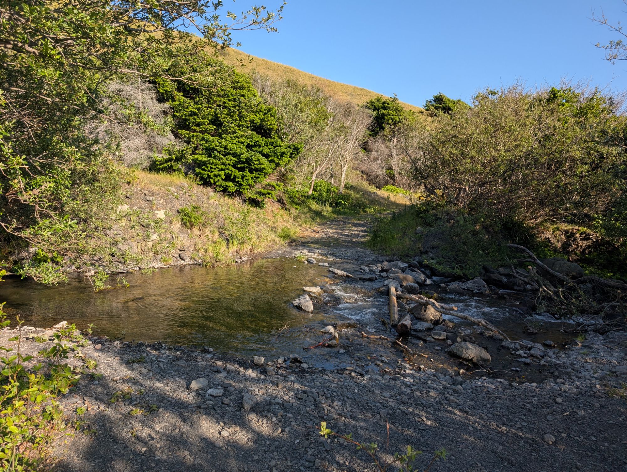
The 2.4 road miles to the unmarked Kinsey Ridge Trailhead go by quickly as the ibuprofen is starting to kick in. I hear a new bird and it’s a Red-breasted Nuthatch. Then a Hutton’s Vireo, Hermit Warbler, Dark-eyed Junco, Yellow-rumped Warbler and Townsend’s Warbler all chime in too. It’s another .8 miles to the Telegraph Spring which is flowing nicely. I had been a little worried that the spring might not be flowing so I carried a little extra. I don’t need much but fill up a liter. The water table is high here and ferns fill the hillside. There’s even several areas where there’s standing water along the side of the road.


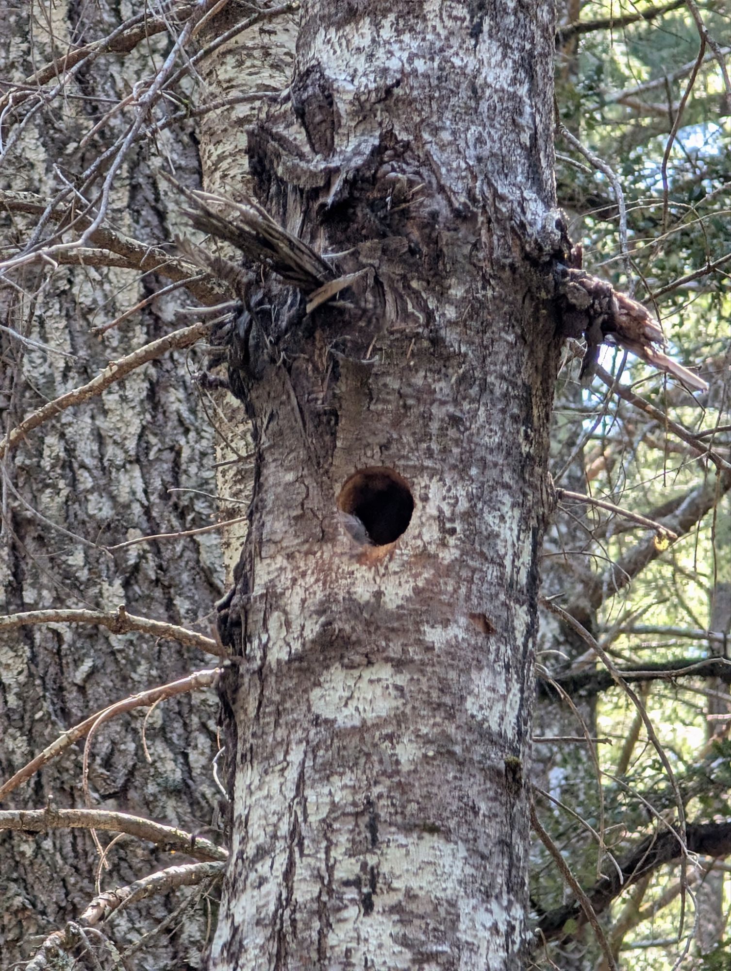
I hear a woodpecker working and stop to see if I can find it. My attention is drawn to this tree where the woodpecker is working inside. Sensing my presence, it stops and pokes its head out. It flies off before I can get a picture but it’s probably a downy woodpecker. I marvel at the perfect hole that it has created and can even see a feather moving in the breeze.
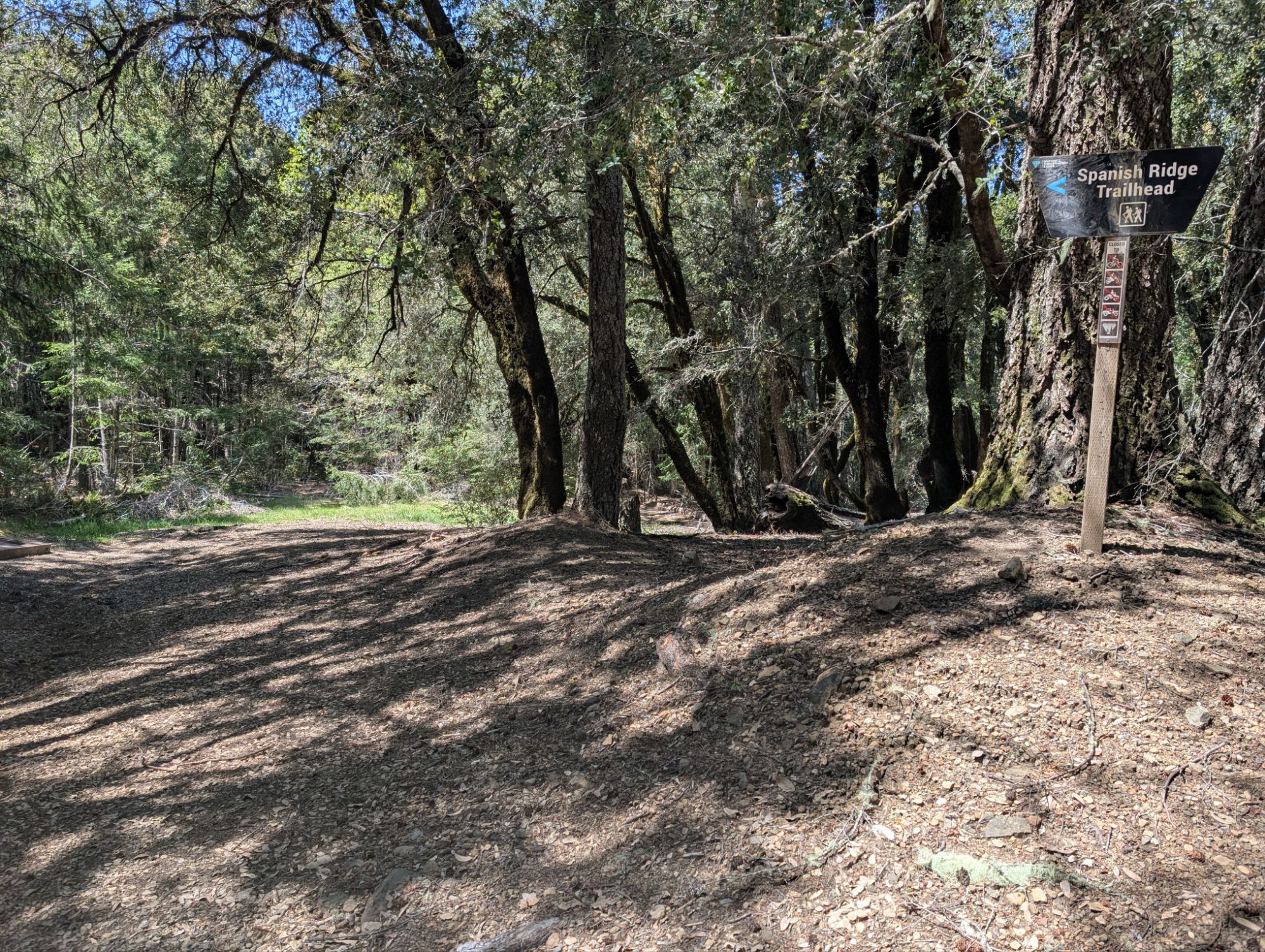
I arrive at the Spanish Ridge Trailhead about 1:30 pm. I’m focused on taking a picture of the trail sign when I hear a clunk to my left. I look over and see a big black bear run across a collapsed trail sign and away into the forest. I’m grateful that my bear friend was happy to run off so quickly. I make the u-turn onto the road aka Spanish Ridge Trail and immediately start climbing. I’m annoyed to be climbing because I know I have so much descent still to do. I have already descended over 3,000 ft today and know that I have at least 2,000-3,000 more. I occasionally turn around to check the trail behind me just in case.

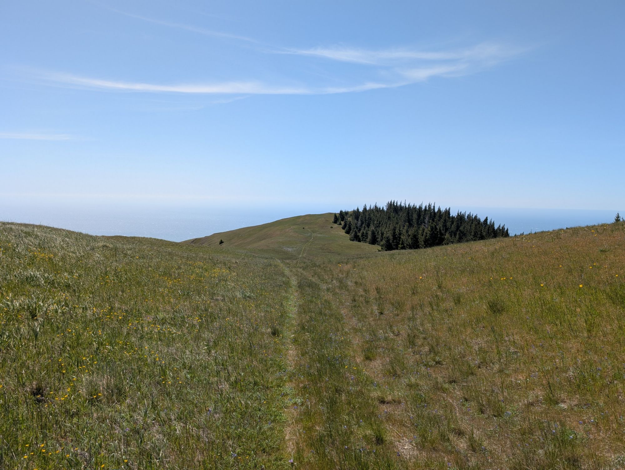
I emerge from the dark and overgrown forest, where Pacific coralroot is just starting to poke up, into the wondrous grassy prairie atop Spanish Ridge. I follow a faint tread that obviously doesn’t get much traffic. With a laugh, I sing the hills are alive. The hills are alive with green and sun and wind and wildflowers and insects. It’s truly spectacular! This is why it’s worth it to do hard things. I do my best not to step on the thousands of wildflowers but they are unavoidable at times.

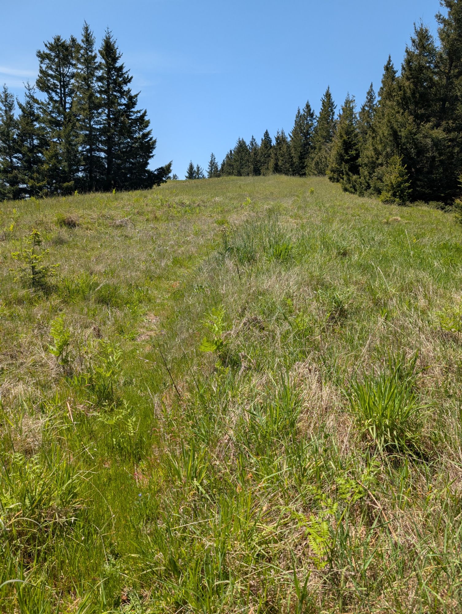
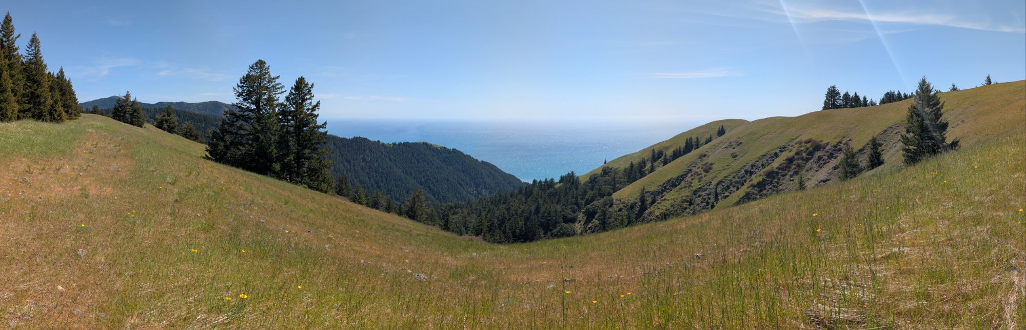
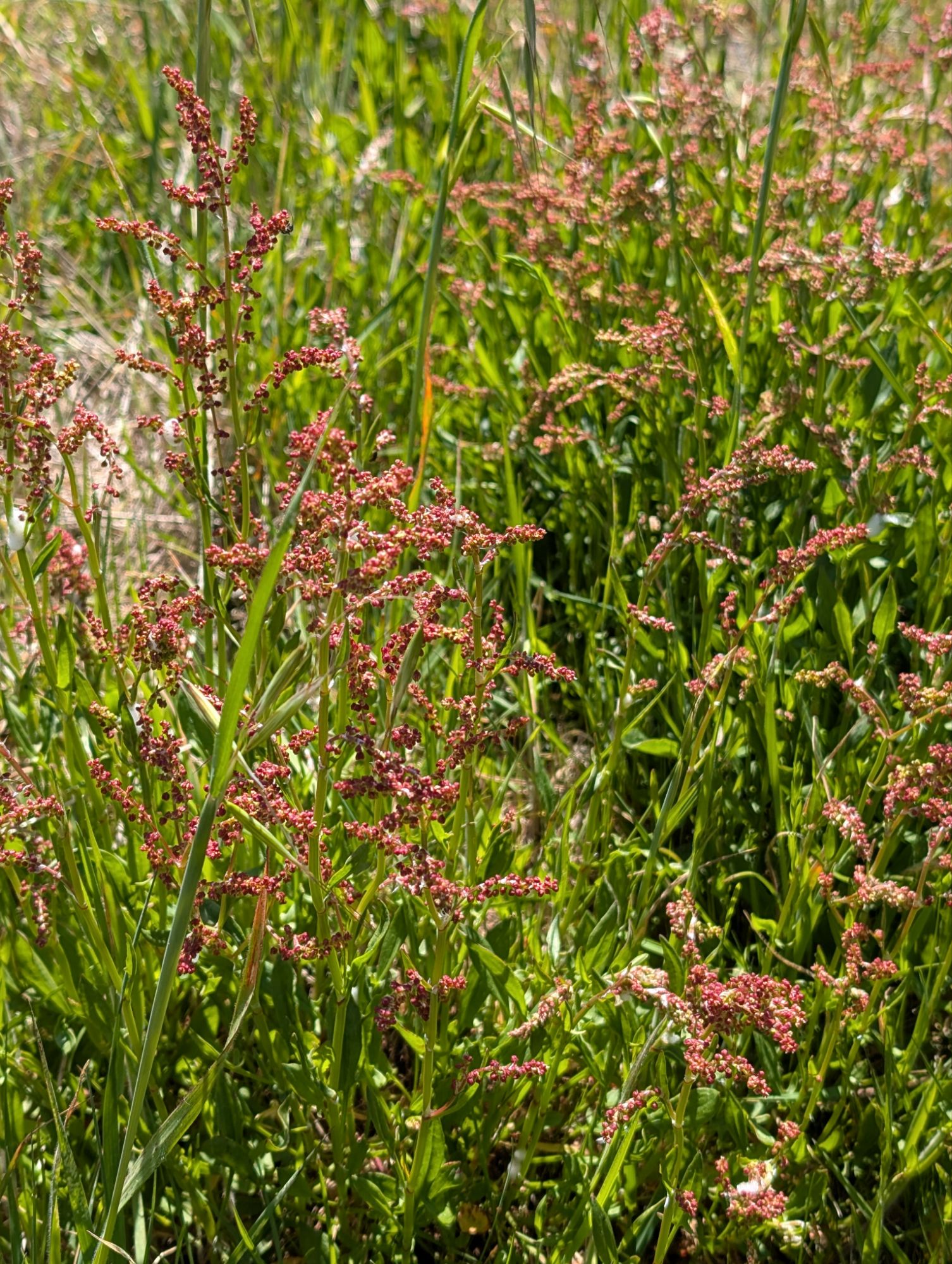
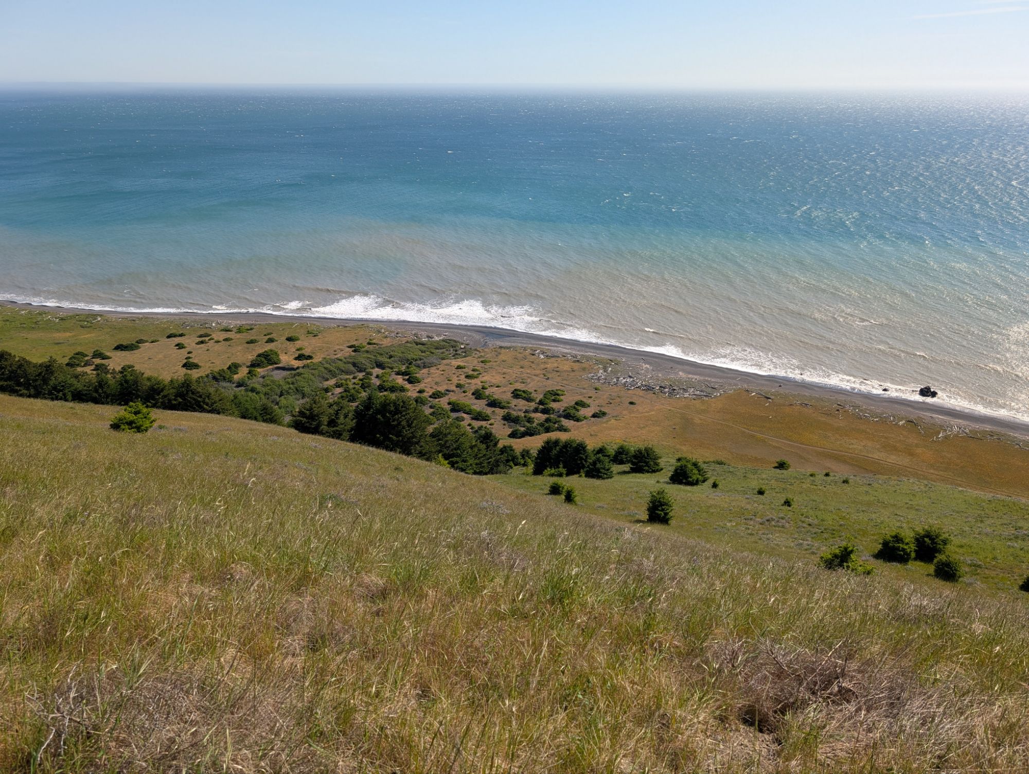
The Spanish Creek drainage cuts a line into the wide blue Pacific horizon. California poppy, Rumex buckwheat, Miniature lupine, Tolmie star-tulip, Ribwort Plantain, Common lomatium, Seaside buckwheat are all flourishing atop this romantic prairie.


I reach the junction with the trail that heads toward Cooksie Creek. I had originally planned to go this route but when my timeline compressed to two hiking days, I opted to go down Spanish Ridge. I follow a faint path up to a small knoll and then walk the old jeep path seemingly straight to the edge. I search and search but can’t see the Western Meadowlark that loudly calls to me.

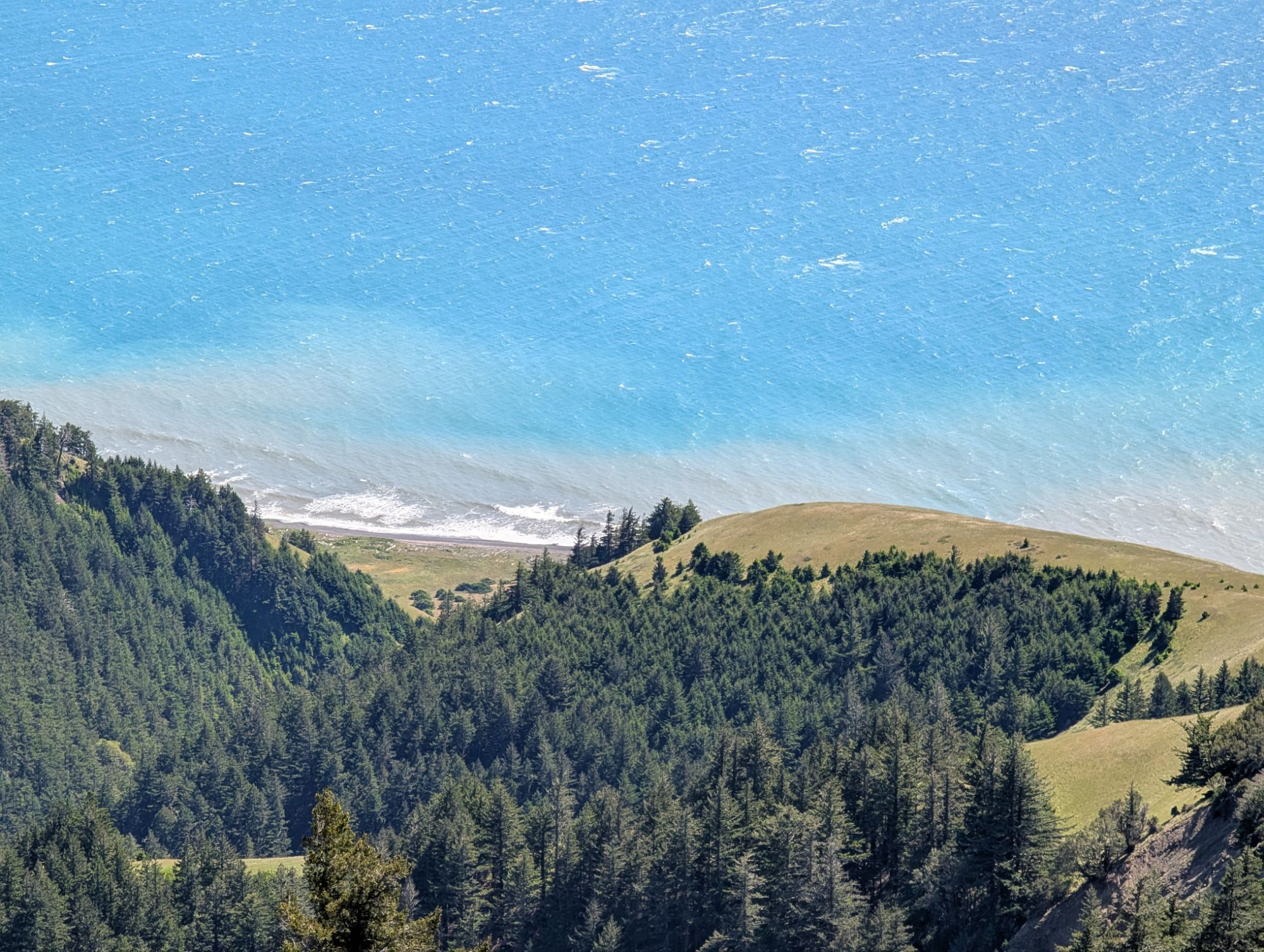
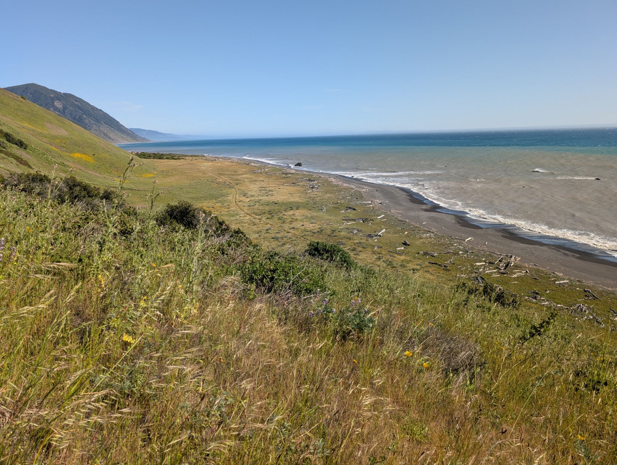
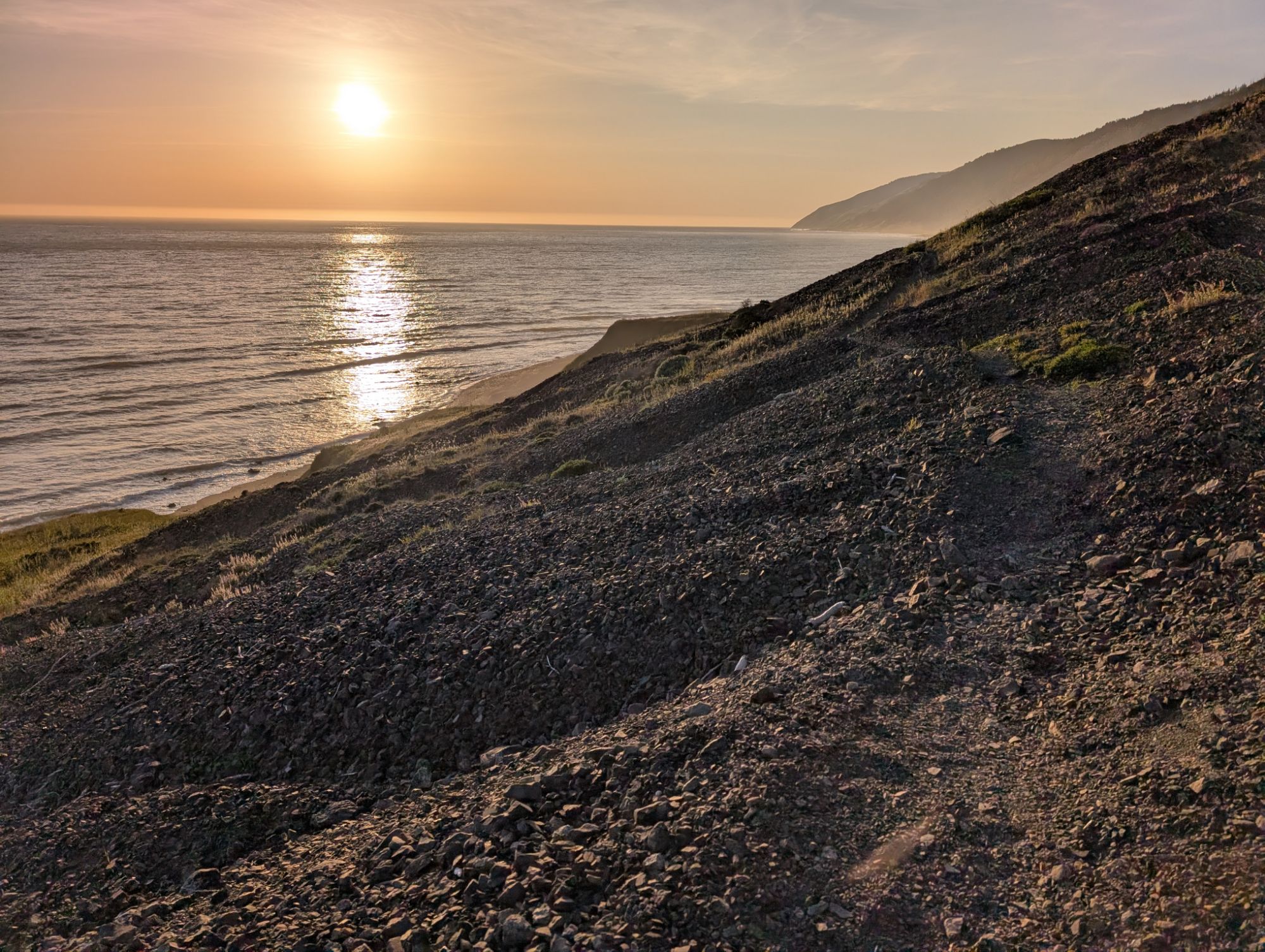
I sit for a snack and electrolyte break while the wind continues to rip. I have to be careful my sit pad doesn’t blow away. Like a neurotic tic, I keep thinking that I feel ticks and have to check. The sediment from the beach and all the creek inlets forms a brown blanket along the coast’s edge. I check my elevation and I still have over 2,000 ft. before I’ll be at sea level. Ugh. Down I go.


As I start down from the ridge, the wind is so intense that I have to hold my hat on. Plus I’m starting to feel the sun on my neck. I add a buff from my front utility pouch and keep marching.

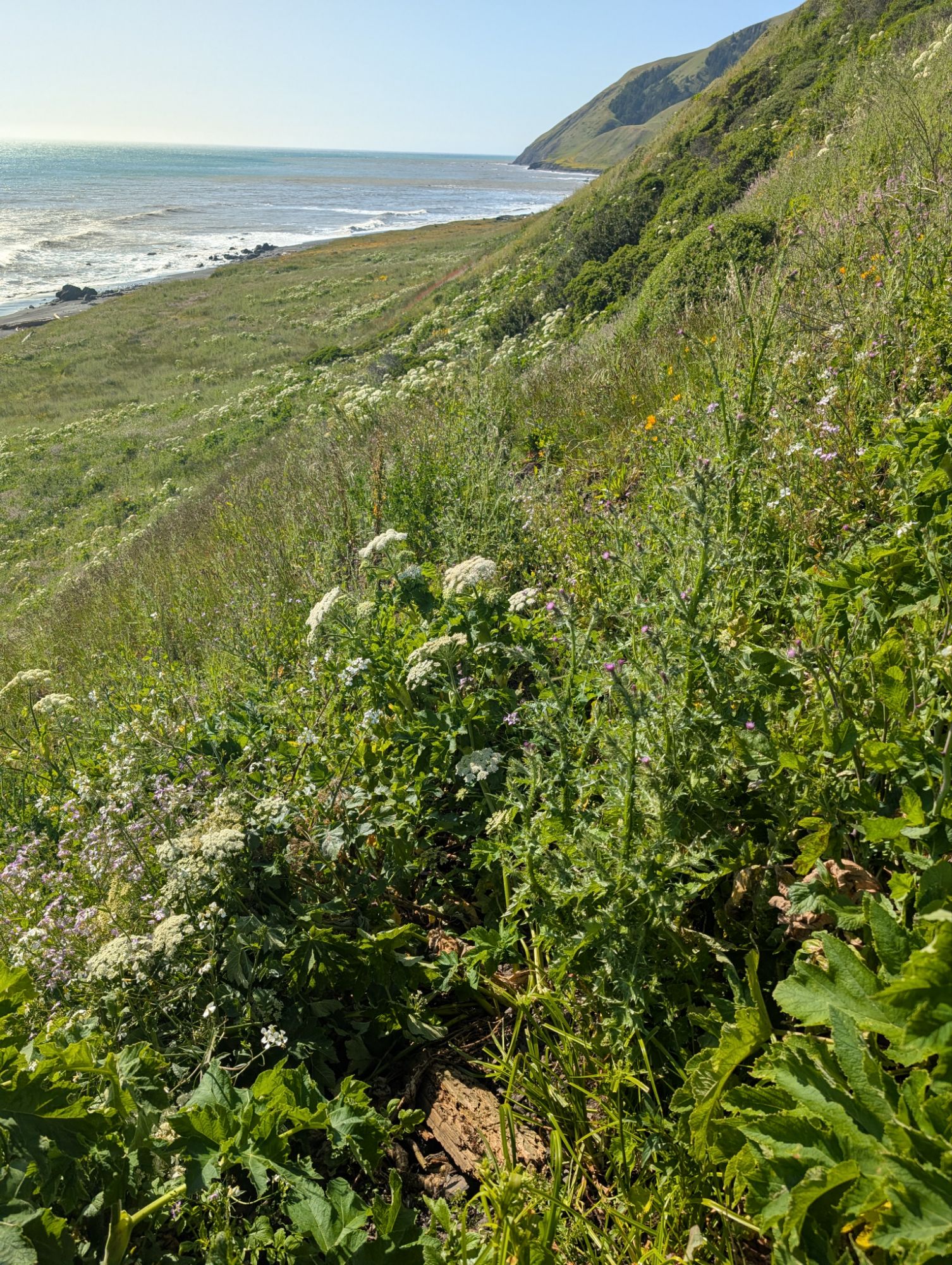
The faint trail seems to disappear into some Douglas firs. I stay high but after checking my topo map I realize that I’m definitely off trail. At the edge of this little bluff, I descend steeply down towards the trail. Not too tough but I have to be strategic to miss the poison oak mounds.
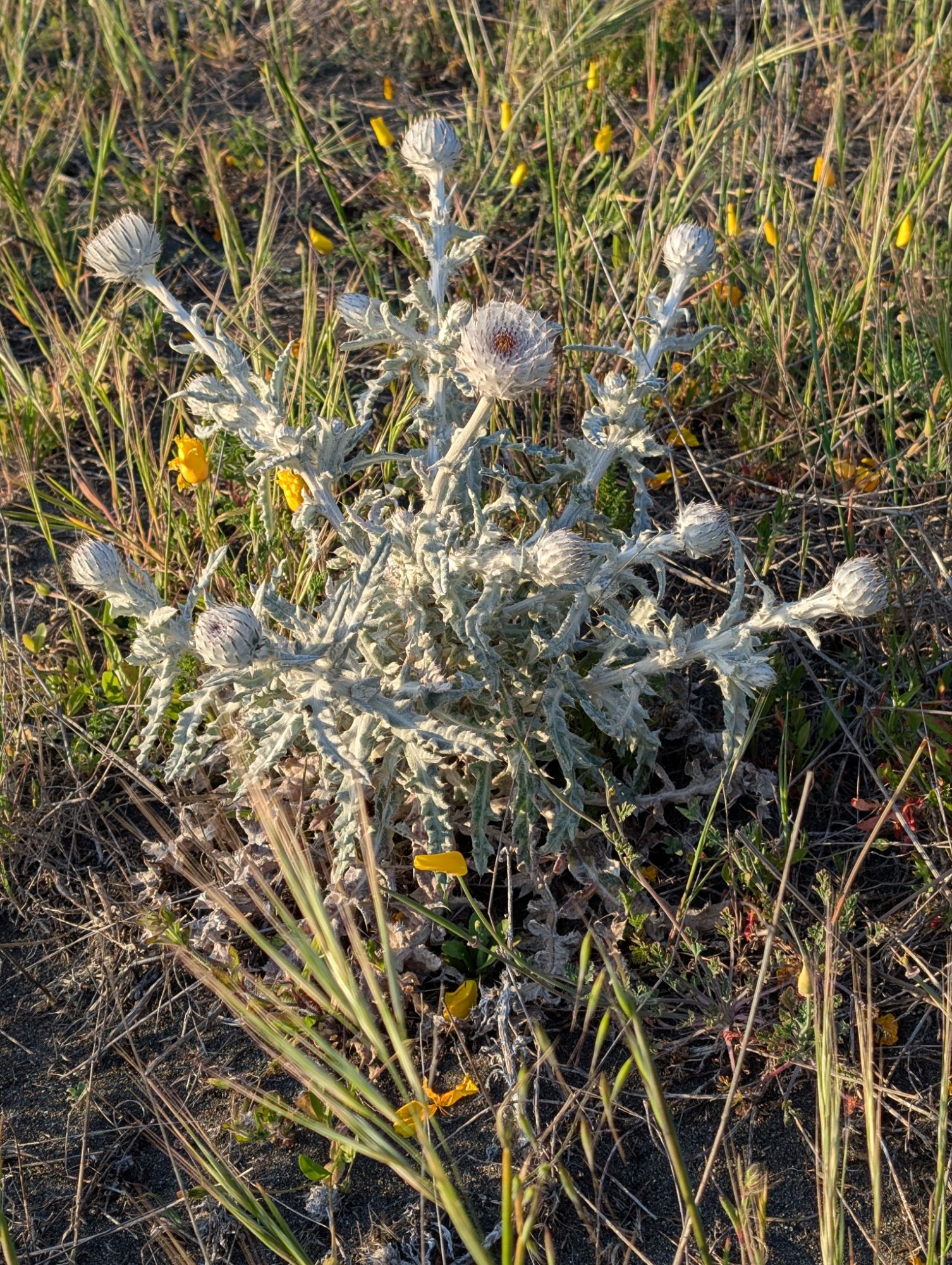
I start to descend the front edge towards Spanish Flat. I come to a draw and there seems to be no trail. I backtrack to where I can see the trail and check my topo. There’s an invisible switchback in the middle of a bunch of thistle. As I trace along, I can tell that the trail has been retread in places because people have had to dodge all the thistle.
I switchback down into an endless hillside of flowers and most notably, thistle. Lots of thistle. Luckily, there seems to have been at least one person who has come through here and I follow the path they forged. I bend and contort and crush with great care and pain and slowness. After the 100th thistle poke, I grow a bit weary. But on the positive, at least there’s no poison oak. Towards the bottom, it turns all boggy and I can feel the coolness through my boots.

It is with great relief that I step foot on the Lost Coast Trail mile 9.9 at 5 pm. Oh to be on flat ground, if only for a moment. I can definitely feel the days cumulative descent in my quads. But I turn south and march as fast as I can, grateful to be down and out of the strongest wind.

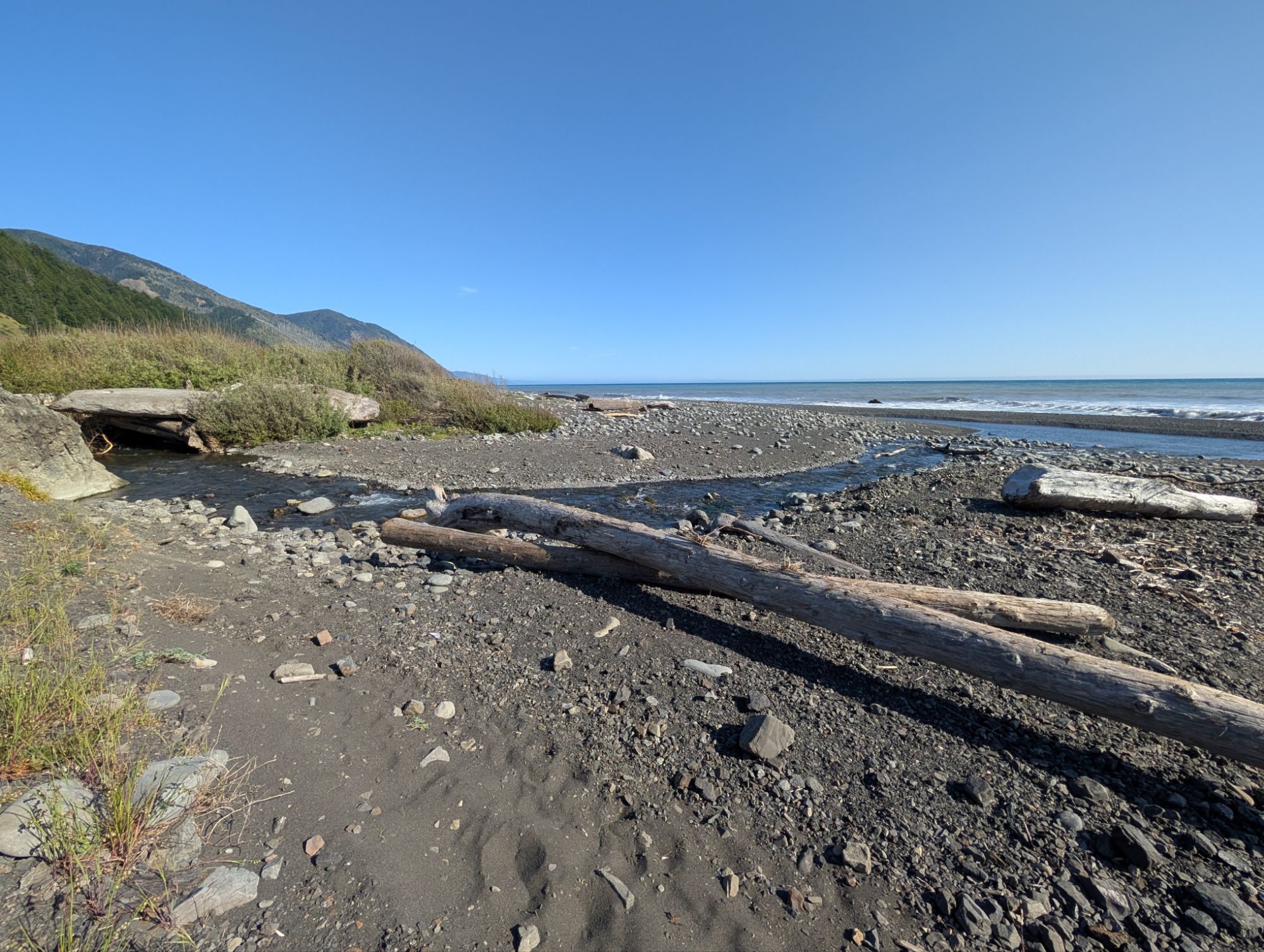
I cross Spanish Creek and can feel that I get a splash of water in my boot. The trail leads to Oak Creek and then Kinsey Creek which are both pretty easy to cross. I’m grateful for the road tread and easy walking. The trees burned during the 2003 fire stand eerily in witness to all of us who pass.


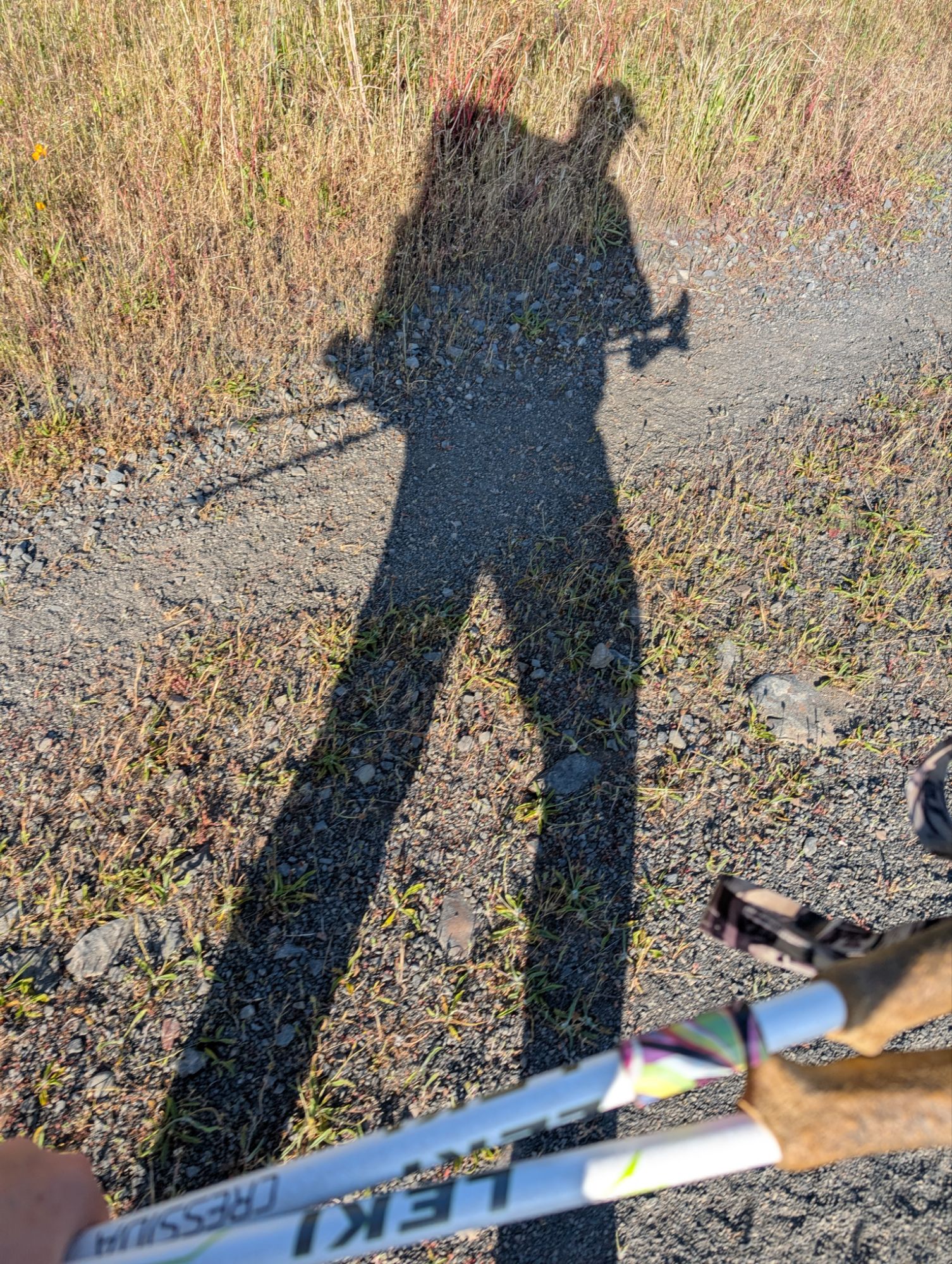
After almost 3 miles of trail walking, a beach section starts. It’s 6 pm and my shadow is growing long. I can see human and dog tracks ahead of me. I carefully cross the mouth of Big Creek. The beach and cobble walking at the end of a long day is a bit brutal. I think to myself that I don’t know how much farther I can make it. My original plan was to camp at Big Flat Creek which is LCT mile 16.7 but I don’t think I’m going to make that.


I trudge along with a weary body. I’m not sure what gives me pause, but I climb a little sandy bluff to see if there might be a camping spot. I check the FarOut app and realize that the LCT is actually just above me. I go a bit farther up and sure enough, there’s a small path through the abundant vegetation. Well, the people with the dog didn’t catch this transition. There’s some poison oak to avoid but it is doable.
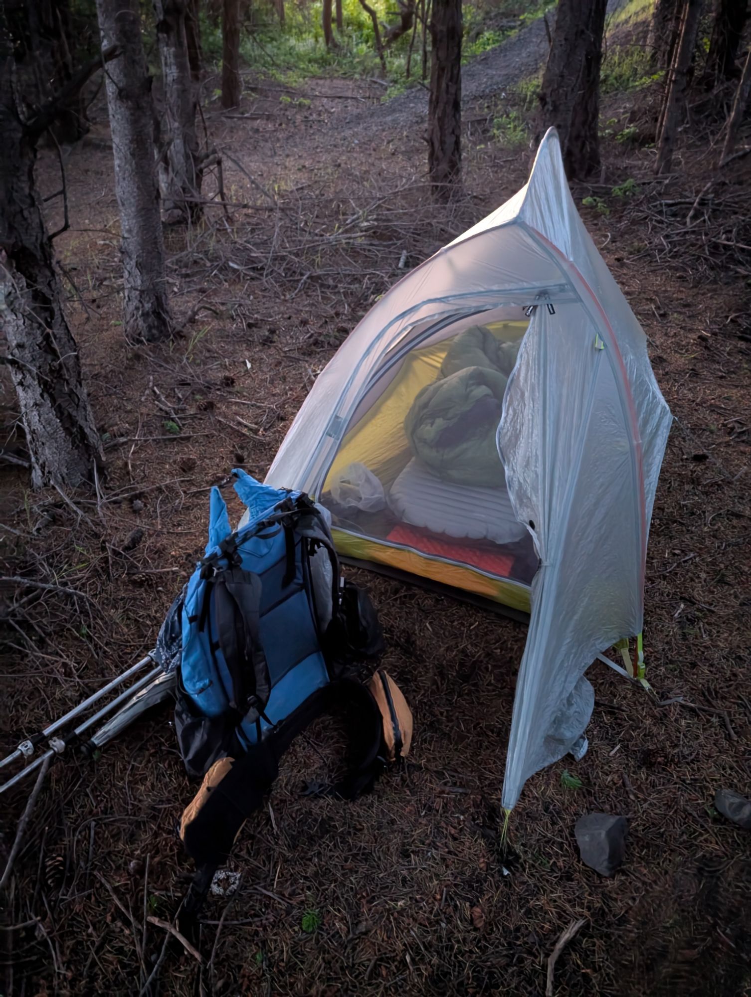
I hike not even another half mile and find my home for the night. There’s a perfect spot for one little tent to tuck in among the trees next to the trail. It’s 7:30 pm and I’m calling it a day. My garmin watch has recorded 6,666 ft. of descent for the day. That’s like Grand Canyon or a long day on the Wonderland Trail kind of numbers. A later search of the number 6666 reveals that it is associated with harmony, balance and spiritual growth. Well, the challenge of today definitely was a growth opportunity and a chance to reaffirm my ability to push myself.
I get everything set up and then have dinner out on the bluff to watch the sunset. I sit a bit too close to poison oak and move forward. My cheese is a bit squishy so I skip it. I eat a bunch of other snacks including a few fritos scoops. Yum! I save a few for tomorrow when I get back to the trail head. I’m almost done with dinner when I notice a tick crawling on my pants. Ok, that’s enough. I get into my tent and out of caution, leave my pants outside. I can not risk getting poison oak. I’ve traded the roar of the wind for the constant of the ocean. The never ending noise presses hard on my brain but I eventually fall asleep.


One thought on “King Crest Lost Coast Day 2: The Romance Of King Peak And Spanish Ridge”
Comments are closed.